Retired Army Sgt. 1st Class Pete Ferrell’s 33-year military career began in Vietnam as a Huey crew chief in 1970 and finished with a 2010 Afghanistan deployment.
Source: www.war.gov
Retired Army Sgt. 1st Class Pete Ferrell’s 33-year military career began in Vietnam as a Huey crew chief in 1970 and finished with a 2010 Afghanistan deployment.
Source: www.war.gov
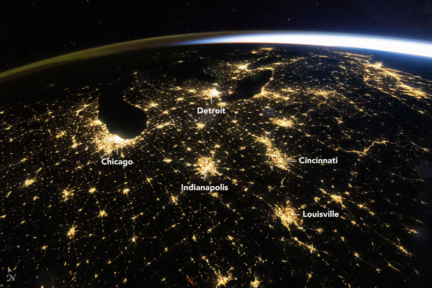
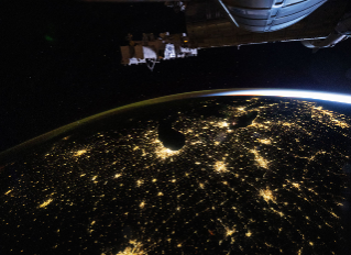
The predawn hours brought clear skies over much of the eastern United States on October 18, 2026. An astronaut aboard the International Space Station seized the opportunity to capture this wide-angle photo at 4:54 a.m. Central Daylight Time (09:54 Universal Time), with illuminated cities large and small arrayed across the darkened landscape.
The U.S. Midwest’s largest metropolitan areas, such as Chicago, Illinois, and Detroit, Michigan, stand out as some of the brightest features. Mid-sized cities—including Indianapolis, Indiana; Cincinnati, Ohio; and Louisville, Kentucky—and their interconnections along state and interstate highways also shine brightly.
Above the web of nighttime lights and Earth’s lower atmosphere, a diffuse layer of green and orange is visible along the horizon to the left. This band of light is airglow, produced when sunlight strikes atoms and molecules in the upper atmosphere and causes them to eject photons. To the right, light from the Sun arcs across the horizon; sunrise was about an hour away on the East Coast and about two hours away in Chicago.
Astronaut photos and other remote sensing observations of nighttime lights are scientifically valuable for tracking changes in the built environment. For example, Chicago’s lightscape appears a homogeneous pale yellow in the wide view above. But in detailed photos, like the one below, a range of colors stemming from different types of lighting is discernible. Using NASA’s extensive Gateway to Astronaut Photography of Earth archive, researchers have developed a method for distinguishing lighting types within the pixels of nighttime photos. Systematically quantifying urban lights’ brightness, color, and extent can provide insight into how cities grow and evolve.

Satellite sensors also observe changes to lighting. In particular, NASA’s Black Marble nighttime lights product suite uses satellite observations to produce science-quality records of nighttime lights across the globe at daily, monthly, and yearly time scales. In the eastern U.S., scientists have used these data to track everything from power outages and restoration following major storms to lighting changes associated with new infrastructure to transitions to LED lighting from older forms.
Astronaut photograph ISS075-E-226709 was acquired on October 18, 2026, with a Nikon Z9 digital camera using a focal length of 14 millimeters, and photograph ISS070-E-105097 was acquired on March 1, 2024, with a Nikon D5 digital camera using a focal length of 400 millimeters. They are provided by the ISS Crew Earth Observations Facility and the Earth Science and Remote Sensing Unit at NASA Johnson Space Center. The images were taken by members of the Expedition 75 and Expedition 70 crews, respectively. The images have been cropped and enhanced to improve contrast, and lens artifacts have been removed. The International Space Station Program supports the laboratory as part of the ISS National Lab to help astronauts take pictures of Earth that will be of the greatest value to scientists and the public, and to make those images freely available on the internet. Additional images taken by astronauts and cosmonauts can be viewed at the NASA/JSC Gateway to Astronaut Photography of Earth. Story by Lindsey Doermann.
Stay up-to-date with the latest content from NASA as we explore the universe and discover more about our home planet.

The tilt in Earth’s axis of rotation makes the apparent position of continents shift with the seasons in imagery from…

A bright lens of anorthosite, a rock type prevalent on the lunar surface, is cradled within sheared rocks in the…

Over the years, astronauts aboard the International Space Station have photographed several of the cities hosting the 2026 FIFA World…
Source: science.nasa.gov
APOD
Astronomy Picture of the Day
Discover the cosmos! Each day a different image or photograph of our fascinating universe is featured, along with a brief explanation written by a professional astronomer.
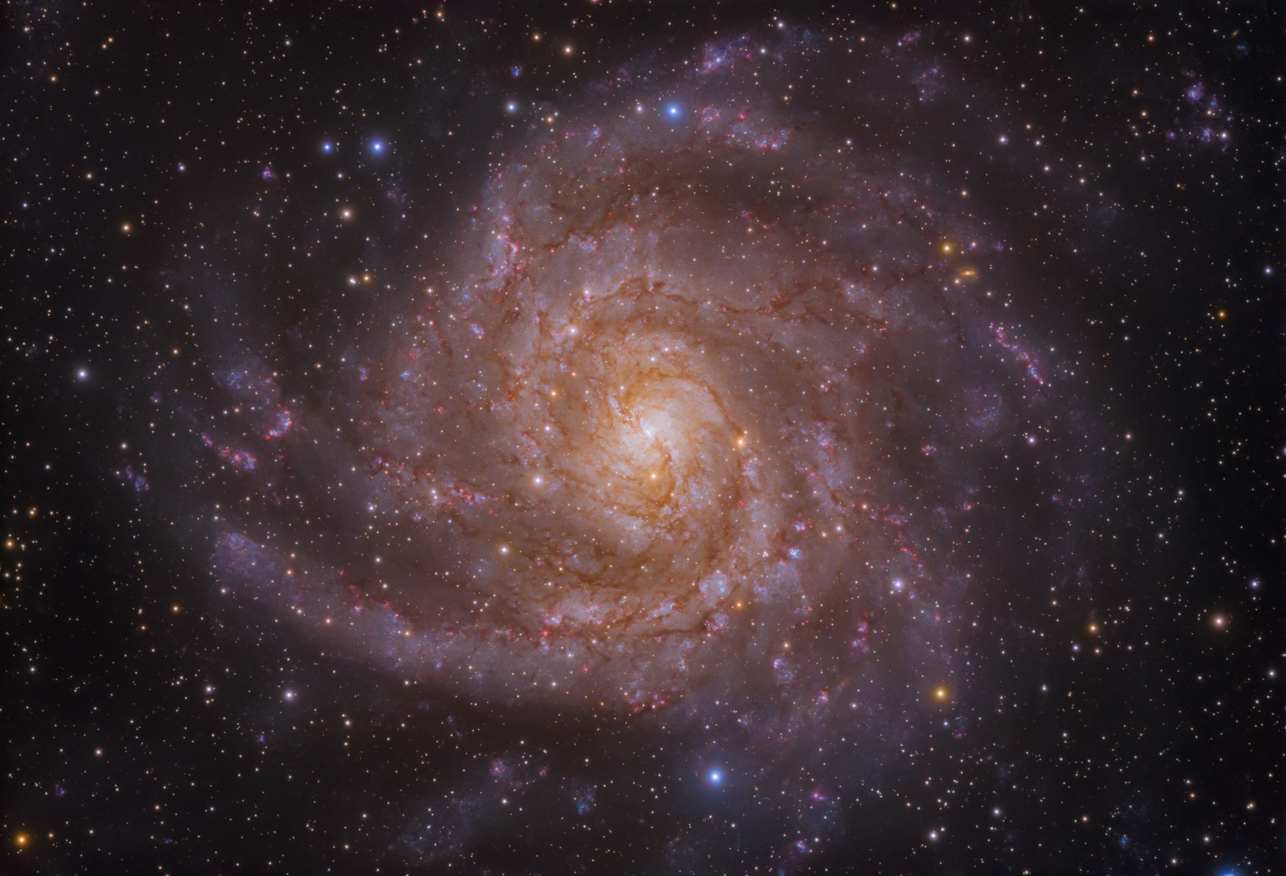
Explanation: “I see” IC 342, the Hidden Galaxy! Today’s image peers through the plane of the Milky Way, through all its gas, dust and stars, to unveil this spiral galaxy. IC 342 (or Caldwell 5) is one of the brightest members of the IC 342/Maffei group of galaxies. Located about 10 million light years away, this group is quite close to the Local Group that includes our Milky Way. Inaccurate accounting of the crowded and dusty Milky Way foreground has led to misunderstandings in IC 342’s history, including the theory that the galaxy was ejected from the Local Group. IC 342 has its own dust intermittently blocking the glow of hydrogen gas, indicating the presence of bright, young stars. Magnetic field maps of IC 342 reveal that magnetic fields may contribute substantially to one of the biggest galactic puzzles: how do spiral arms form?
Tomorrow’s picture: open space
| Date: | November 4, 2026 |
|---|---|
| Credit & Copyright: | Artem Mironov |
| Authors & editors: | Keighley Rockcliffe, Robert Nemiroff, Jerry Bonnell, Cecilia Chirenti |
| A service of: |
ASD at NASA / GSFC, NASA Science Activation & Michigan Tech. U. |
Source: science.nasa.gov
4 min read
Earth’s protective ozone layer remains on track for long-term recovery, despite atmospheric conditions that contributed to a larger Antarctic ozone hole in 2026, NASA and the National Oceanic and Atmospheric Administration (NOAA) reported. The ozone hole ranked seventh largest by area in 48 years of monitoring, but was not as deep as other large holes on record.
From Sept. 7 to Oct. 13, peak ozone depletion season, the average extent of the hole covered about 9.6 million square miles (25 million square kilometers). Scientists continually track the amount of ozone in the stratosphere because it acts as the Earth’s sunscreen that helps shield life from harmful solar radiation. This is distinct from ground level ozone, which is an air pollutant commonly resulting from human activities.
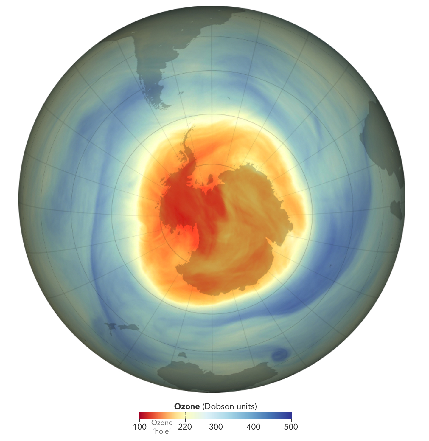
“The annual ozone hole has been forming later in the season in recent years, which tells us the ozone layer is healing,” said Paul Newman, a senior scientist at the University of Maryland, Baltimore County, and longtime leader of NASA’s ozone research team at the agency’s Goddard Space Flight Center in Greenbelt, Maryland. “But an unusually powerful polar vortex has extended ozone depletion in the Antarctic this season, allowing the hole to grow to proportions we haven’t seen in a decade.”
The ozone hole reached its greatest one-day extent for the year on Sept. 18 at 10.5 million square miles (27.1 million square kilometers). For comparison, the largest ozone hole observed since monitoring began reached its maximum extent in September 2000.
“The 2026 ozone hole is large but could have been 1 to 2 million square miles (3.5 million square kilometers) larger if ozone-depleting substances were as prevalent in the atmosphere today as they were at their peak in 2000,” Newman said.
The Antarctic polar vortex helps create the cold conditions that allow chlorine and bromine from human-made compounds to deplete stratospheric ozone.
“The polar vortex was unusually large this year in part because planetary-scale weather systems that typically propagate up from the lower atmosphere and break up the vortex were especially weak in August and September,” said Amy Butler, a research scientist at the NOAA Chemical Sciences Laboratory. “That weak wave action kept the strongest polar vortex winds further from the pole by several degrees of latitude, creating a larger area for conditions ideal for ozone depletion to occur.”
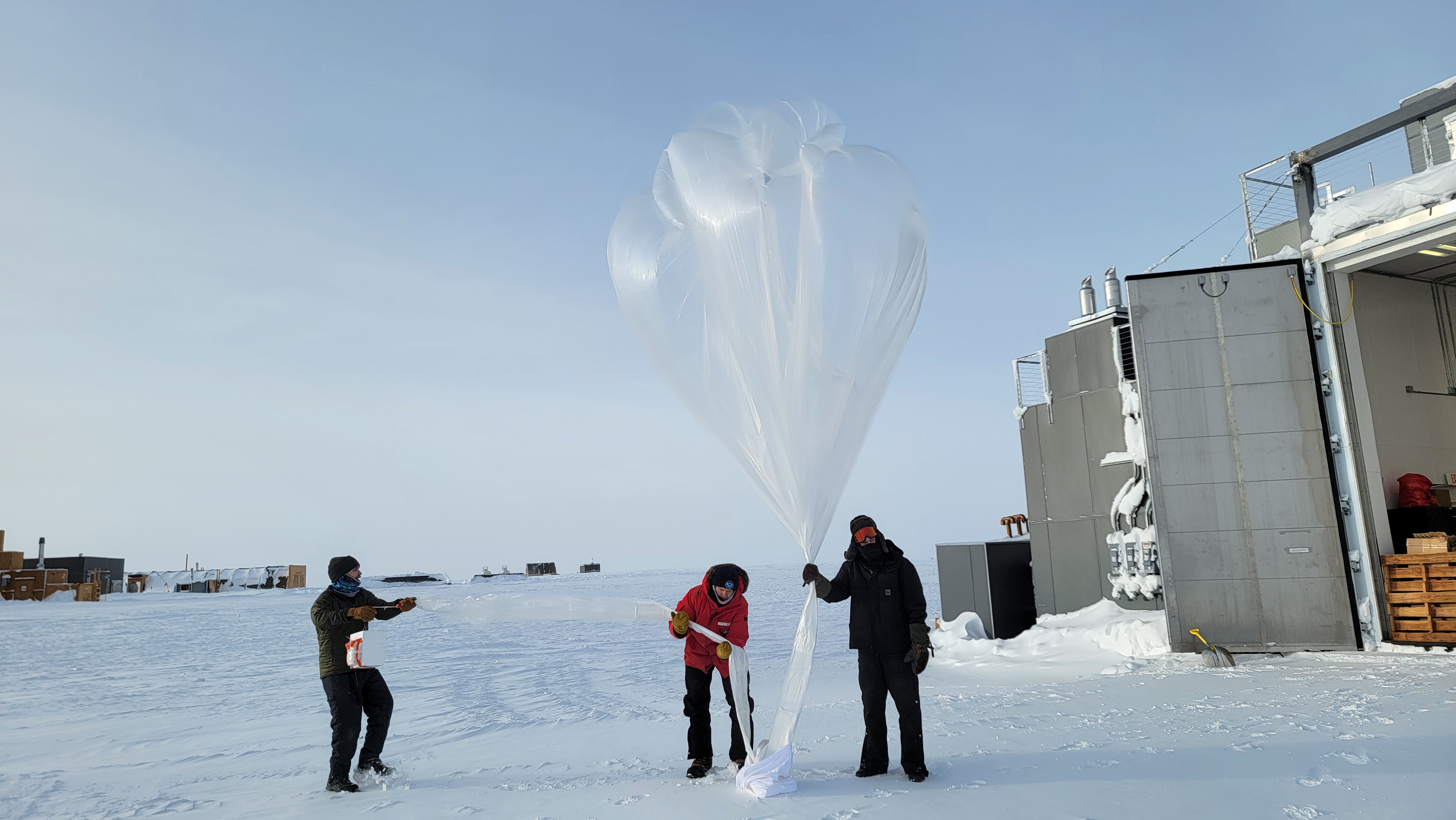
Despite its relatively large area, this year’s ozone hole was not as deep as the record ozone holes observed in previous decades. Using balloon-borne instruments from the South Pole Baseline Atmospheric Observatory, NOAA scientists found that ozone concentrations directly overhead reached their lowest value for the year — 105 Dobson units — on Oct. 17. The Dobson unit is the standard measurement used to express ozone concentration. The lowest value recorded over the South Pole was 92 Dobson units in October 2006.
In addition to NOAA’s balloon- and ground-based observations, satellite data has been integral to monitoring the health of Earth’s protective ozone layer since 1979. Instruments aboard NASA’s Aura satellite, the NOAA-20 and NOAA-21 satellites, and the Suomi National Polar-orbiting Partnership satellite, jointly operated by NASA and NOAA, all contributed to the report.
NASA and NOAA scientists said that the ongoing monitoring shows that controls established by the Montreal Protocol in 1987 continue to drive long-term recovery of stratospheric ozone. As part of that agreement, countries committed to replacing ozone-depleting substances with less-harmful alternatives. From their peak, chlorine levels in the Antarctic stratosphere derived from ozone-depleting substances have since declined by about a third relative to 1980s levels, said Stephen Montzka, senior scientist of the NOAA Global Monitoring Laboratory.
Chlorofluorocarbons and other ozone-depleting compounds were once widely used in consumer goods like refrigerators, air conditioners, and building insulation. They can linger in the atmosphere or leach out of old products and landfills for many decades. As those legacy compounds break down, scientists estimate that the ozone hole will recover by the 2070s.
View the latest status of the ozone layer over the Antarctic with NASA’s Ozone Watch and NOAA’s South Pole Ozone website. Learn more about how NASA studies the ozone hole.
By Sally Younger
NASA’s Earth Science News Team
Media Contact:
Aries Keck
NASA Headquarters
202-604-2356
[email protected]
Peter Jacobs
NASA’s Goddard Space Flight Center, Greenbelt, Md.
301-286-3308
[email protected]
Theo Stein
NOAA Communications
303-819-7409
[email protected]
Source: science.nasa.gov

This photo released on Nov. 2, 2026, showcases NGC 4449, a dwarf irregular. Researchers using NASA’s Hubble Space Telescope studied 37 nearby dwarf galaxies — small galaxies containing a few thousand to hundreds of millions of stars — including NGC 4449 and found that much of the oxygen they expected to see is missing.
Image credit: NASA, ESA, Hubble Heritage–ESA/Hubble Collaboration, Alessandra Aloisi (STScI, ESA)
Source: www.nasa.gov
4 min read
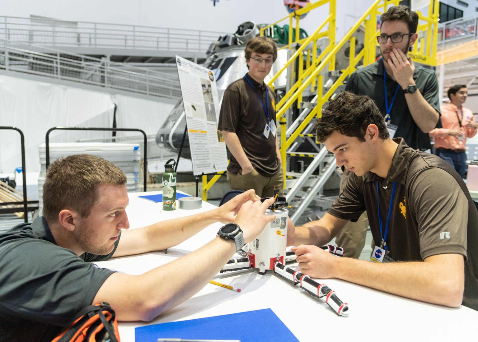
NASA’s Inspiration Tour spread the excitement of space exploration and aeronautical innovation by connecting the public, industry, and academia with the people, technologies, and organizations that drive American leadership in space. At nearly every stop across the country, NASA Space Grant has brought students into the heart of the action.
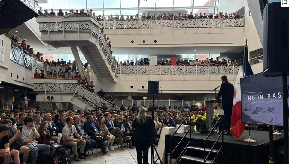
In Iowa, NASA Administrator Jared Isaacman toured the Make to Innovate program lab at Iowa State University. Students from the Iowa Space Grant Consortium’s Mission Moon program, along with consortium-funded student organizations including Cardinal Space Mining, CySat, and CyLaunch, shared research findings and demonstrated the institution’s strong connection to NASA via agency-funded projects. During a well-attended town hall event NASA experts briefed students on the agency’s Moon Base efforts and how their work can contribute to future exploration.
“We’re grateful for the opportunity to welcome NASA leadership to Iowa State,” said Sara Nelson Iowa Space Grant director. “The excitement among students was incredible, and the visit highlighted how the research and innovation happening in Iowa can help advance Artemis and NASA’s future exploration efforts.”
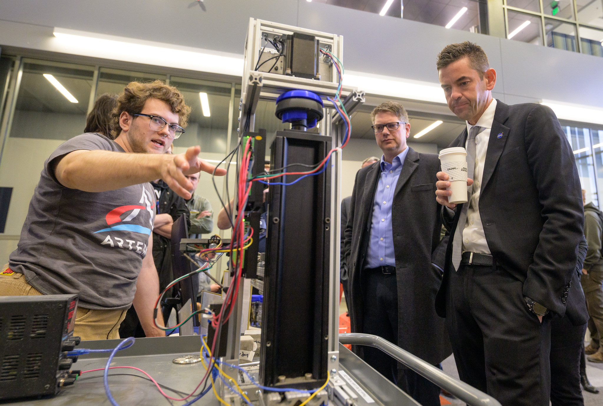
At the University of Arizona, the NASA administrator saw firsthand the space research and engineering capabilities that are enabled by the Arizona Space Grant Consortium. From satellite communications testing to complex optics for peering into deep space to student-built high-altitude balloon payloads and even small satellites, students at the University of Arizona have a long history of contributing to NASA missions and making aerospace career connections. This tour stop also included a Q&A session where the NASA administrator answered questions from local high school and college students.
“It was incredible to present the high-altitude ballooning research we do in SEDS (Students for the Exploration and Development of Space) to Jared Isaacman and those at NASA,” said Ella Miller, a junior studying mechanical engineering at the University of Arizona. “Arizona Space Grant has allowed me to get hands-on experience through an entire mission design process every semester, helping me pursue a career in space research and secure internships in this field.”
At the University of Alaska in Fairbanks, the Administrator toured two Geophysical Institute facilities: Poker Flat Research Range, the university’s scientific rocket launching facility, and the Alaska Satellite Facility. During an Alaska Space Grant science fair, students shared research in hibernation biology and showcased CubeSat technology advancements. Students were also able to learn about the agency’s Moon Base program and ask questions about opportunities available to the next generation of innovators and explorers.
In North Dakota, the Inspiration Tour focused on future exploration capabilities. Space Grant-funded research at the University of North Dakota is helping to shape the future of exploration across STEM fields. Student fellows and NASA interns shared their projects on supercell mergers using satellite imagery, geomagnetic conditions of aurora borealis, and in-situ resource utilization, to name a few. North Dakota Space Grant STEM ambassador students also shared robotics and drone activities as part of “Mission Moon”, which centers Artemis initiatives in statewide collaborations with educators and other North Dakota colleges and universities.
“Getting to speak with the NASA Administrator was an amazing opportunity!” said research fellow and STEM ambassador Malissa Reinhardt. “He genuinely cared about what we students had to say and the research we’re working on, which makes all the hard work we put into our research and North Dakota Space Grant Consortium so rewarding.”
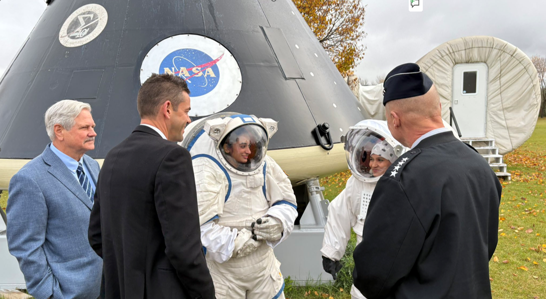
NASA’s Inspiration Tour will culminate in MAX POWER, a public showcase of air and space innovation on Nov. 7 and 8, highlighting the agency’s commitment to preparing the next generation of innovators and explorers for humanity’s next giant leap. As NASA enters a Golden Age of innovation and exploration, the national network of Space Grant consortia is expanding opportunities for students to lead the way in an aerospace workforce that is evolving and growing. At learning institutions from coast to coast, today’s Space Grant students are launching America’s future in space.
To find ways to engage with NASA’s exciting missions, broad range of careers, and unique learning opportunities, visit:
https://www.nasa.gov/learning-resources
Source: www.nasa.gov
3 min read
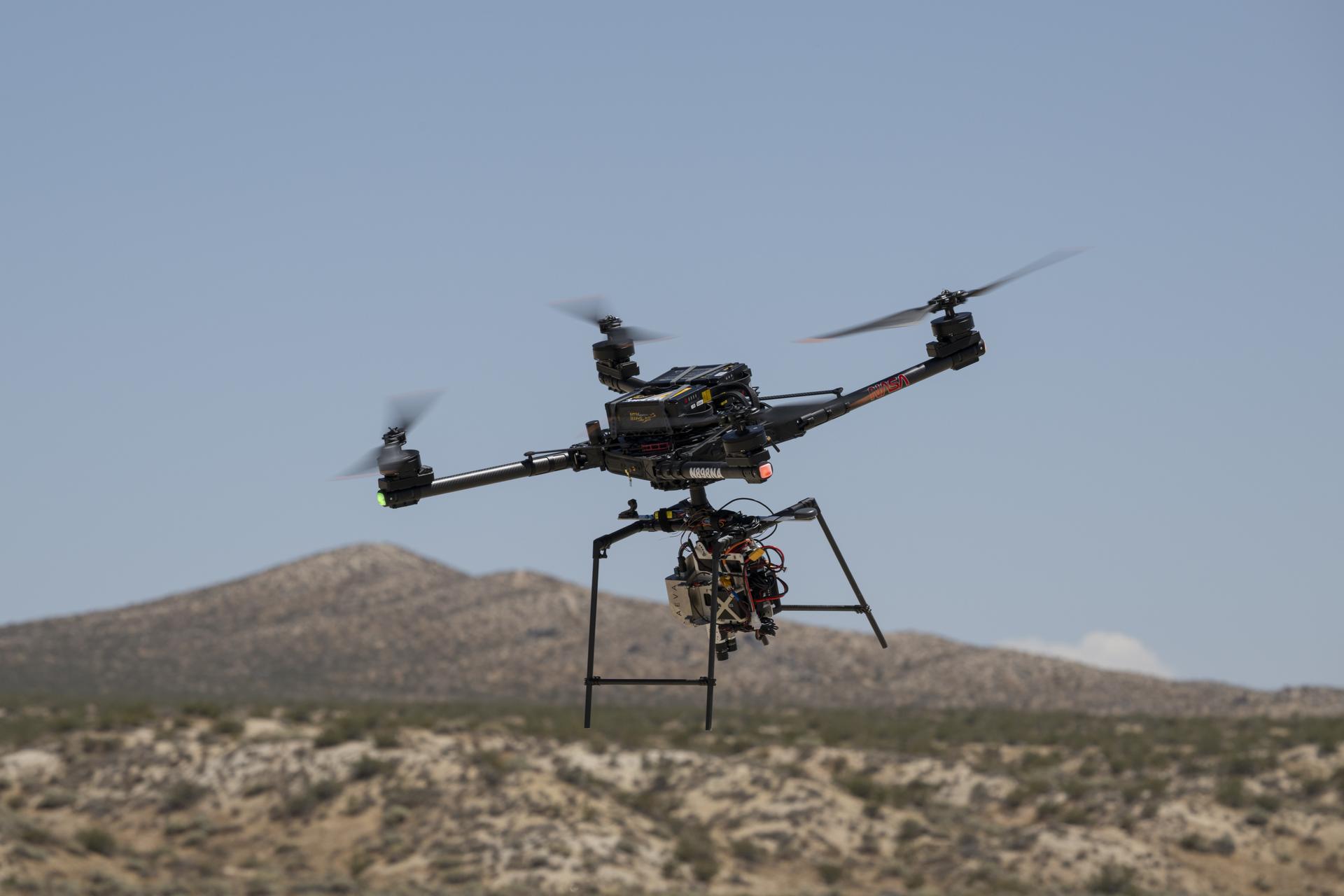
NASA successfully demonstrated technology designed to help spacecraft autonomously navigate to safe landing sites on the Moon and on other planets.
An Alta-X drone equipped with the agency’s Safe and Precise Landing – Integrated Capabilities Evolution (SPLICE) guidance, navigation, and control payload completed simulated lunar descent and landing maneuvers Aug. 27. The flight took place at Rogers Dry Lake near NASA’s Armstrong Flight Research Center in Edwards, California.
During the tests, the SPLICE payload used an advanced guidance system to map the terrain and assess potential landing areas. If the system determines the targeted landing area is unsafe, the system diverts the drone to a safer location. The system generates high-resolution digital elevation maps from light-detection and sensor data.
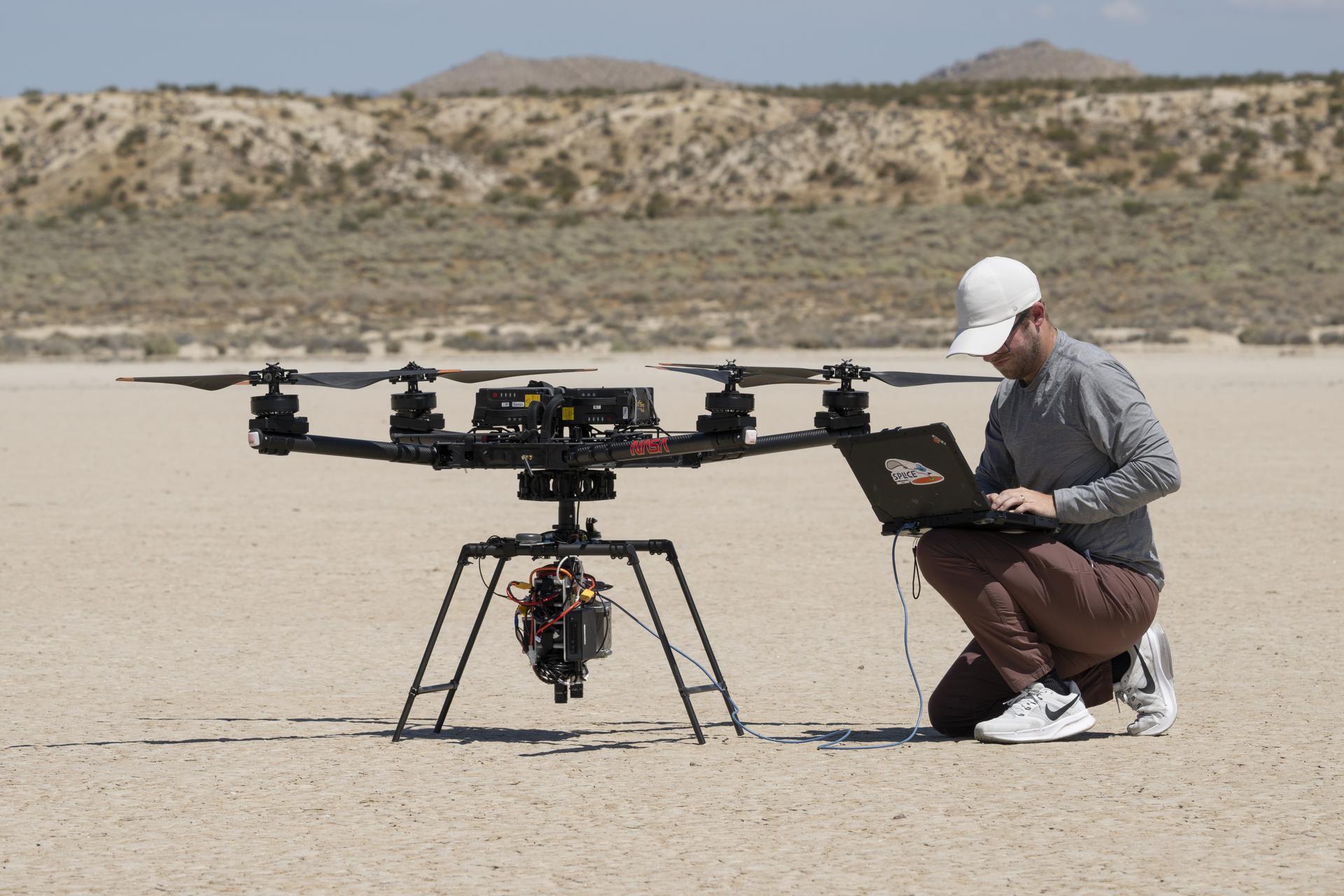
Researchers at NASA’s Johnson Space Center in Houston developed the SPLICE payload and partnered with specialists at NASA Armstrong to integrate, test, and fly it aboard the Alta-X drone in June and July. Those tests verified communications, data handling, telemetry, and command- control performance between the SPLICE payload and the drone to prepare for a full-scale test at Voyager Technologies in Mojave, California, later this month.
“This flight test is the culmination of almost a decade of work, for the SPLICE project,” said Davis Adams, NASA project manager. “This flight raised the technology readiness level, priming it for integration into future robotic and crewed lunar flights. Validation of the guidance and navigation systems are applicable to terrestrial, lunar, and Martian descent and landing missions.”
NASA has worked with a number of commercial lunar lander providers to implement iterations of SPLICE into their platforms. A number of the landers slated for upcoming Moon Base missions leverage data collected by NASA through the development of systems like SPLICE to execute soft touchdowns on the lunar surface.
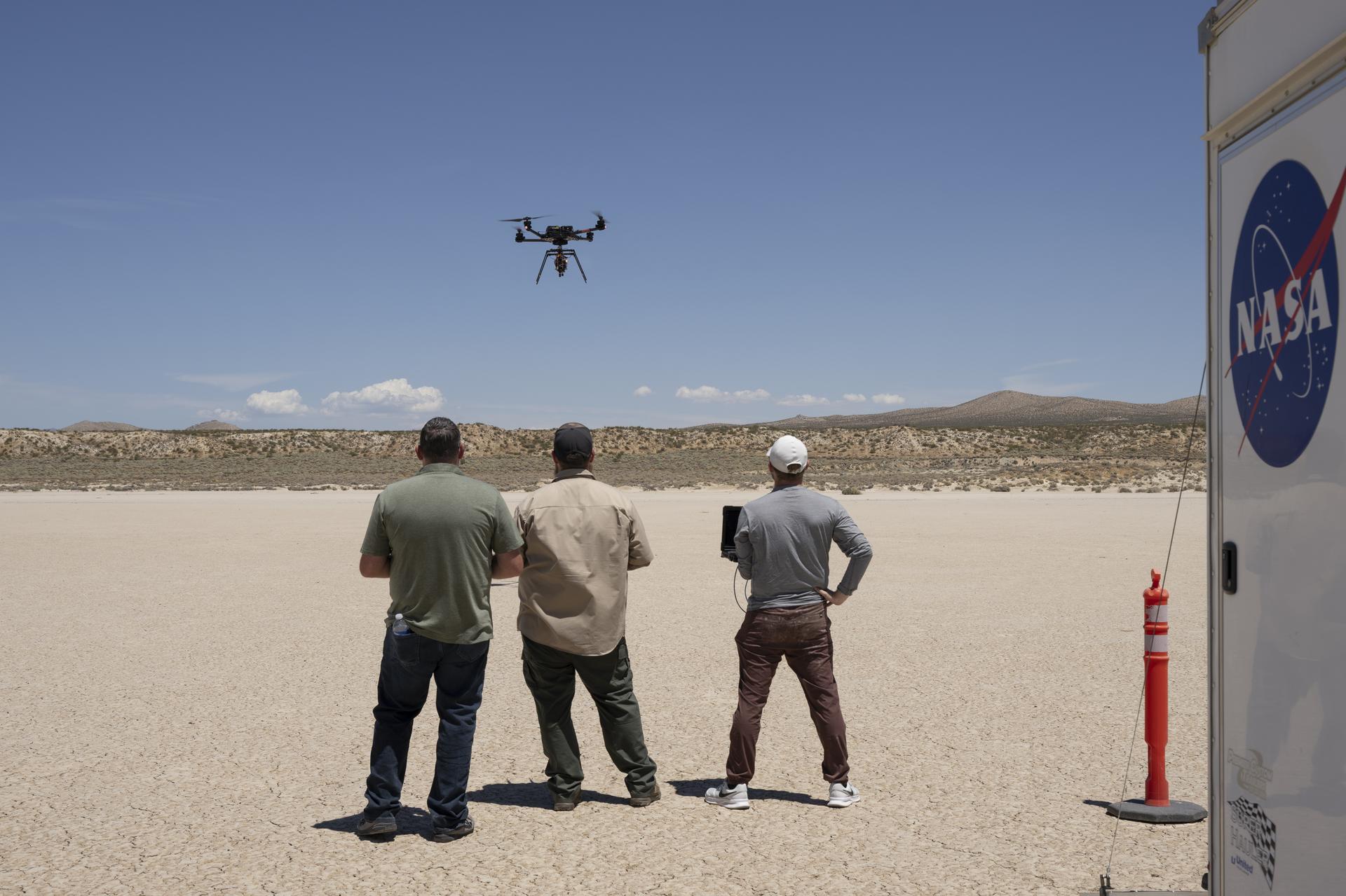
“We are coordinating with industry regarding the usage of the guidance system once the system is available in the NASA software catalog, currently planned for this fall,” Adams said. “Some of the companies also are evaluating the system’s navigation capabilities for precision landing applications, as well as potential extensions for autonomous surface mobility.”
NASA’s Flight Opportunities project, based at NASA Armstrong, enabled flight testing of the SPLICE project early in its development that laid a foundation for it to continue advancing its technology readiness level to what it is today. Flight testing included both a descent altitude and a landing trajectory in 2019 similar to what is expected on a lunar mission and the demonstration of two NASA-developed precision landing sensor systems in 2020.
Source: www.nasa.gov
NASA selected three companies on Wednesday to perform work to develop Ka-band space relay capability concepts that are compatible with current missions in space, ensuring service continuity for existing spacecraft without requiring modifications to their onboard systems.
Through this work, NASA will aim to acquire end-to-end solutions that include space, ground, launch, operations, and integration elements, as one of many customers in the commercial marketplace.
The awards, under the Next Space Technologies for Exploration Partnerships-3 Broad Agency Announcement Appendix E, are firm-fixed-price contracts that give NASA the option to provide additional funding up to the award limit to advance from initial concept development and risk reduction to an in-orbit flight demonstration. The initial period of performance runs from Nov. 4 through May 3, 2027, with additional priced options to continue work through 2029.
The contract awardees with maximum potential value inclusive of all future options are:
Facilitated through the agency’s SCaN (Space Communications and Navigation) program’s Communications Services Project, this work supports NASA’s decision to gradually retire the Tracking and Data Relay Satellite fleet and adopt commercial services for future missions. In addition to the commercial capabilities currently under development by the program’s industry partners, Ka-band services are needed to support select in-orbit missions that cannot feasibly modify flight hardware or transition to non-compatible commercial services.
To learn more about NASA’s Network Extension for User Continuity and Sustainability Ka-band service acquisition, visit:
-end-
Jennifer Dooren / Jessica Taveau
Headquarters, Washington
202-358-1600
[email protected] / [email protected]
Source: www.nasa.gov