Six soldier-athletes from the U.S. Army World Class Athlete Program will carry Army pride and medal ambitions to the 2026 United World Wrestling Championships in Astana, Kazakhstan.
Source: www.war.gov
Six soldier-athletes from the U.S. Army World Class Athlete Program will carry Army pride and medal ambitions to the 2026 United World Wrestling Championships in Astana, Kazakhstan.
Source: www.war.gov
3 min read

Written by Alex Innanen, Atmospheric Scientist at York University
Earth planning date: Friday, Oct. 9, 2026
Happy New Mars Year! We mark the start of a new year on Mars at the beginning of the northern hemisphere spring, or the vernal equinox. We then keep track of the seasons by counting degrees of solar longitude — each season is 90 degrees as Mars completes the whole 360 degrees of its orbit. The start of Mars year 39 at a solar longitude of 0 degrees (or Ls=0°, pronounced “ell-sub-ess-zero” if you want to sound like a Martian) came at the end of September on Earth. The new year also means it’s now autumn in Gale Crater, just south of the equator.
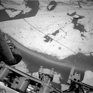
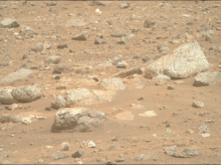
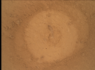
As Michelle talked about last week, we rang in the Martian new year with our drill campaign at “Basque Lakes.” This week was dedicated to wrapping up drill activities before we drive away on the weekend. After the team got a chance to see the results of last week’s lab activities, the SAM team decided on an additional GCMS (Gas Chromatograph/Mass Spectrometry) experiment. While GCMS tends to be an energy-intensive activity, we had four whole sols in Monday’s plan to play with, so we still had room for a slew of remote-sensing activities from Mastcam and ChemCam and contact science of the drill tailings — the bits of rock and minerals that are left over from our drill sample. This weekend’s plan gives us a couple more sols to wrap up drill activities at Basque Lakes and collect any last contact- or remote-science targets we want here before we begin a drive back toward the neat crystal forms we saw in the “Chiu Chiu” region.
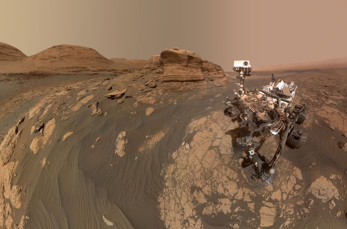
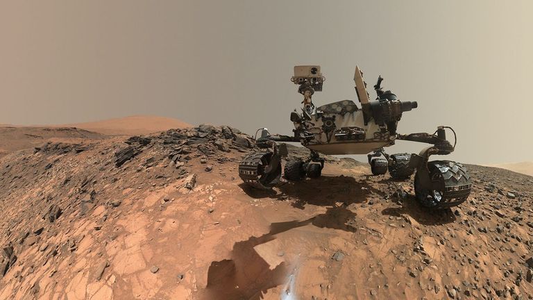
While all this is happening, the atmosphere around us continues to go through its seasonal changes. Autumn means the return of high-altitude twilight clouds, which the low sun angle at sunset illuminates beautifully. While twilight cloud activity will pick up as the autumn progresses, our late afternoon cloud movies on Wednesday of this week already caught our first high-altitude clouds of the season, as you can see at the top of this post. Most of the clouds we tend to see at Gale Crater are suboptical, or too thin to be seen with either human eyes or with Curiosity’s robotic “eyes,” but these twilight clouds are bright enough that we can see them in the raw Navcam images. I’m looking forward to another Martian autumn of watching all these different clouds go by.
Source: science.nasa.gov
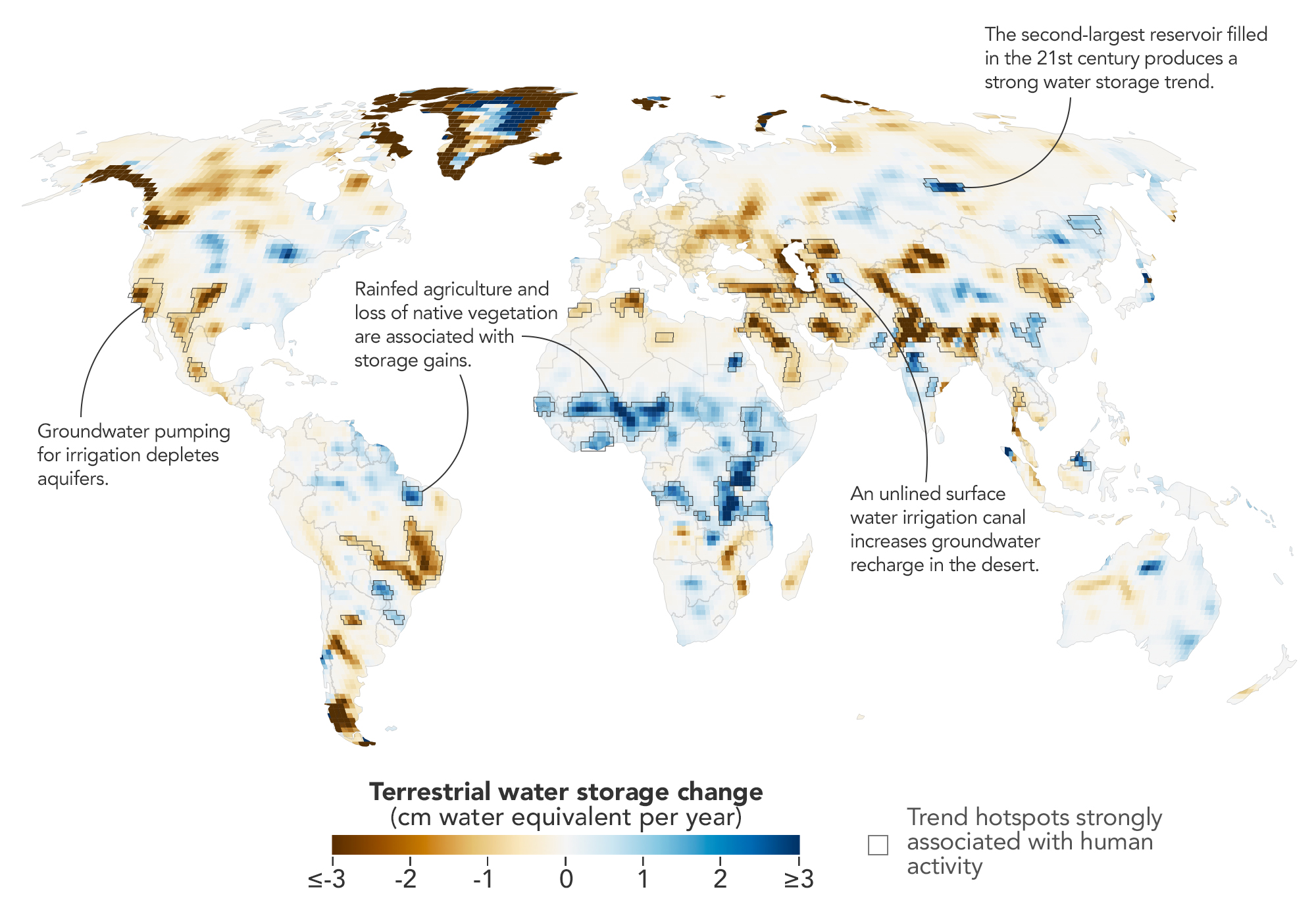
Humans are exerting increasing influence over how water moves through lakes, rivers, soil, and the subsurface, and a new NASA study shows where those effects are greatest. Using more than two decades of satellite measurements of subtle changes in Earth’s gravity, the researchers sharpened the picture of how—and why—terrestrial water storage has changed.
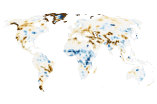
This map encapsulates their findings, depicting changes in terrestrial water storage from April 2002 to November 2025. Beyond the influence of climate variability, the scientists identified 40 regions where the changes also aligned with human activities such as irrigation, reservoir impoundment, and land-use change. These activities were significantly related to terrestrial water storage trends on every nonpolar continent except Australia.
In some areas, the effects of human activities were especially strong. “In four continental regions, an anthropogenic variable showed a stronger relationship with the storage trends than any climate variable did,” said Mary Michael O’Neill, a hydrologist at NASA’s Goddard Space Flight Center and lead author of the study.
They include well-known spots such as California’s Central Valley and northern India, where farmers’ heavy reliance on groundwater has drawn down storage—in India’s case, faster than earlier estimates suggested. Elsewhere, some types of farming and water management appear to have done the opposite.
The data behind the map come from the GRACE (Gravity Recovery and Climate Experiment) and GRACE-FO (GRACE Follow-On) missions, each of which consists of two satellites that fly in tandem. As the lead satellite passes over an area with greater mass, the slight change in gravity tugs at it, and instruments aboard the satellites measure the change in distance between them. Since water and ice are heavy and shift around regularly, scientists can use GRACE data to infer gains and losses.
The satellites’ data are typically processed into monthly maps that show broad patterns of water storage. But over more than 20 years, the satellites have passed over most of the planet many times. By combining all of those passes, the researchers could map long-term water trends with five to 10 times more spatial detail than previous analyses. The tradeoff was a loss of temporal detail. They then applied statistical techniques to weigh the importance of various anthropogenic and climatic factors in the storage trends and to pinpoint where human activities may have contributed.
The improved spatial resolution uncovered some human impacts that had not been previously detected, said Matthew Rodell, deputy director of Earth Sciences for Hydrosphere, Biosphere, and Geophysics at Goddard and one of the study’s authors. The analysis also showed that some known trends were stronger than previously realized.
Across several continents, groundwater-irrigated farmland was strongly associated with declines in terrestrial water storage. In North America, these declines appeared in California’s Central Valley, the southern High Plains of the U.S., and Chihuahua, Mexico, where long-term droughts have increased farmers’ reliance on groundwater. Groundwater pumping also drove declines in northern India, where the refined analysis showed a steeper downward trend than previously realized. Consistent with previous findings, retreating Himalayan glaciers accounted for only 15 percent of the decline there.
Other types of agriculture had a different relationship with water storage trends. In parts of sub-Saharan Africa, for example, some increases occurred where rainfed cropland has expanded. There, swaths of native savanna were replaced by millet cultivation throughout the study period, and water tables rose despite below-average precipitation. A similar pattern emerged in northern Brazil’s Maranhão state, where soybean fields have replaced forests and shrublands. The resulting water storage trend might be explained in part by the efficient water use of cereal and legume plants and by Indigenous practices that help direct water into shallow aquifers, the researchers said.
Water storage and diversion projects also came into focus on the new map. Hundreds of large reservoirs were filled during the study period, the authors note, but the coarse spatial resolution of gravity measurements previously made them difficult to track. In the new analysis, the Boguchany Reservoir on Russia’s Angara River, the second-largest reservoir filled in the 21st century, produced the strongest water storage trend in nonpolar northern Asia.
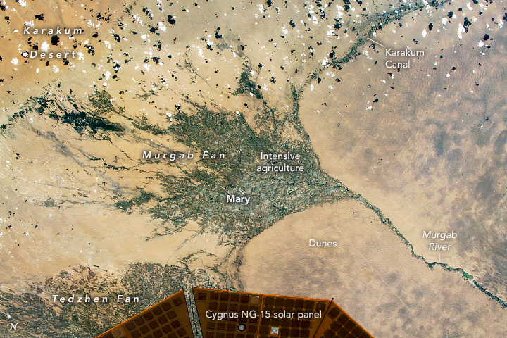
The map also resolves smaller reservoirs and other hydrologic engineering projects. The Karakum Desert in Turkmenistan registered water storage gains stemming from the long, largely unlined Karakum Canal running through it. The canal diverts river water to support desert agriculture, but enough seeps into the ground during its journey to alter the water picture in the desert. The map’s finer resolution allows for better monitoring of such hydrologic changes in remote areas where other measurement options may be limited.
Moving forward, O’Neill wants to capture how dams, diversions, irrigation, and other controls on Earth’s water affect storage downstream, and to disentangle the influence of local and non-local activities. “I’d also like to recover more of the temporal picture,” she said. One way to do that is by combining the higher-resolution data with standard monthly products or by applying the recent technique over shorter timeframes. “This could help track how localized trends evolve in response to specific events like droughts or policy changes.”
NASA Earth Observatory map by Michala Garrison, using data from O’Neill, M.M., et al. (2026). Astronaut photograph ISS065-E-111045 was acquired on June 13, 2021, with a Nikon D5 digital camera using a focal length of 1,150 millimeters. It is provided by the ISS Crew Earth Observations Facility and the Earth Science and Remote Sensing Unit at NASA Johnson Space Center. The image was taken by a member of the Expedition 65 crew. The image has been cropped and enhanced to improve contrast, and lens artifacts have been removed. The International Space Station Program supports the laboratory as part of the ISS National Lab to help astronauts take pictures of Earth that will be of the greatest value to scientists and the public, and to make those images freely available on the internet. Additional images taken by astronauts and cosmonauts can be viewed at the NASA/JSC Gateway to Astronaut Photography of Earth. Story by Lindsey Doermann.
Stay up-to-date with the latest content from NASA as we explore the universe and discover more about our home planet.
Drought in the Rio Grande basin contributed to New Mexico’s largest reservoir dwindling to its lowest level in decades.
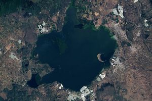
Relentless rains are threatening a lake in Kenya’s Great Rift Valley that has become a key hub in the global…

Using satellite data, researchers connected harmful algal blooms with warm water and low water levels at one of Colorado’s largest…
Source: science.nasa.gov
APOD
Astronomy Picture of the Day
Discover the cosmos! Each day a different image or photograph of our fascinating universe is featured, along with a brief explanation written by a professional astronomer.

Explanation: This is an unusual rainbow. For one thing, the rainbow is not complete, appearing only in a sunlit fan — but that by itself is not very unusual. What is most unusual is the fake location of the Sun. The Sun appears to be toward the front, just below those hills — but it is not. That is not how rainbows work. Rainbows involve a backward reflection from falling rain, so that the Sun must really be behind you. In this case, gaps between clouds near the setting Sun allowed rays to cross the entire sky and appear to converge in front, an unusual phenomenon called anticrepuscular rays. The photo was taken with a phone last week at sunset in Presenzano, Italy. The seemingly reverse rainbow was noticed when hanging up laundry.
Tomorrow’s picture: open space
| Date | October 20, 2026 |
|---|---|
| Credit & Copyright | Aurelia Degli Esposti |
| Authors & editors: | Robert Nemiroff, Jerry Bonnell, Cecilia Chirenti, Keighley Rockcliffe |
| A service of: |
ASD at NASA / GSFC, NASA Science Activation & Michigan Tech. U. |
Source: science.nasa.gov
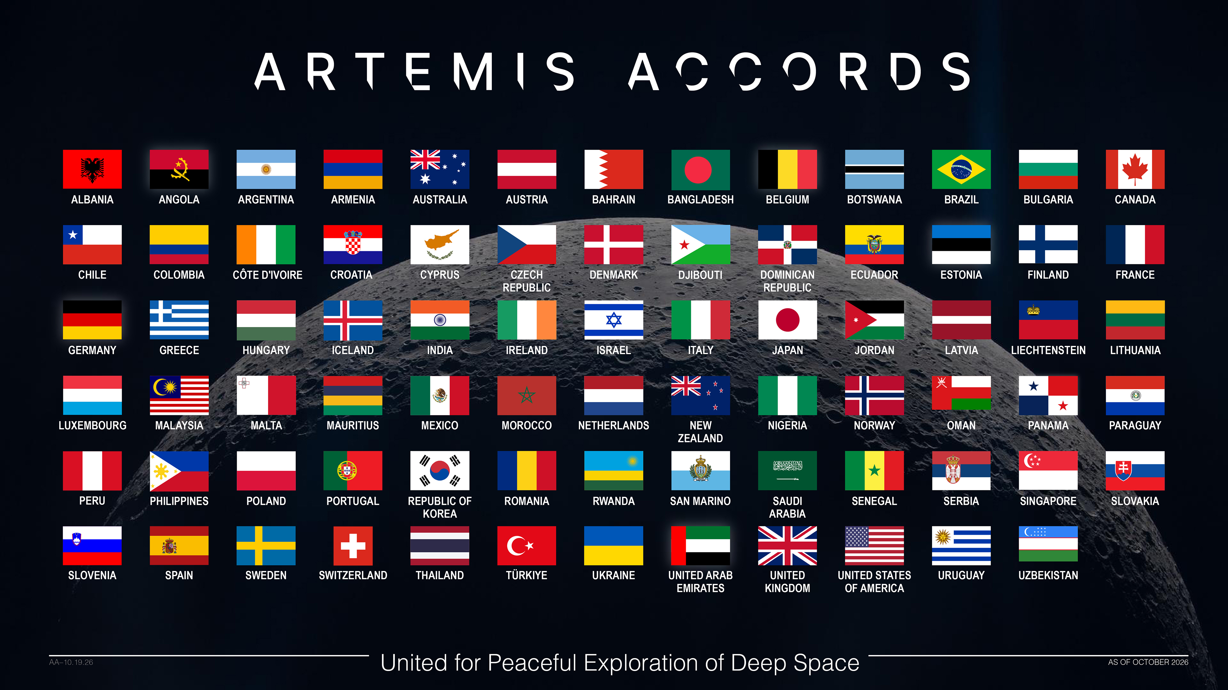
The Republic of Uzbekistan became the 77th signatory of the Artemis Accords during a ceremony in Samarkand on Monday, committing to the practical principles that guide safe, transparent, and responsible civil space exploration.
“Uzbekistan joins the Artemis Accords at a pivotal moment,” said NASA Deputy Administrator Matt Anderson. “President Trump has directed NASA to build a Moon Base and establish an enduring presence on the lunar surface. As we put the principles of the Artemis Accords into practice, we are expanding opportunities for like-minded nations around the world to contribute to humanity’s return to the Moon. Uzbekistan is a welcome addition to this growing coalition.”
Minister of Foreign Affairs of the Republic of Uzbekistan Bakhtiyor Saidov signed the Artemis Accords on behalf of the country. The signing took place during a visit by U.S. Secretary of State Marco Rubio.
Uzbekistan has increasingly engaged with NASA and the broader international space community through its development of a national space program aimed at advancing Uzbekistan’s space industry and participation in global space forums. Uzbek students also are working to develop and launch the country’s first CubeSat, or small satellite technology demonstration, by 2028.
In early October, NASA officials met with representatives from Uzbekistan’s Ministry of Digital Technologies and Uzbekistan’s space agency, Uzcosmos, during the 2026 International Astronautical Congress in Antalya, Türkiye, where the two sides discussed civil space cooperation and opportunities for increased engagement. Uzbekistan is scheduled to host the annual global space event in 2028.
In 2020, NASA and the State Department joined with seven other founding nations to establish the Artemis Accords, responding to the growing interest in lunar activities by both governments and private companies. They introduced the first set of practical principles aimed at enhancing the safety and coordination between nations as they explore the Moon, Mars, and beyond.
Signing the Artemis Accords means committing to explore peaceably and transparently, to render aid to those in need, to enable access to scientific data that all of humanity can learn from, to ensure activities do not interfere with those of others, and to preserve historically significant sites and artifacts by developing best practices for space exploration for the benefit of all.
More countries are expected to sign the Artemis Accords in the months and years ahead, as NASA continues its work to establish a safe, peaceful, and prosperous future in space.
Learn more about the Artemis Accords at:
https://www.nasa.gov/artemis-accords
Source: www.nasa.gov

An image from NASA’s James Webb Space Telescope released on Oct. 6, 2026, reveals a cauldron of cosmic creation. Webb has unveiled numerous stars formerly hidden by clouds of dust in a stellar nursery known as NGC 7129, which resides about 3,300 light-years from Earth.
Learn more about this region – and tour it in an interactive experience.
Image credit: NASA, ESA, CSA, STScI; Image Processing: Alyssa Pagan (STScI)
Source: www.nasa.gov
6 min read
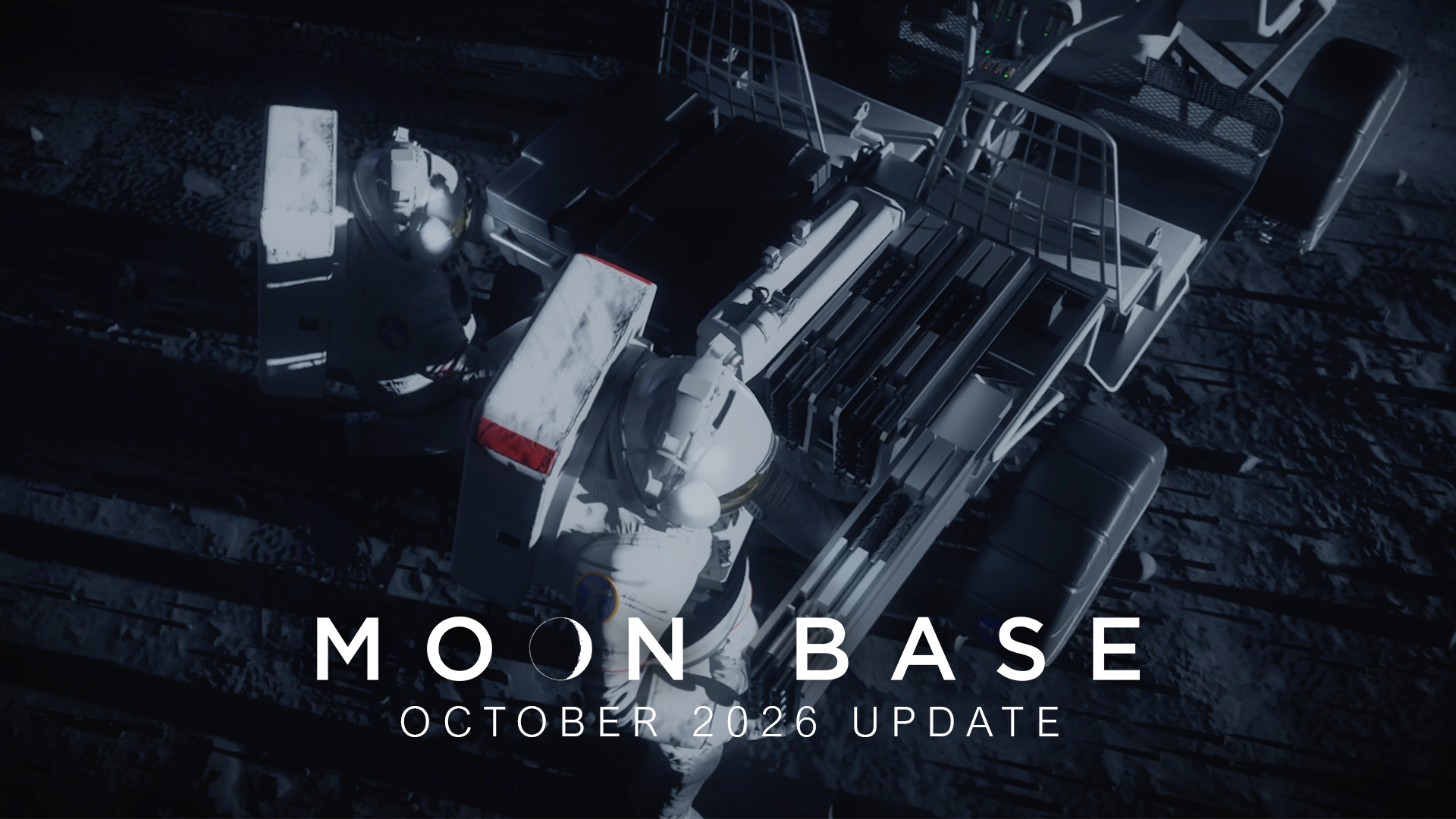
As NASA works to build the Moon Base, crewed and robotic lunar rovers will play a crucial role during early development through technology demonstrations, astronaut transport, terrain mapping, scientific investigations, and resource prospecting. Data from these early missions will inform future mobility systems and infrastructure needed for astronauts to live and work on the Moon.
On Tuesday, NASA released a Moon Base video update offering a closer look at the progress being made on the commercial lunar terrain vehicles and robotic rovers that will enable the surface mobility needed to build humanity’s first lunar outpost.
“Lunar rovers are central to our surface mobility strategy,” said Robert Pickle, director of the Surface Mobility Office within the agency’s Moon Base Program. “Their performance will lay the groundwork for the mobility systems that will define the next era of exploration and ultimately determine how effectively we can build, operate, and expand the infrastructure required for long‑duration exploration.”
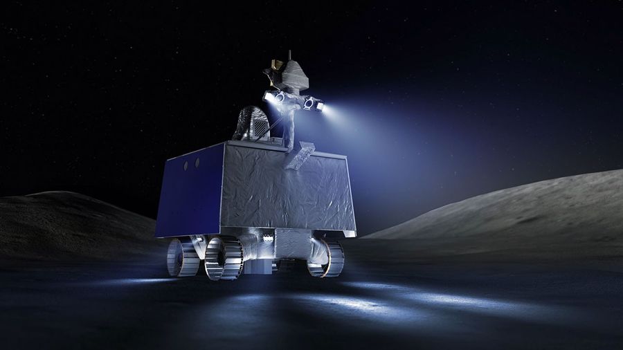
NASA’s VIPER (Volatiles Investigating Polar Exploration Rover) will embark on a mission to the lunar South Pole region in 2027 to venture into permanently shadowed craters looking for water and other valuable resources essential for sustainable exploration.
After delivery to the lunar surface by a Blue Moon Mark 1 lander, VIPER will travel more than 18 miles (30 kilometers), collecting information about the thermal, lighting, and terrain environment in the Moon’s South Pole region. This data could provide information about the origin and distribution of water on the Moon, help determine how lunar resources could be used for the Moon Base, as well as better understand the history of the Moon, Earth, and the processes that helped shape conditions for life.
Mission operations for VIPER will be run out of NASA’s Ames Research Center in Silicon Valley where teams are simulating possible scenarios for when the rover begins its mission on the Moon.
The VIPER rover is currently at NASA’s Johnson Space Center in Houston where it is fully built and undergoing final testing before traveling to NASA’s Kennedy Space Center in Florida for launch to the Moon.
To advance surface mobility on the Moon, NASA awarded Astrolab and Lunar Outpost task orders to build the first phase of Moon Base rovers capable of carrying crew, called lunar terrain vehicles (LTVs), that will be delivered to the Moon ahead of crewed Artemis missions. NASA awarded Blue Origin a task order to deliver the LTVs to the lunar South Pole region by 2028 through the agency’s CLPS (Commercial Lunar Payload Services) initiative.
The LTVs will be remotely operated from Earth, traversing up to 3.7 miles (6 kilometers) a day, mapping the lunar surface to help scientists produce high-resolution maps of the region, prior to crew arriving on future missions. The rovers also will collect information to help NASA and its partners learn about operating in this extreme environment, such as data on lighting, navigation, and how well the LTVs preserve energy and function when driving in and out of permanently shadowed regions that can reach minus 334°F (minus 203°C). This will help inform Moon Base development and improve on design and capability for future mobility systems, hardware, and infrastructure.
During missions on the lunar surface, Artemis astronauts will drive the LTVs as they explore geologically diverse areas of the lunar South Pole region, gathering geology samples to bring back to Earth for scientists to study. The LTVs will be able to support up to three moonwalks per Artemis mission, transport up to 176 pounds (80 kilograms) of lunar samples and tools, and travel up to six miles (10 kilometers) on a single battery charge.
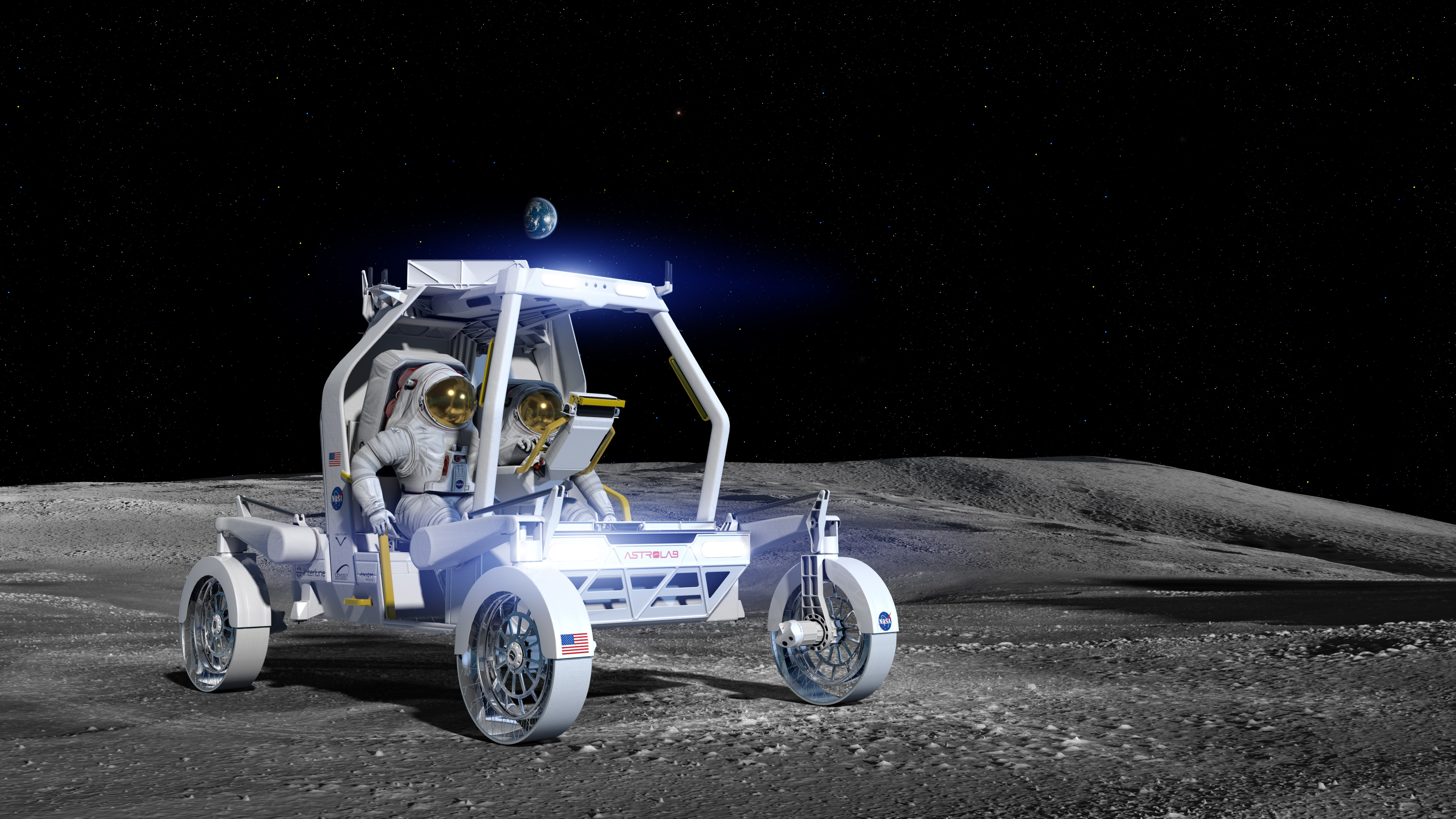
Astrolab’s Crewed Lunar Vehicle 1, or CLV-1, is a rover adapted from the company’s FLEX (Flexible Logistics and Exploration Vehicle) LTV architecture. Astrolab recently delivered a mockup of CLV-1 to Axiom Space, where NASA astronauts wore mock-ups of the Artemis lunar spacesuit and evaluated the lunar rover’s design, crew cabin, and display interfaces.
Prior to CLV-1 arriving to the Moon, Astrolab will send its first robotic rover, FLIP (FLEX Lunar Innovation Platform), to the lunar surface as a payload on Voyager Technologies’ Griffin Mission One scheduled to launch in late 2026. FLIP will study the environment of the South Pole and serve as a testbed for critical subsystems on CLV-1, which will include similar tires, batteries, radios, and cameras.
In the next few weeks, Astrolab engineers will head to NASA’s Glenn Research Center in Cleveland where they will use the center’s Simulated Lunar Operations laboratory to evaluate the how CLV-1’s flexible, airless wheels perform while driving on a simulated lunar surface.
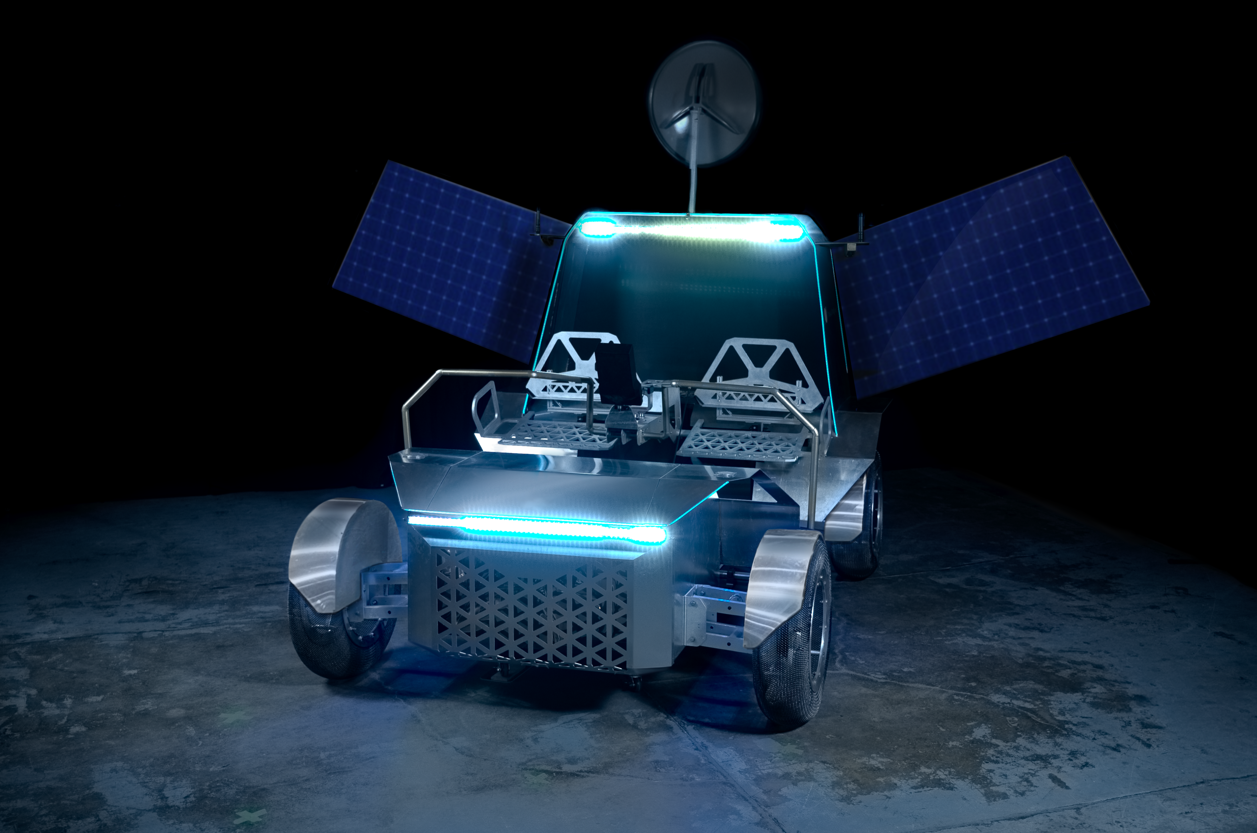
Lunar Outpost’s Pegasus crewed LTV is a lighter, mission-ready evolution of the company’s Eagle LTV. Prior to the award, Lunar Outpost built two mockups of Pegasus and recently delivered a third static mockup to NASA’s Johnson Space Center for crewed testing. During the test, NASA astronauts wore pressurized spacesuits and evaluated the rover’s design, usability, and crew comfort.
In 2025, Lunar Outpost’s robotic exploration rover MAPP (Mobile Autonomous Prospecting Platform) operated at the Moon’s South Pole. During the mission, MAPP acted as a testbed and collected data, achieving flight-proven readiness for key hardware and software subsystems, like its automatic thermal control system, navigation cameras, and mission control software that will be used to remotely operate Pegasus. With a second MAPP rover scheduled to launch in early 2027, Lunar Outpost is advancing many of the key technologies that are directly transferable to Pegasus.
In the next few weeks, Lunar Outpost teams also will head to NASA Glenn to test and evaluate the soil mechanics, traction, and mobility of Pegasus’ spring mesh tires.
In the coming months, both Astrolab and Lunar Outpost will test drivable LTV mockups with NASA crew to evaluate how the rovers drive and operate in a simulated lunar environment. Lunar Outpost is scheduled to complete the preliminary design review of their LTV in October, and Astrolab is scheduled to complete their preliminary design review by the end of December. Both companies are on schedule to deliver the flight-ready hardware to NASA at the end of 2027.
As part of a Golden Age of innovation and exploration, NASA will send Artemis astronauts on increasingly difficult missions near the lunar South Pole to explore more of the Moon than ever before. In addition to providing economic benefits and advancing scientific discovery through its Moon missions, NASA will establish an enduring human presence on the lunar surface and build on the agency’s foundation for the first crewed mission to Mars.
To learn more about the Moon Base, visit:
Source: www.nasa.gov
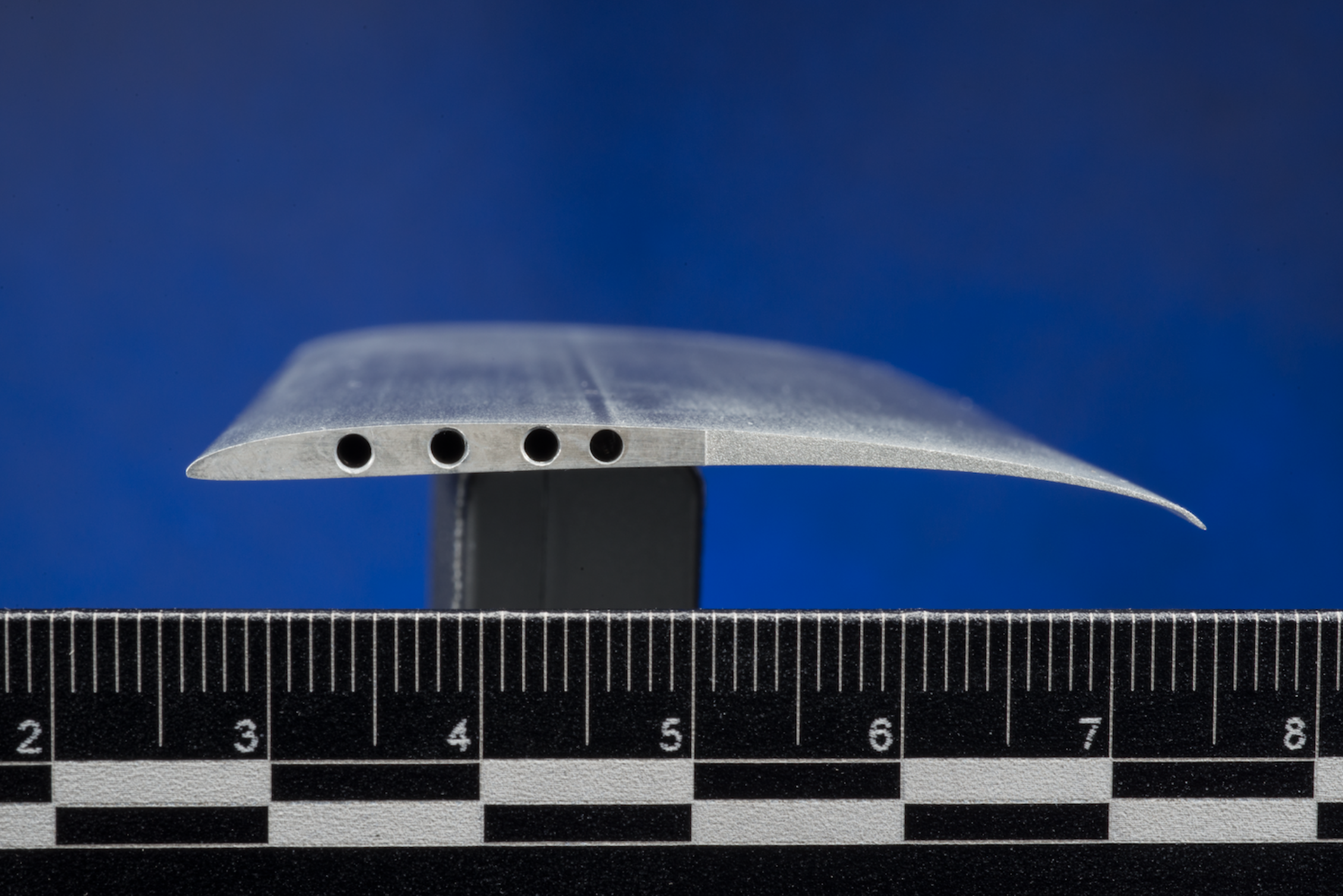
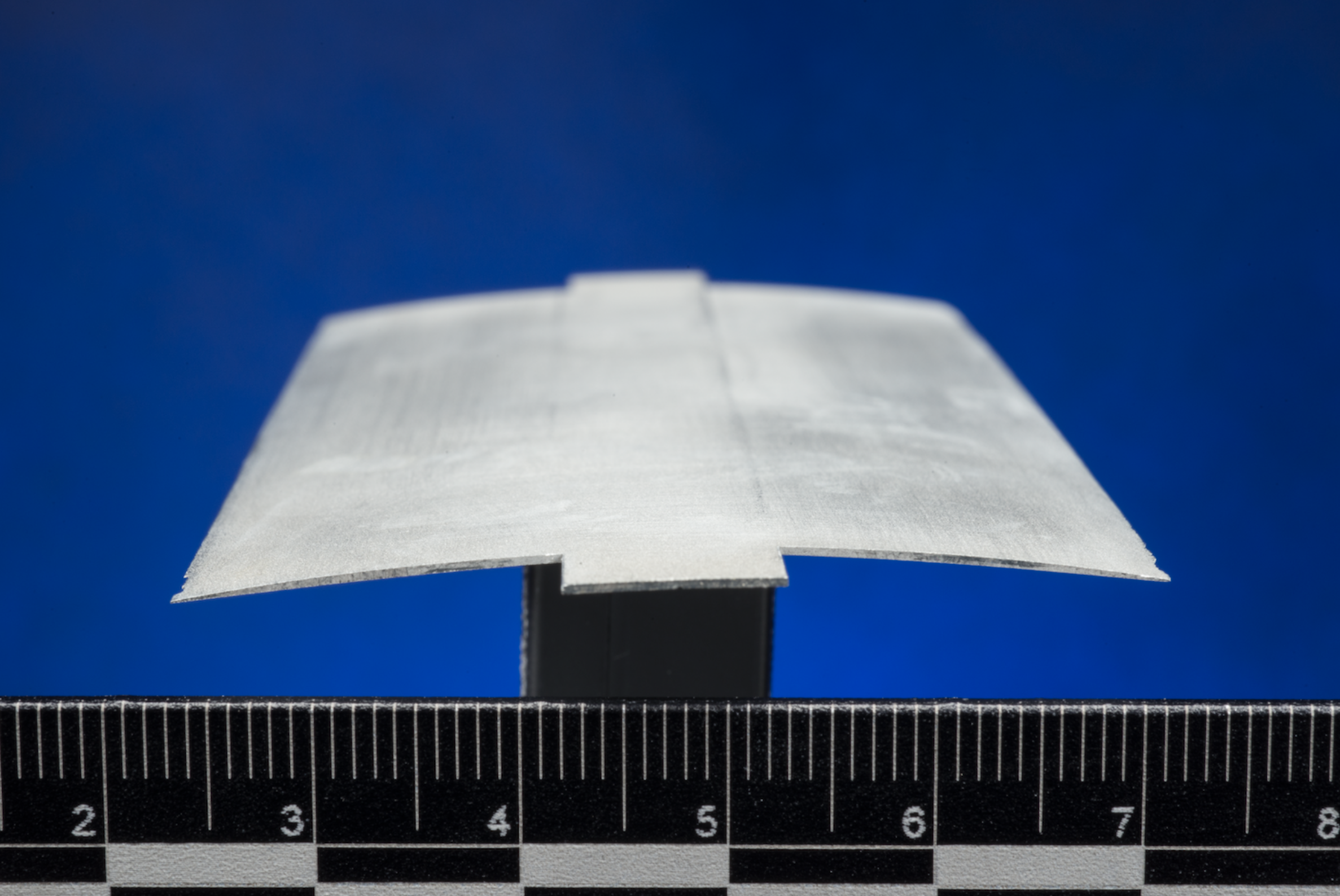
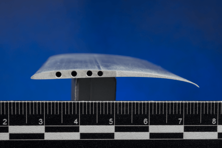

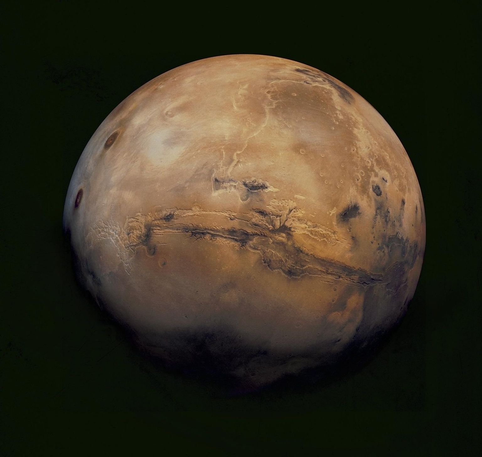
NASA researchers are developing the future of flight on Mars, laying the groundwork for helicopters with the ability to fly higher and farther while conducting science on the Red Planet. Using high-fidelity computer simulations and wind tunnel tests, engineers are reimagining the rotorcraft blades that could carry the next generation of Mars flyers.
NASA’s Ingenuity helicopter made history as the first powered aircraft to fly on another planet. The SkyFall mission, scheduled for launch in 2028, builds on that legacy with a trio of helicopters destined for Mars exploration. Both missions utilize a blade designed to operate in Mars’ thin atmosphere, with a curved edge reminiscent of but distinct from blades used on Earth.
Researchers are exploring unconventional blade designs that are thinner and sharper, aiming to enable future missions after Skyfall to expand their single-flight range across Mars. One team at NASA’s Ames Research Center in California’s Silicon Valley is working with Imperial College London, United Kingdom, and Nagoya University, Japan, to test a new blade cross-section, or airfoil, that promises to significantly boost aerodynamic performance on Mars.
Researchers designed the new airfoil, called roamx-0201, using advanced simulations and algorithms tuned to Mars conditions, pointing researchers toward a thinner, asymmetrical shape. Subsequent wind tunnel tests showed that the optimized design boosted performance and was better able to recover in risky flight conditions.
Researchers used high-fidelity simulation tools to analyze the performance of the roamx-0201 airfoil and compare it to Ingenuity’s capacity. They found that the redesigned blades could enable future Mars helicopters to expand the distances that can be covered in one uninterrupted flight from Ingenuity’s 0.7 kilometers to as much as 18.7 kilometers while carrying scientific instruments. The findings were announced in a paper published Sept. 22 in the journal of the American Institute of Aeronautics and Astronautics.
The roamx‑0201 blades performed well in part because they were able to operate longer at higher speeds before experiencing a phenomenon known as “drag divergence”, where performance drops suddenly when the rotors approach the speed of sound, which is lower on Mars than on Earth.
The new blade also differs from earlier designs in how it uses turbulence to create lift. As air flows over a rotorcraft blade, it forms a thin region called the “boundary layer.” The new airfoil intentionally disrupts the flow of that boundary layer at the front of the airfoil directly at the leading edge to create a disturbance that, counterintuitively, pulls the blade upward to help lift the rotorcraft more effectively than with earlier designs.
Another challenge for rotorcraft is “stall,” an aerodynamic condition in which performance drops sharply and flight becomes unstable following a change in the angle of airflow. Ingenuity’s blades experienced steep performance degradation at stall, but under the conditions studied, the roamx-0201 design showed significantly improved stall behavior. That means future helicopters could operate safely at a wider range of flight angles.
While the technology is not yet ready for Mars, tests are helping engineers understand and resolve discrepancies between computational predictions and real-world performance. Ongoing research across NASA aims to enable more efficient Mars helicopters that can fly farther, carry more payload, and unlock new science and discovery missions.
Source: www.nasa.gov
2 min read
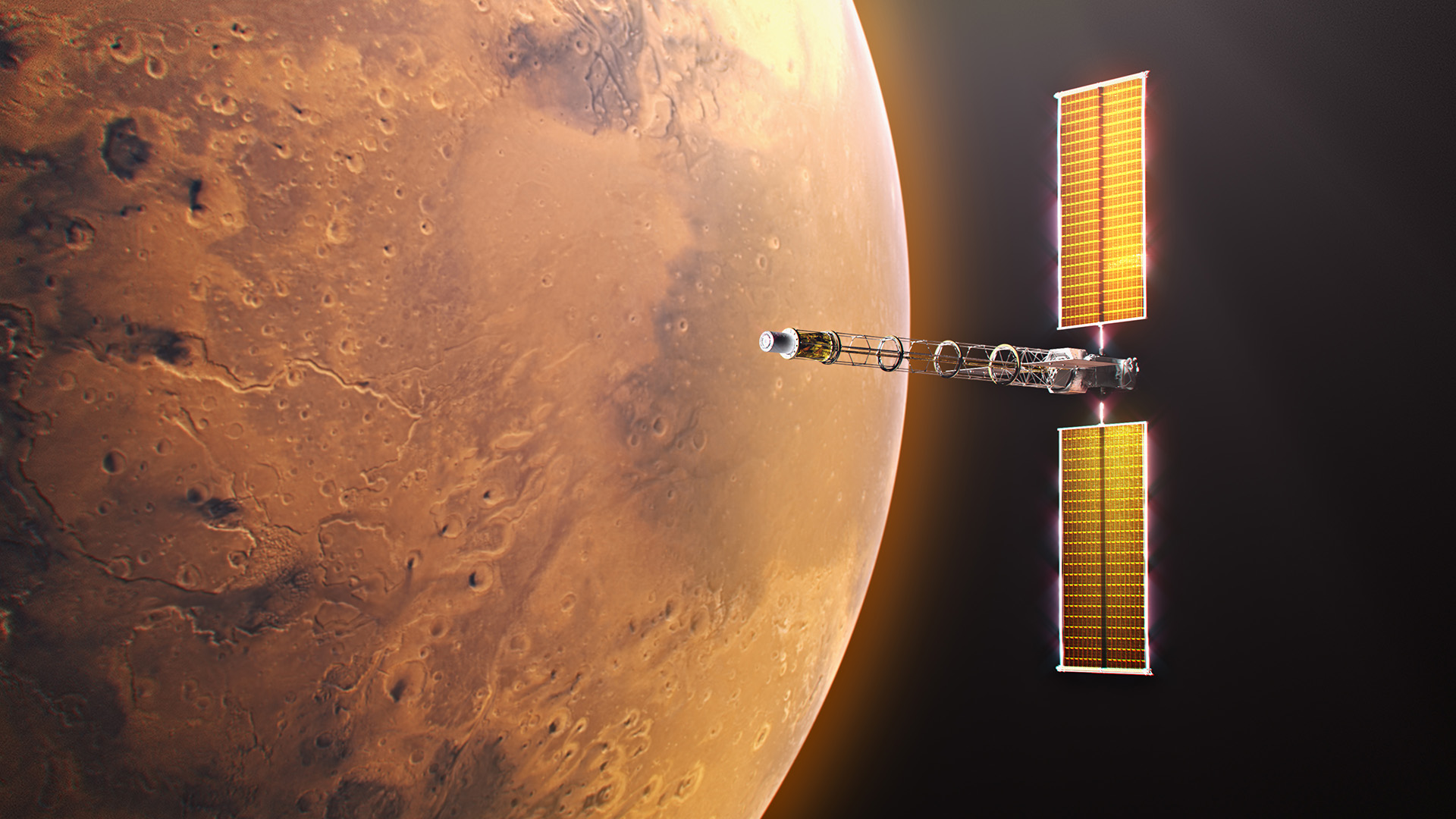
Destined for Mars and beyond, NASA’s Space Reactor-1 (SR-1) Freedom will be humanity’s first fission-powered spacecraft to travel outside Earth’s orbit. Announced during NASA’s “Ignition” event, this mission will demonstrate nuclear electric propulsion in deep space, and progress is underway on its key element: the nuclear power module. To expedite development of the spacecraft, NASA and its partners have mutually agreed to key contract actions that will advance the SR‑1 Freedom mission.
“These contract actions not only reduce technical risk and help us maintain momentum toward our 2028 launch, but they also strengthen collaboration across our partners,” said Steve Sinacore, SR-1 Freedom program director. “These actions keep SR‑1 Freedom on track and ensure we’re building the strongest possible foundation for NASA’s first fission‑powered voyage beyond Earth orbit while developing technology extensible to a vibrant space nuclear future.”
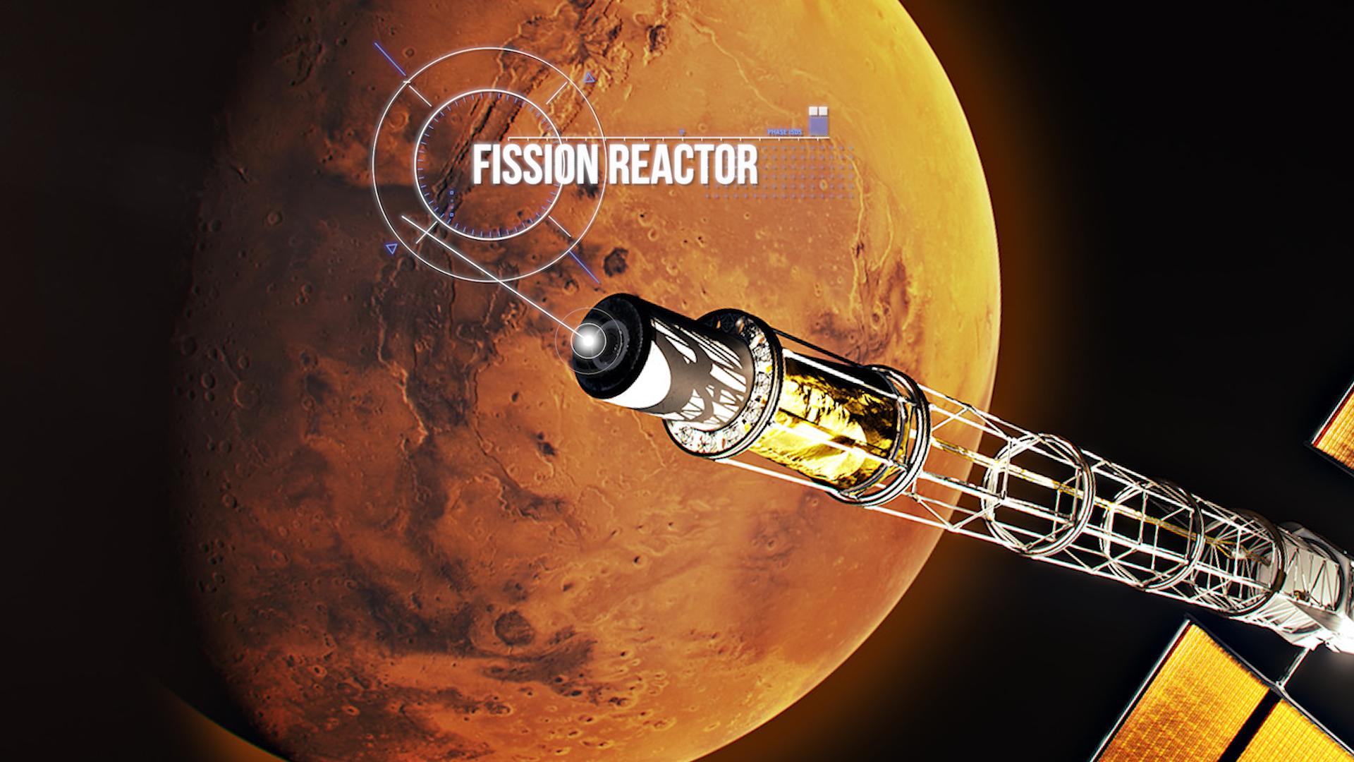
Sierra Lobo Inc. will provide the nuclear power module’s closed Brayton cycle power conversion system, which converts thermal energy from its fission reactor into electrical power needed for SR-1 Freedom’s nuclear electric propulsion demonstration. The work will be conducted under the Space Flight Systems Development and Operations Contract III, awarded in 2024, to support spaceflight hardware design, development, testing, and operations at NASA’s Glenn Research Center in Cleveland.
The power conversion system will be integrated with the fission reactor, which is being designed and developed by the Department of Energy (DOE)’s Idaho National Laboratory to complete the nuclear power module. NASA and DOE incorporate thorough safety standards throughout the design and development of the SR-1 Freedom spacecraft, including interagency safety reviews, continuous oversight by a NASA chief safety officer, regulatory compliance, and a rigorous safety design process focusing on hazards, failure tolerance, and nuclear safety. In addition, the nuclear reactor portion of SR-1 Freedom will remain inactive until the spacecraft leaves Earth orbit.
Launching in late 2028, SR‑1 Freedom will deliver the SkyFall science mission, a team of three Mars helicopters evolved from the Ingenuity design, to collect scientific data, demonstrate exploration zones, and identify potential water sources. The mission will pave the way for deep space exploration and next‑generation fission-powered systems designed to keep NASA’s Moon Base operating through periods of darkness and in locations where solar power alone is not sufficient.
For information about SR-1 Freedom, visit:
https://www.nasa.gov/mission/space-reactor-1-freedom/
Source: www.nasa.gov