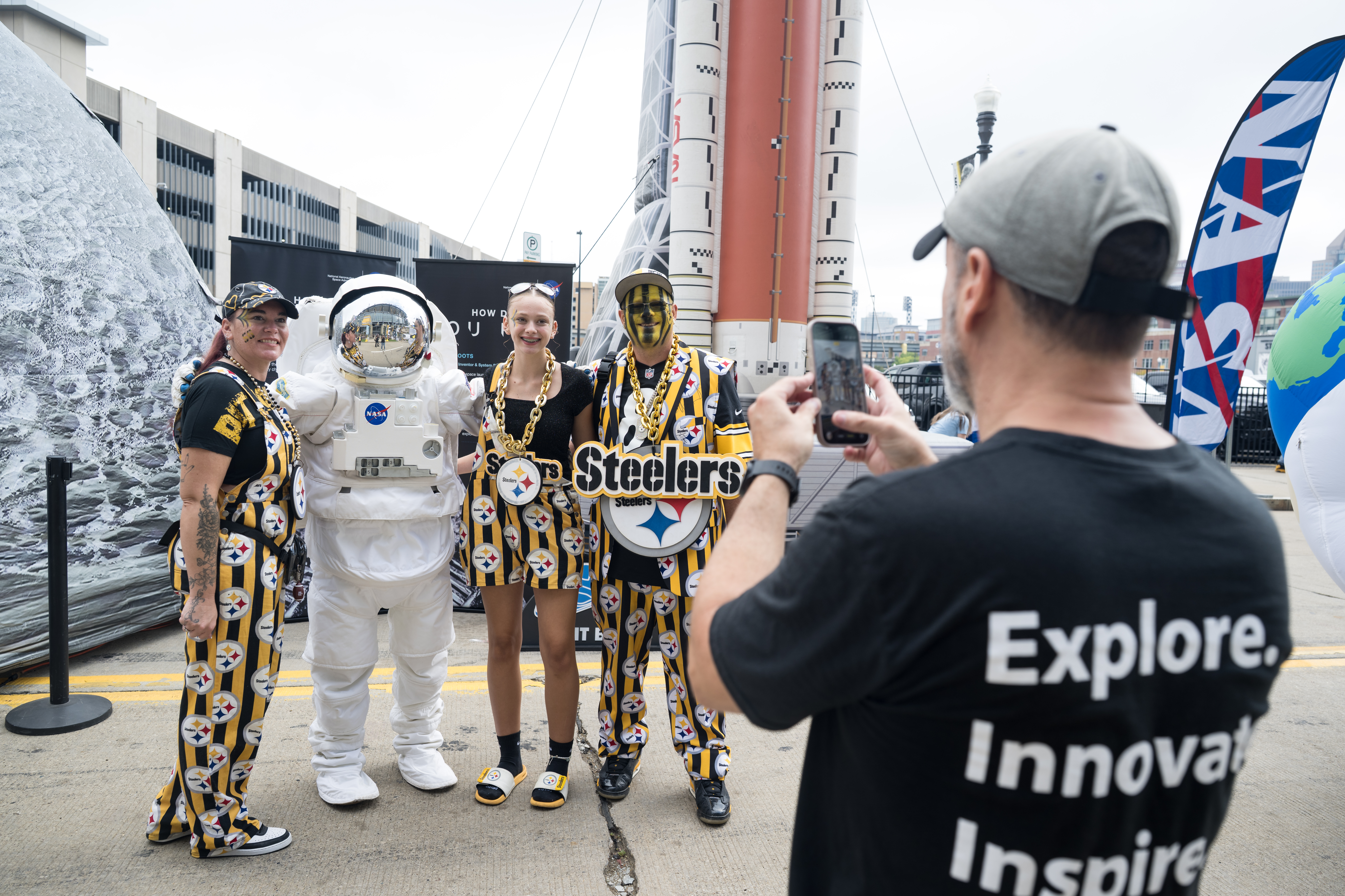
Fans pose for a photo with an astronaut in the NASA Experience Zone at an NFL game between the Pittsburgh Steelers and the Atlanta Falcons at Acrisure Stadium, Sunday, Sept. 13, 2026, in Pittsburgh, Pennsylvania.
NASA’s engagement at NFL games is part of the agency’s Inspiration Tour, aimed at strengthening connections between NASA and its partners and showcasing innovation in air and space in the lead up to the MAX POWER aerospace technology expo and air show at the agency’s Kennedy Space Center in early November.
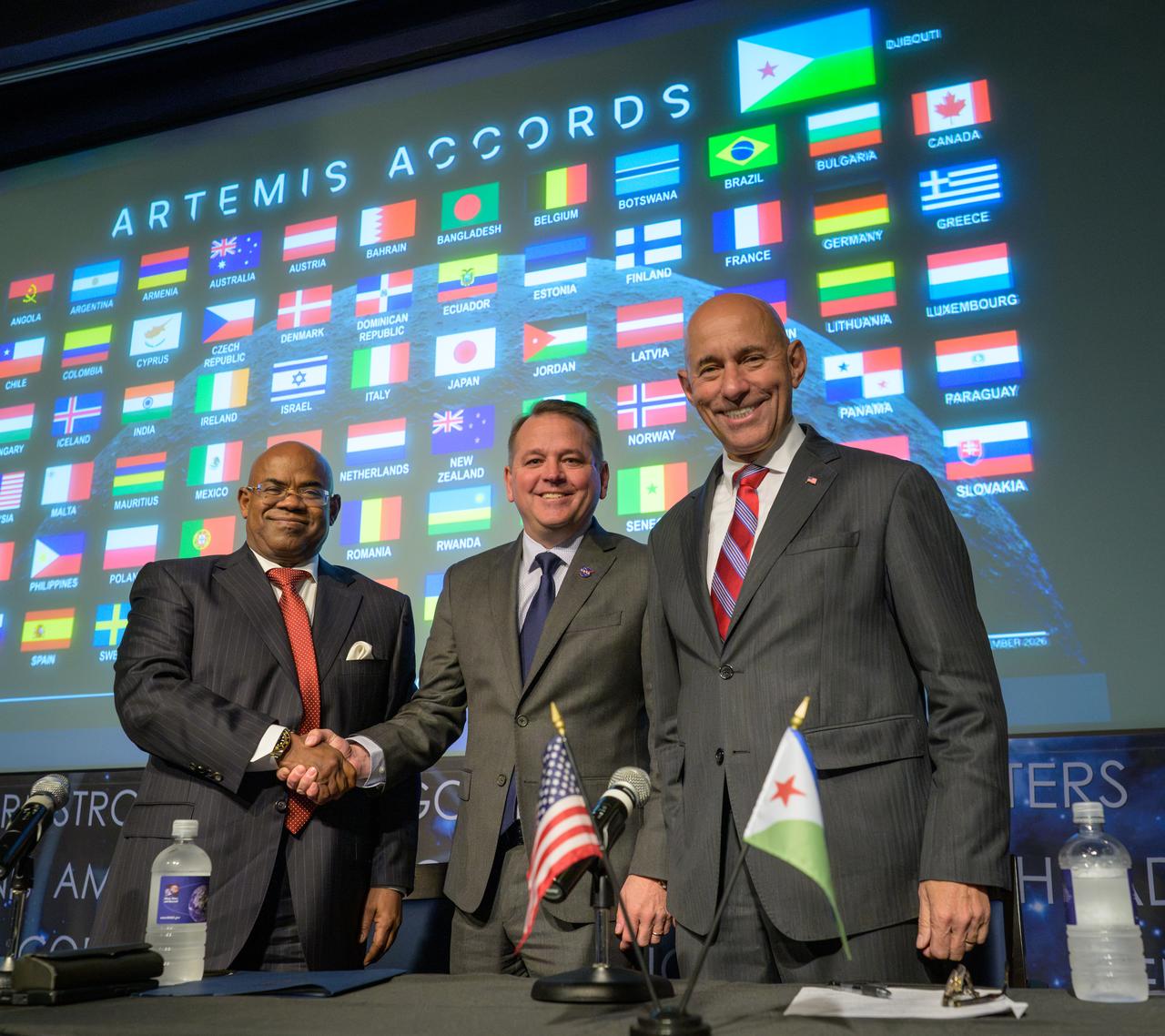
NASA Deputy Administrator Matt Anderson, center, Ambassador of Djibouti to the United States, Mohamed Siad Douale, left, and Assistant Secretary of State for African Affairs, Frank Garcia, right, pose for a group photograph after the Artemis Accord signing, Monday, September 14, 2026, at the Mary W. Jackson NASA Headquarters building in Washington.
NASA/Bill Ingalls
The Republic of Djibouti became the 72nd nation and eighth African country to sign the Artemis Accords during a ceremony Monday at NASA Headquarters in Washington. The Artemis Accords are the first set of practical principles aimed at enhancing transparency, safety, and coordination among nations as they explore the Moon, Mars, and beyond.
“Djibouti joins this coalition of like-minded nations at an important time,” said NASA Deputy Administrator Matt Anderson, who hosted the ceremony. “President Trump has directed NASA to return Americans to the lunar surface, establish an enduring presence, and lay the foundation for human exploration of Mars. NASA will lead, but we will not do it alone. We are creating opportunities for Artemis Accords nations to contribute hardware, scientific payloads, technology demonstrations, CubeSats, and other capabilities to future missions.”
Ambassador of Djibouti to the United States Mohamed Siad Douale signed on behalf of Djibouti. U.S. State Department Assistant Secretary for African Affairs Frank Garcia also participated in the event.
Djibouti’s national space program, launched in 2020 and managed by the Centre for Studies and Research of Djibouti within the Ministry of Higher Education and Research, has steadily expanded its technical capabilities. The nation successfully launched its first satellites, Djibouti 1A and Djibouti 1B, in 2023 and 2024, respectively. Both reached orbit aboard American Falcon 9 rockets launched from Vandenberg Space Force Base in California, an early example of how the U.S. is supporting Djibouti capabilities in space.
“By joining the Artemis Accords, Djibouti seeks to deepen its partnership with the United States and with the growing community of nations committed to peaceful space cooperation,” said Douale. “We look forward to building partnerships in scientific research, satellite applications, education, and technical training, while creating new opportunities for Djibouti students, researchers, engineers, and entrepreneurs.”
In 2020, NASA and the State Department joined with seven other founding nations to establish the Artemis Accords, responding to the growing interest in lunar activities by both governments and private companies, and committing nations to:
Explore peaceably and transparently
Render aid to those in need
Enable access to scientific data
Ensure activities do not interfere with those of others
Preserve historically significant sites and artifacts by developing best practices
By signing the Artemis Accords, nations open the door to opportunities for future lunar exploration with NASA, advancing humanity’s return to the Moon, and shaping the Golden Age of space exploration and innovation.
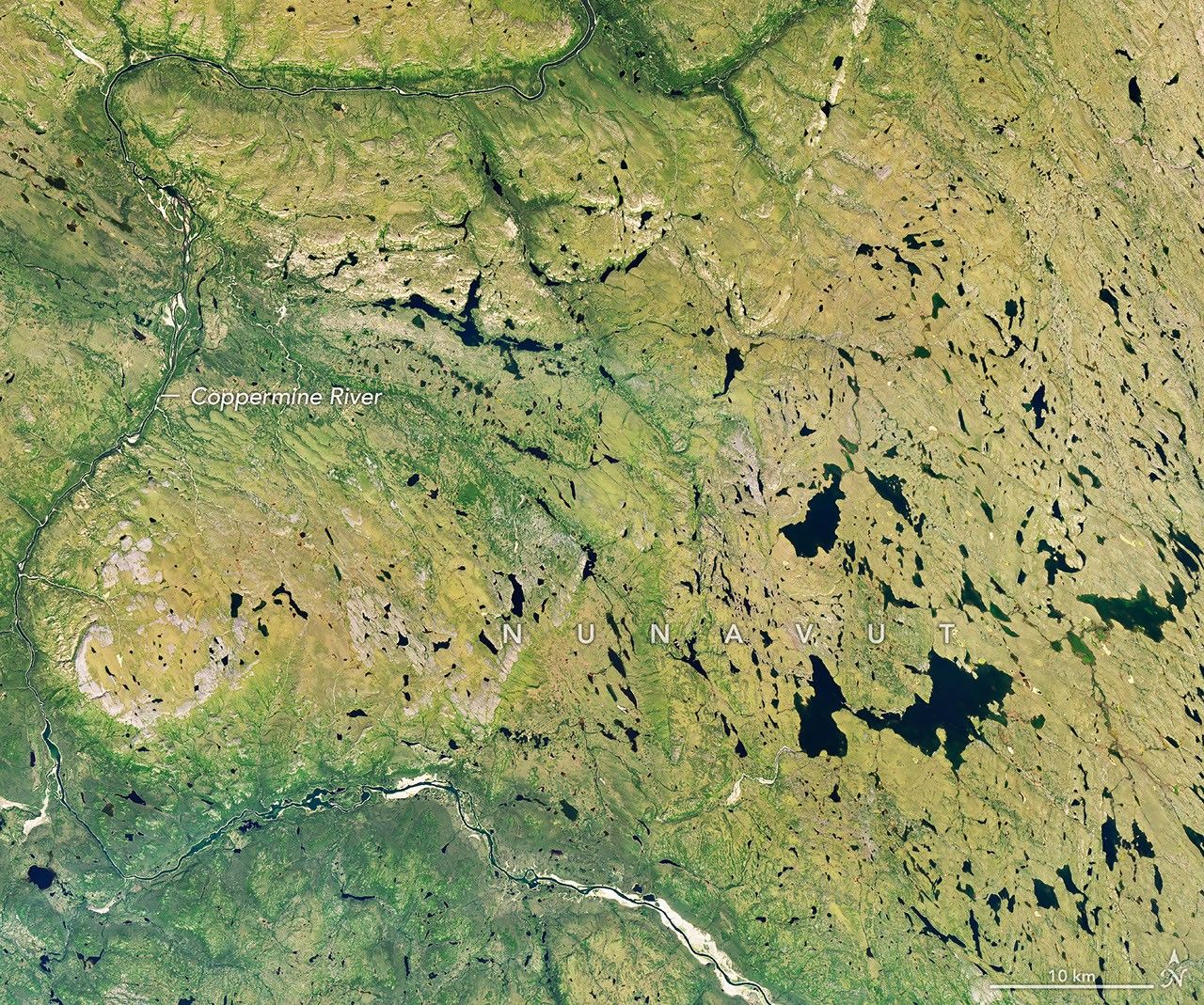
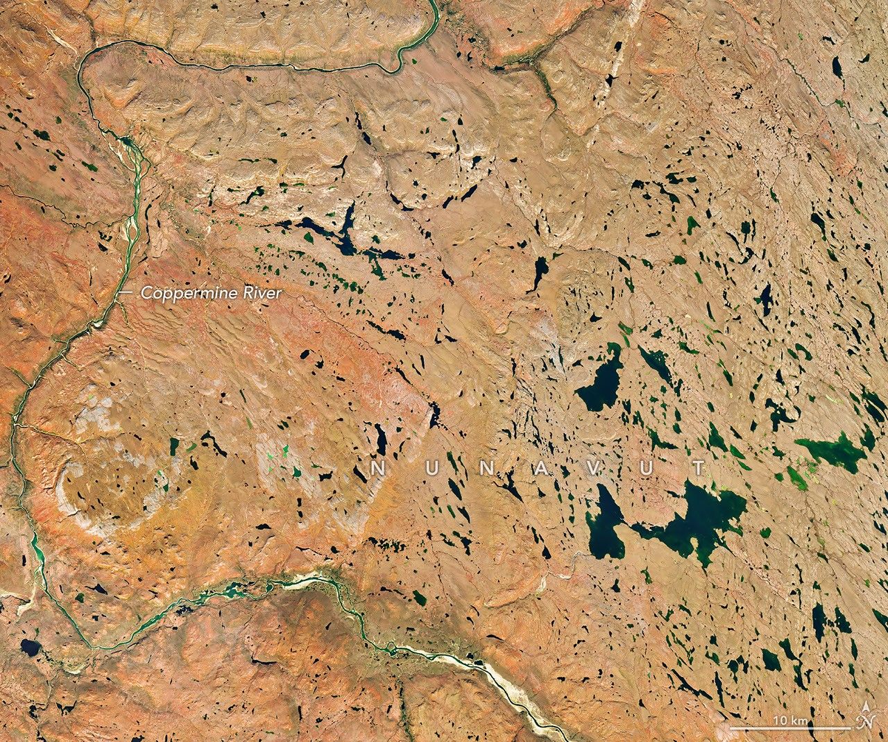
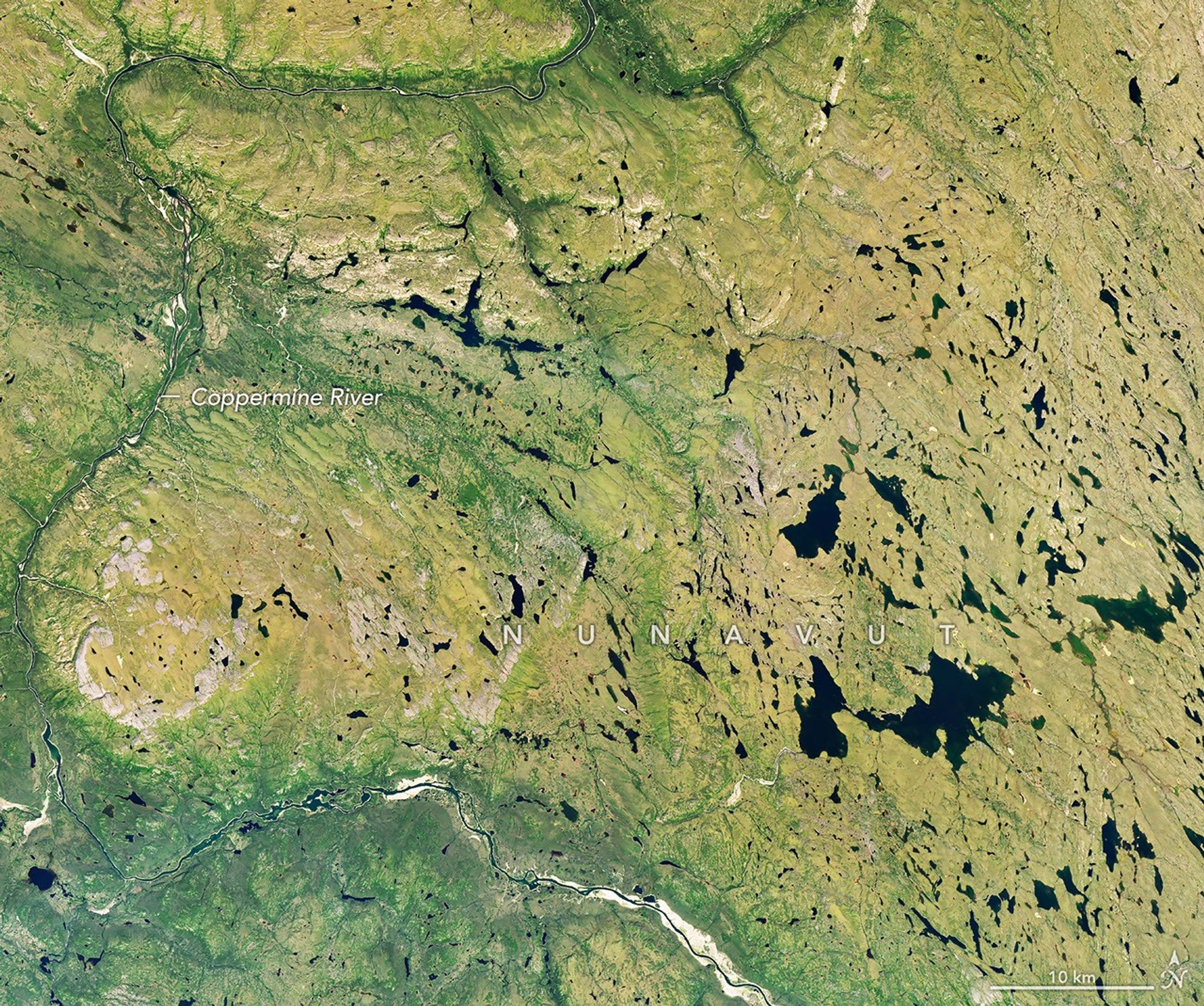
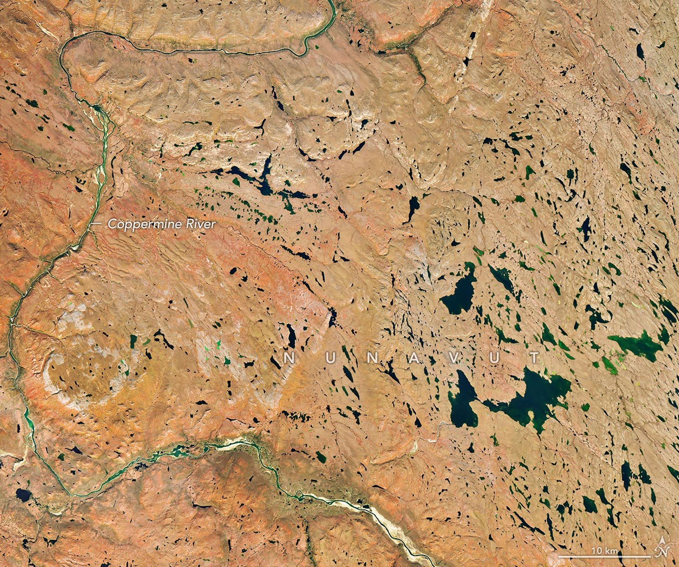
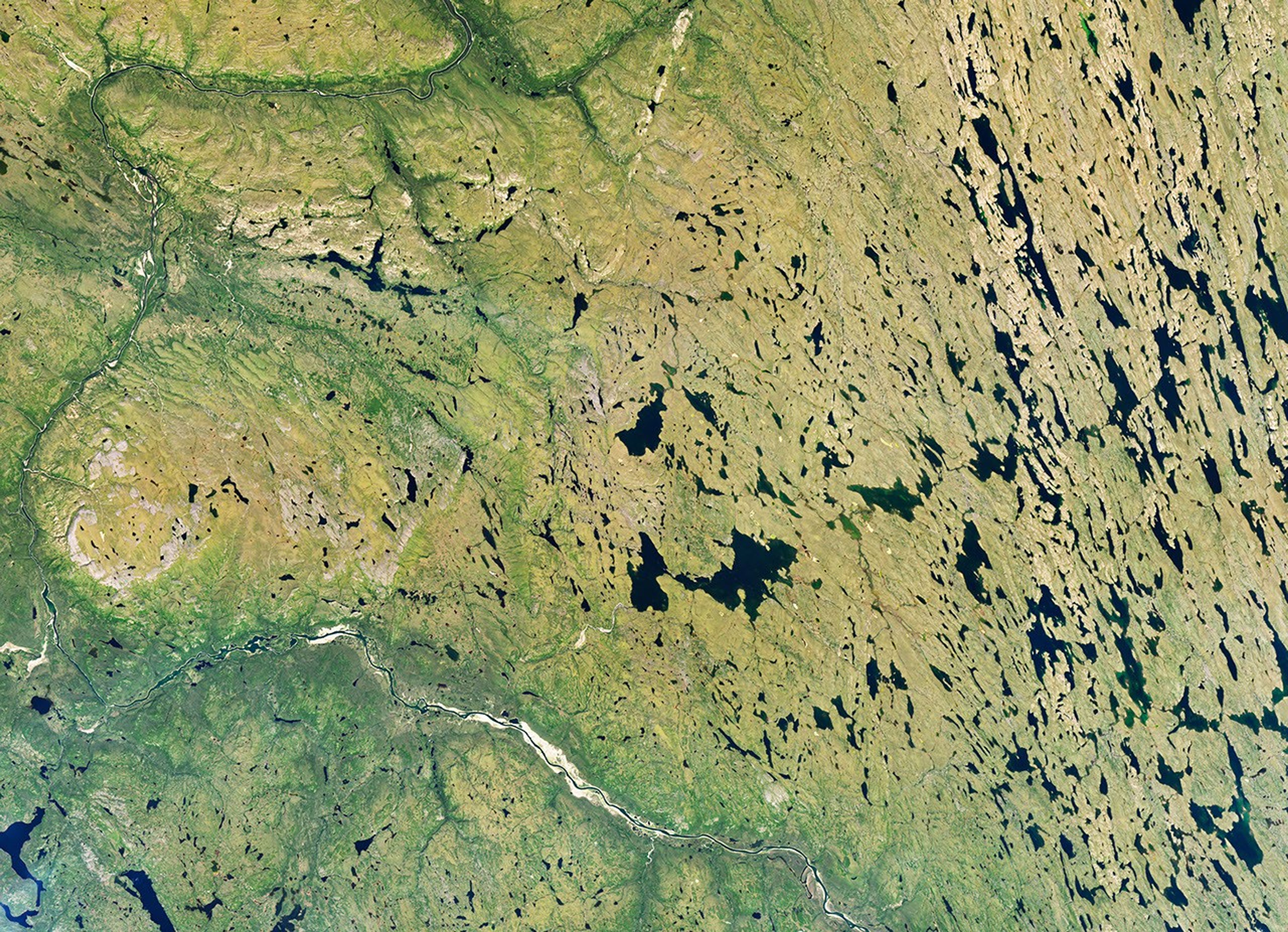
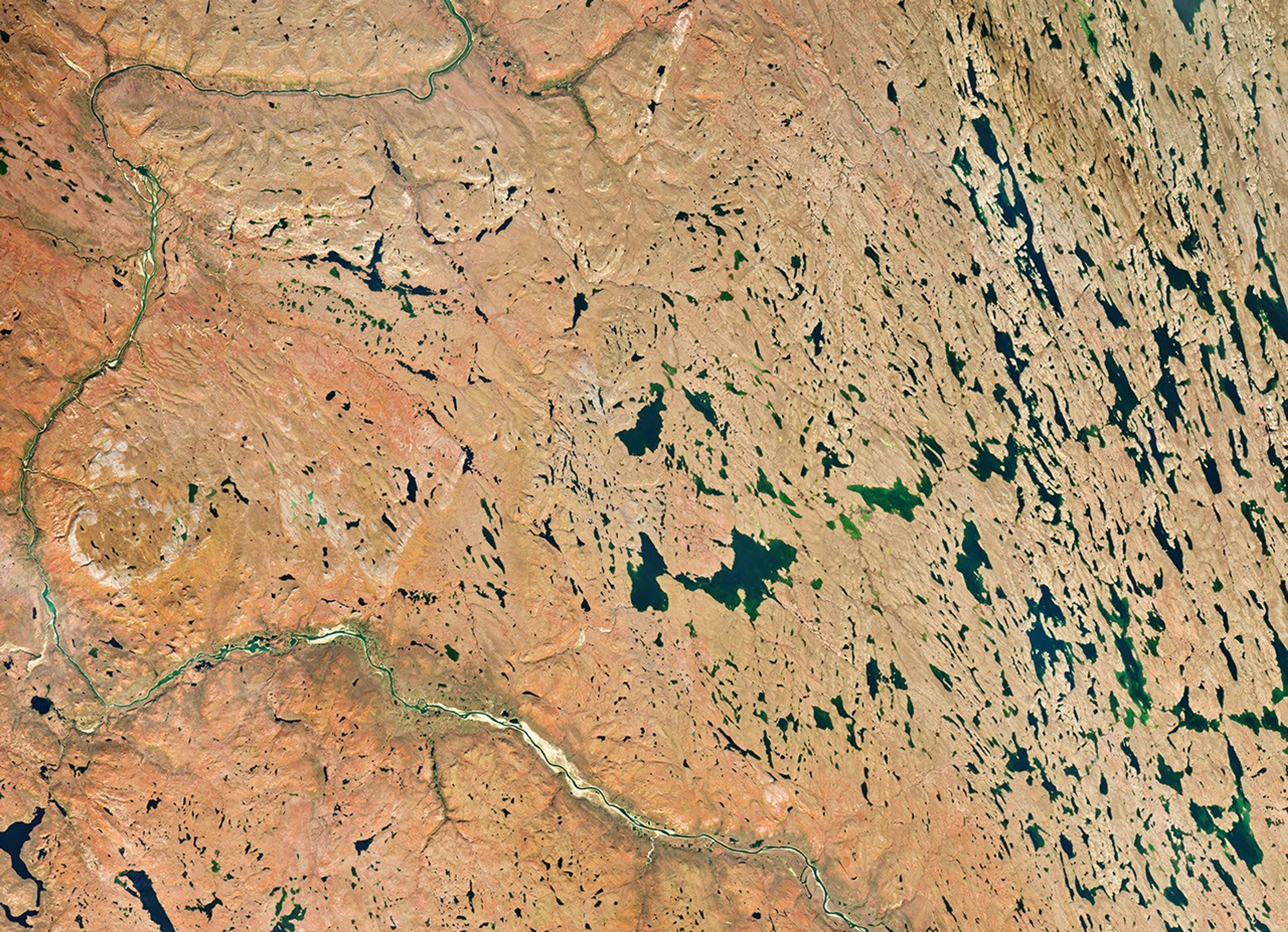
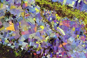
Autumn color sweeps across the low-growing shrubs and tundra vegetation of Nunavut, Canada, in this image pair captured by the OLI (Operational Land Imager) on Landsat 9. NASA Earth Observatory images by Michala Garrison.
As North America rode out a summer of remarkable heat, fall foliage and cool, crisp weather still seemed like distant, alien concepts across much of the continent in early September 2026. But fall comes early in the tundra and subarctic ecosystems of Nunavut, in far northern Canada.
Vivid signs of the season were already sweeping across the landscape on September 6 when the OLI (Operational Land Imager) on Landsat 9 captured this image (right) of the Coppermine River winding through low-growing shrubs and tundra vegetation upriver of Kugluktuk, a community at the river’s mouth. The other image (left) shows the same area on July 27, 2026, when vegetation was still green.
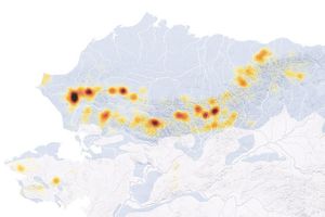
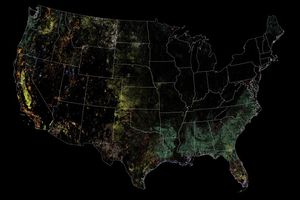
The region is known for willow and birch shrubs, blueberries, bearberries, and other low-growing tundra plants that turn shades of red, orange, and yellow each fall. A NASA and South Dakota State University analysis of seven years of satellite data found that foliage in the region begins to change in early September and peaks in mid-month, making this one of the first places on the North American continent to change color. But blink and you might miss it: the analysis also showed that far northerly regions tend to have shorter periods of peak color—sometimes a week or less—compared to many lower-latitude areas.
In the fall, leaves change colors as they lose chlorophyll, the molecule that plants use to synthesize food. Chlorophyll makes plants appear green because it absorbs the red and blue light from sunlight as it strikes leaf surfaces. However, chlorophyll is not a stable compound, and plants must continuously synthesize it, a process that requires ample sunlight and warm temperatures. As temperatures drop and days shorten in autumn, levels of chlorophyll fall as well.
As concentrations of chlorophyll decline, the green fades from leaves, presenting an opportunity for other pigments—carotenoids and anthocyanins—to take the stage. Carotenoids absorb blue-green and blue light, so in the absence of chlorophyll, they cause leaves to appear yellow. Anthocyanins absorb blue, blue-green, and green light, so light reflecting off the pigments appears red.
Citizen scientists have an opportunity to help NASA scientists track fall color and contribute to long-term environmental databases with the GLOBE North American Phenology Campaign. Participants observe and record leaf color changes during the spring and fall, helping scientists understand plant responses to climate and environmental changes.
NASA Earth Observatory images by Michala Garrison, using Landsat data from the U.S. Geological Survey.Story by Adam Voiland.
NASA’s Hubble, Webb Find Far-out Solar System Objects ‘Remember’ Past
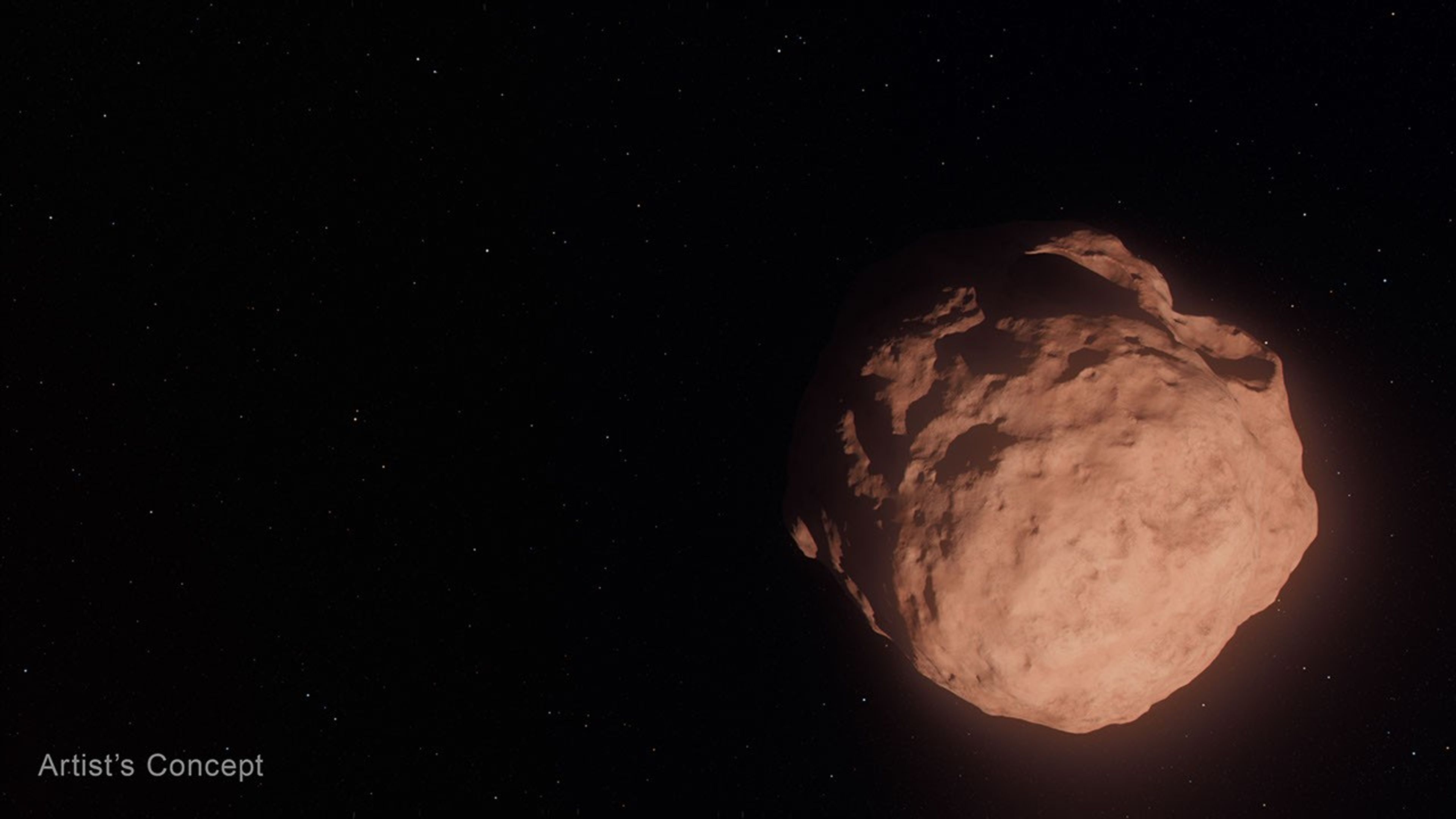
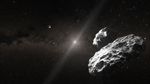
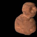
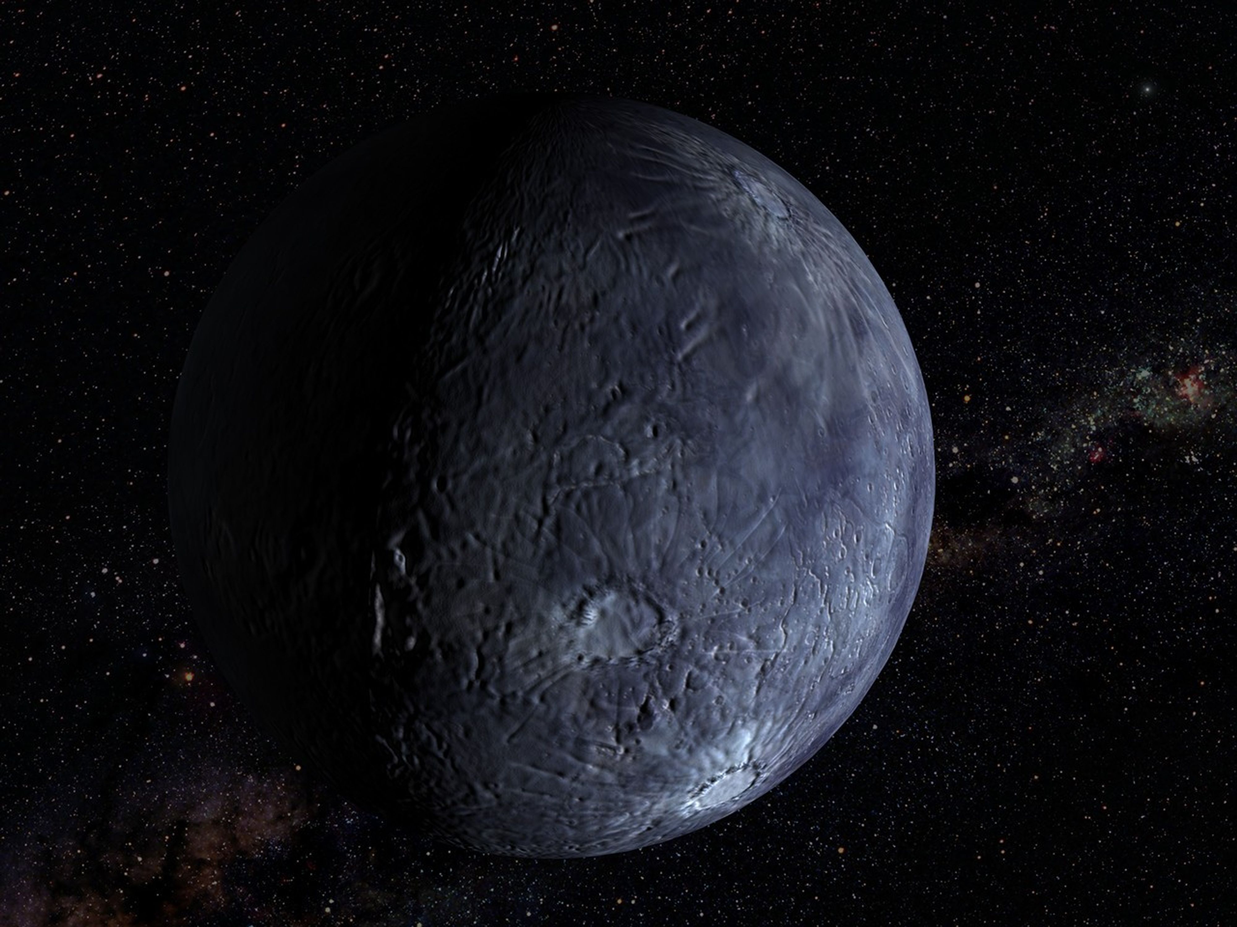
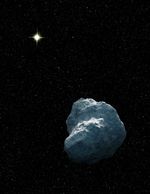
This artist’s concept depicts a Trans-Neptunian Object, a small, faint, icy body orbiting the Sun beyond the orbit of Neptune. These objects are so small that even with NASA’s Hubble and Webb space telescopes, they appear only as tiny points of light.
Artwork: NASA, ESA, Leah Hustak (STScI)
For the first time, scientists used the joint power of NASA’s Hubble and James Webb Space Telescopes to study some of the most far-flung bodies in our solar system, Trans-Neptunian Objects (TNOs). Some of these are the smallest and faintest ever directly seen. The researchers unexpectedly found fewer small TNOs than they expected, and that the colors of these bodies followed the same relationships as their larger family members.
These objects are typically small, faint, icy bodies orbiting the Sun beyond the orbit of Neptune. Most are more than 100 million times dimmer than objects visible to the unaided eye. In two complementary papers published Tuesday in The Astronomical Journal, teams analyzed the color, composition, and size distribution of 27 newly discovered tiny, dim TNOs.
This class of small bodies offers the best view into an early stage of planet-building, when a disk of dust and pebbles in orbit around the Sun coalesced into city-sized “planetesimals” — the solid building blocks that clump together to form planets — but had not yet merged into full-sized worlds. Beyond Neptune, this second stage never happened, leaving behind a frozen population of planetesimals.
In the deepest TNO survey to date, teams led by PhD candidates from the University of Victoria in Canada, under the guidance of the National Research Council of Canada, and Northern Arizona University in Flagstaff examined a patch of sky simultaneously with Hubble, observing the TNOs’ visible light, and Webb, observing their infrared light. The team of researchers measured the objects’ colors, which are like a fingerprint of the surface composition, as well as their sizes and determined their orbits.
In the coordinated observations, the teams studied two different types of TNOs. The first, dynamically “cold” TNOs, are on their original, relatively circular orbits around the Sun in the plane of the solar system. The second type, dynamically “hot” TNOs, formed between the current locations of Uranus and Neptune but were pushed outward where they are today when the outer gas giants migrated early in the solar system’s history. Today they reside in highly elliptical orbits and move in and out of the plane of our solar system.
NASA’s Goddard Space Flight Center; Lead Producer: Paul Morris
Prior to these observations, astronomers thought that small TNOs from both hot and cold populations would have undergone many collisions, changing their surfaces compared to larger TNOs. But that’s not what the observations showed. Instead, the small bodies look like their larger counterparts. This implies that collisions are not changing the surfaces significantly—perhaps because there are fewer collisions than expected, or because the TNOs somehow retain their primordial, pre-collision compositions. The teams are still trying to unravel this mystery.
“You could imagine a scenario where getting knocked around and fragmented would change the surface composition, and then you would see a different surface color for tiny TNOs compared to their larger siblings. So it’s really fascinating to see that the smallest objects are somehow ‘remembering’ and preserving the history of how they were made,” said Northern Arizona University PhD candidate Anastasia Morgan, who led the study of color and composition.
“These dynamically ‘hot’ TNOs retain a signature of where they were born, even though they’ve been orbitally scrambled since then,” said co-author David Trilling of Northern Arizona University.
Both the “hot” and “cold” populations seem to keep the same colors as when they were formed, with little change since the birth of the solar system.
The Webb data also allowed researchers to measure the number of objects of each size. They found that the overall size distributions for both populations were surprisingly similar.
“It’s very interesting that the process of planetesimal formation ends up producing the same distribution of sizes for both cold and hot populations, despite forming in different regions of the early solar system. The process seems to be insensitive to disk conditions, producing similar planetesimal sizes whether the disk is hot or cold, and dense or fluffy,” said University of Victoria PhD candidate Marielle Eduardo, who led the study on size distribution.
Researchers also found fewer of these very small bodies than they expected based on some planet formation models. Webb discovered 27 new, remarkably dim TNOs, one so faint it is equivalent to standing on Earth and seeing a small swarm of fireflies on the Moon. The smallest one they observed has a diameter of about 3 miles (5 kilometers), which is about five times smaller than what is possible to detect with the most sensitive ground-based telescopes.
This project would not have been possible without Hubble and Webb working together to detect and characterize these TNOs. With Hubble’s sensitivity in visible light and Webb’s in infrared, the space telescopes provide more insights than either can on its own.
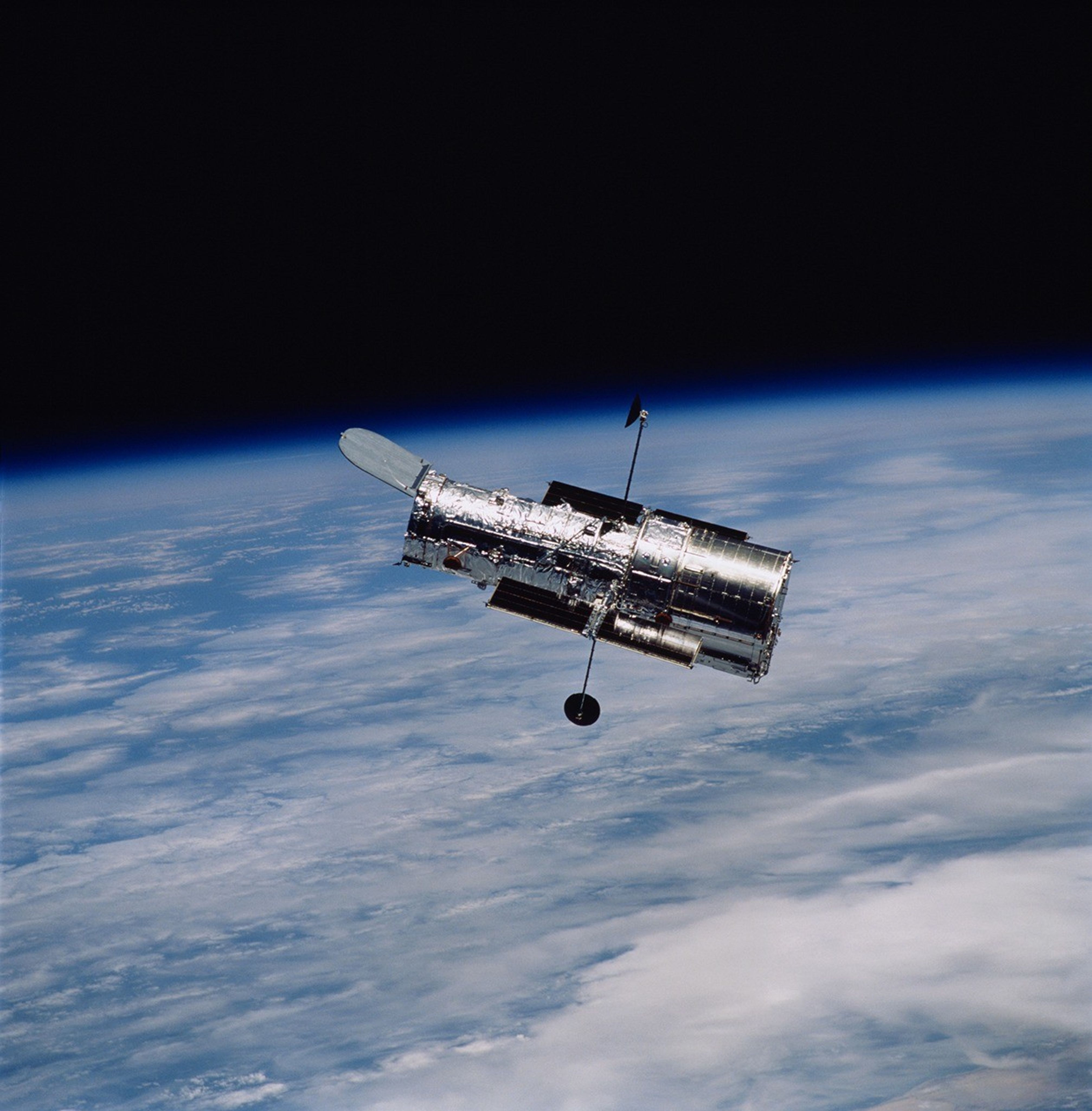
The Hubble Space Telescope has been operating for over three decades and continues to make ground-breaking discoveries that shape our fundamental understanding of the universe. Hubble is a project of international cooperation between NASA and ESA (European Space Agency). NASA’s Goddard Space Flight Center in Greenbelt, Maryland, manages the telescope and mission operations. Lockheed Martin Space, based in Denver, also supports mission operations at Goddard. The Space Telescope Science Institute in Baltimore, which is operated by the Association of Universities for Research in Astronomy, conducts Hubble science operations for NASA.
The James Webb Space Telescope is the world’s premier space science observatory. Webb is solving mysteries in our solar system, looking beyond to distant worlds around other stars, and probing the mysterious structures and origins of our universe and our place in it. Webb is an international program led by NASA with its partners, ESA (European Space Agency) and CSA (Canadian Space Agency).
This artist’s concept depicts a Trans-Neptunian Object, a small, faint, icy body orbiting the Sun beyond the orbit of Neptune. These objects are so small that even with NASA’s Hubble and Webb space telescopes, they appear only as tiny points of light.
Tiny Worlds Discovered by Hubble and Webb
This video explains how Hubble and Webb are giving scientists a new look at some of the solar system’s oldest survivors and revealing new clues about how the building blocks of planets, including Earth, first formed.
Explore More
NASA’s Hubble Finds Kuiper Belt Duo May Be Trio
A team of researchers found a potential three-body system in the Kuiper Belt. The system, known as the Altjira, challenges traditional collision theories by suggesting that these triple systems might form directly from the gravitational collapse of material in the early solar disk.
NASA’s Webb Reveals the Ancient Surfaces of Trans-Neptunian Objects
Within the first two years of science operations, Webb took high-quality spectra of over 75 TNOs and provided the first comprehensive look at what they are made of.
Uncovering Icy Objects in the Kuiper Belt
Hubble observations of the outskirts of our solar system found a moon orbiting Makemake and several new moons around Pluto. These observations played a critical role in helping NASA plan the New Horizons spacecraft’s flyby of Pluto and beyond.
Hubble Harvests Distant Solar System Objects
Astronomers using clever techniques to cull the data archives of NASA’s Hubble Space Telescope have added 14 new TNOs to the catalog.
Kuiper Belt: Exploration
The Kuiper Belt is a doughnut-shaped region of icy objects beyond the orbit of Neptune. It is home to Pluto and most of the known dwarf planets and some comets.
NASA, IBM Launch AI Foundation Model for Lunar Science
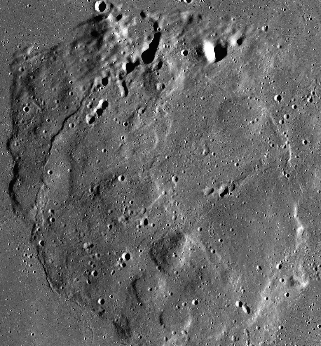
A 10-image mosaic captured by NASA’s Lunar Reconnaissance Orbiter’s Narrow Angle Camera between June 2012 and April 2016 showing the volcanic feature Mons Rümker and its surrounding mare plains.
NASA/GSFC/Arizona State University
NASA is bringing artificial intelligence to the study of the Moon, helping researchers transform how they analyze the Moon’s surface. In an ongoing collaboration with IBM Research and several academic institutions, NASA has launched the NASA-IBM Lunar Foundation Model, among the first open-source AI models built specifically for lunar science. The model, trained primarily on data from NASA’s Lunar Reconnaissance Orbiter (LRO), is hosted publicly on Hugging Face for anyone to use, with the complete codebase available on GitHub for testing and experimentation.
The NASA-IBM Lunar Foundation Model supports the next generation of lunar science by helping researchers quickly analyze vast quantities of data to better understand the Moon’s surface. Using the model as a mapping tool, researchers can rapidly develop actionable strategies for evaluating the Moon’s rugged surface, understanding its geological past, and planning future lunar research.
“NASA has spent decades building an extraordinary scientific record of the Moon, but collecting data is only part of the job,” said Kevin Murphy, chief science data officer and acting chief data and AI officer at NASA Headquarters in Washington. “We also have to make data easier for scientists to explore and use. The NASA-IBM Lunar Foundation Model shows what’s possible when we bring AI to NASA’s petabytes of scientific data. That’s a real opportunity we see with AI: turning large-scale data into new discoveries.”
Unlike traditional models that require building and training specialized algorithms from scratch for specific tasks, foundation models are pre-trained on vast, unlabeled datasets. The broad knowledge they acquire through pre-training allows them to generalize across multiple scientific domains through quick fine-tuning, making foundation models both versatile and efficient in accelerating scientific research.
The NASA-IBM Lunar Foundation Model shows what’s possible when we bring AI to NASA’s petabytes of scientific data.
Kevin Murphy
NASA Chief Science Data Officer and Acting Chief Data Officer/Chief AI Officer
Data collected by NASA’s LRO over the past 17 years was well-suited for training this foundation model because it covers most of the lunar surface in detail. The data produced from the LRO mission is larger than all other NASA planetary missions combined, capturing an almost seamless, high-resolution mosaic of the entire Moon. The NASA-IBM model was trained on roughly 2 million image tiles from this dataset, comprising more than 1 million high-resolution camera images at 1-meter resolution and nearly 964,000 multispectral images at 100-meter resolution. The model also was trained on high-resolution Moon imagery and terrain data from multiple other missions such as NASA’s GRAIL (Gravity Recovery and Interior Laboratory), NASA’s Lunar Prospector, and JAXA’s (Japan Aerospace Exploration Agency) Selenological and Engineering Explorer.
Because the foundation model is already pre-trained on this dataset, planetary scientists can adapt the model to many different lunar research tasks such as mapping craters, spotting young volcanic features, and estimating where ice may exist near the lunar poles by using only small amounts of labeled data. For researchers who study the Moon’s polar ice, the NASA-IBM model can help them estimate where ice patches are likely to be stable, on and below the surface. Dark areas like the Moon’s permanently shadowed regions remain cold enough to trap and preserve ice for up to billions of years. Studying these areas offers insight into the Moon’s history and presents an opportunity to map potentially usable resources for future space exploration.
The NASA-IBM model reproduces patterns of lunar ice prospectivity (scaled from blue to yellow), shown at four locations (left) near the Moon’s pole. Top row: reference ice prospectivity map of Mons Mouton near the lunar south pole; middle row: predictions from the ConvNeXt model; bottom row: predictions from the NASA-IBM model. The NASA-IBM model preserves many fine-scale prospectivity patterns in the reference data.
NASA/IBM Research
While the Moon is thought to no longer be volcanically active, it once experienced dynamic geological processes. For researchers studying lunar volcanism, the NASA-IBM model accelerates the identification of unusual looking volcanic features known as irregular mare patches. Because these structures appear relatively young, they challenge established timelines for lunar cooling, and mapping them could help scientists piece together a more accurate understanding of the Moon’s thermal evolution.
The model also can map surface features, such as craters, more efficiently than manual methods. Every crater is formed by an impact, making crater counts and measurements essential for dating the lunar surface and reconstructing solar system history. The foundation model helps speed up the process of identifying and measuring craters, allowing scientists to focus on interpreting findings and determining their implications for exploration.
These Lunar Reconnaissance Orbiter images show the Moon’s surface near Einstein crater before (left) and after (right) a SpaceX rocket body impact. The NASA-IBM Lunar Foundation Model detected existing craters (blue outlines) and highlighted the newly formed impact crater (red box). Because the post-impact image was excluded from pre-training, this test demonstrates how the model can be fine-tuned to recognize novel surface changes between observations. This approach can help scientists automatically detect natural impacts and surface changes across vast lunar datasets, though varying lighting conditions between orbits may influence smaller crater visibility.
NASA/IBM Research
Overall, the model matched or exceeded the performance of several other strong baseline models across all evaluated tasks, achieving comparable results on crater mapping and segmentation of irregular mare patches, while demonstrating a clear advantage on estimating polar ice stability.
The NASA-IBM Lunar Foundation Model is part of the agency’s Office of the Chief Science Data Officer’s strategy for AI for science — a larger, ongoing collaboration between NASA and IBM aimed at using advanced AI to explore our planet and solar system. It joins a growing collection of AI models developed through this partnership, including:
The Prithvi Models: a family of models pre-trained on Earth observation data and designed to support applications such as disaster monitoring, flood mapping, crop yield prediction, and hurricane prediction.
The Surya Model: a heliophysics model trained on high-resolution solar observation data to predict space weather phenomena such as solar flares which can disrupt power grids and satellite operations.
Within NASA, the Impact AI team at the agency’s Marshall Space Flight Center in Huntsville, Alabama, collaborated with scientists in the agency’s Science Mission Directorate Planetary Science Division, NASA’s Goddard Space Flight Center in Greenbelt, Maryland, and NASA’s Ames Research Center in California’s Silicon Valley, to build the NASA-IBM model. The model is an example of open science in action, uniting experts from NASA, industry, and academia to turn raw data into a resource for lunar discovery. To support the global research community, the team released comprehensive machine learning-ready pre-training datasets and benchmark collections alongside the model, which is integrated into the open-source TerraTorch toolkit. Supported by a companion paper available on Hugging Face, this open release ensures reproducible research and equips scientists worldwide to build, compare, and refine AI models for the future of lunar exploration.
The science team, assembled by NASA Headquarters, included experts from the Universities Space Research Association in Huntsville, Alabama; the SETI Institute in Silicon Valley, California; the University of Maryland, Baltimore County in Catonsville, Maryland; Howard University in Washington, D.C.; NASA’s Science Mission Directorate Planetary Science Division; NASA Ames; and NASA Goddard.
For more information about NASA’s strategy of developing foundation models for science, visit:
The Pentagon quickly rebuilt after the traumatic events of Sept. 11, 2001, and an important addition to the grounds is the National 9/11 Pentagon Memorial honoring those who were lost.
Discover the cosmos! Each day a different image or photograph of our fascinating universe is featured, along with a brief explanation written by a professional astronomer.
Comet NEOWISE Rising Over the Adriatic Sea
Explanation: This sight was worth getting out of bed early. Just over four years ago, Comet C/2020 F3 (NEOWISE) rose before dawn to the delight of northern sky enthusiasts awake that early. Up before sunrise on July 8th, the featured photographer was able to capture in dramatic fashion one of the few comets visible to the unaided eye this century, an inner-Solar System intruder that has become known as the Great Comet of 2020. The resulting video detailed Comet NEOWISE from Italy rising over the Adriatic Sea. The featured time-lapse video combines over 240 images taken over 30 minutes. The comet was seen rising through a foreground of bright and undulating noctilucent clouds, and before a background of distant stars. Comet NEOWISE remained unexpectedly bright for over a month, with its ion and dust tails found to emanate from a nucleus spanning about five kilometers across.
NASA’s Life-Saving Technology Where Cell Signals Can’t Go
Rescued after more than four hours in the water, Easton Barrett (center, red shorts) and his friend were picked up by the U.S. Coast Guard thanks to a personal locator beacon (PLB). The devise sends a distress signal to satellites that are relayed back to Earth, launching a rescue operation.
Credits: Easton Barrett
Memorial Day weekend 2024 started with a blue sky and a mild three- to four-foot chop in the water off the Gulf Coast of Mississippi — a perfect day for a fishing competition. A team of five was about 40 miles offshore checking their sonar, and 30 seconds later the boat was gone. They were in the water struggling to pull on life jackets and grab the coolers as they bobbed up. When a boat sinks, survivors can be virtually invisible amid the vast expanse of water.
When their fishing trip went wrong, Easton Barrett had the only mobile phone and no cell service. He recorded a brief farewell, planning to put his phone in a cooler in hopes someone would find it.
Another team member activated a personal locator beacon (PLB) that had been stowed at the last minute, which sent a distress signal to the Search and Rescue Satellite-Aided Tracking (SARSAT) technology carried by multiple satellites in Earth orbit. In the SARSAT system, developed partly by NASA, an emergency signal containing the transmitter’s location is directed to the nearest available ground station.
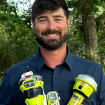
406 megahertz is the wavelength dedicated for PLB distress signals. On the annual 406 Day, Easton Barrett posts videos and messages on his social media accounts to help raise awareness about essential survival gear.
Credit: ACR
A mission control center then alerts rescue coordination centers to mobilize search and rescue crews. For Barrett and his crew, that was a Florida Coast Guard boat.
“Ever since, I have tried to teach others about safety on the water and in the outdoors by using a PLB,” said Barrett. “If that will save one life, it’s worth the effort.”
A beacon like the one that saved his crew, a registered ResQLink PLB developed by ACR Electronics Inc. of Fort Lauderdale, Florida, also notifies the device owner’s emergency contact, indicating a distress call was activated. All emergency beacons must meet the same requirements to ensure they work when needed. Every rugged, buoyant, handheld devices have a five- to 10-year battery life.
SARSAT began operations in 1982, becoming an international collaboration in 1985. The flight and ground technologies used globally were originally developed at NASA’s Goddard Space Flight Center in Greenbelt, Maryland. Now there are 62 satellites in the program and 45 nations contributing services, from operating ground stations to providing rescue crews. More than 63,000 lives have been saved.
Turning on a ResQLink View PLB from ACR Electronics will automatically “ping” orbiting satellites that send location and GPS information
to the nearest search and rescue station. Whether on land or water, the appropriate resources will be dispatched to help anyone in distress
anywhere in the world.
Credit: ACR
SARSAT by the Numbers
The Search and Rescue Satellite-Aided Tracking system developed over several decades by NASA and other government agencies saves lives on land or at sea.
1982 — the start of U.S. operations
1985 — the start of international operations
62 operational satellites
45 nations contributing services
63,000+ lives saved
One rescue in 2024 demonstrates how it all comes together.
40 miles off the Mississippi Gulf Coast
5-person team participating in a fishing competition
30 seconds for a boat to sink
200 pounds of bait dumped to make a cooler buoyant
3 close encounters with wildlife, likely sharks and eels
4 hours in the water
1 personal locator beacon
1 Coast Guard rescue boat
5 lives saved
“If it has anything to do with NASA, it's got to be awesome.”