Curiosity Blog, Sols 4988-4994: More New Tricks for an Old Dog

2 min read

Curiosity Blog, Sols 4988-4994: More New Tricks for an Old Dog
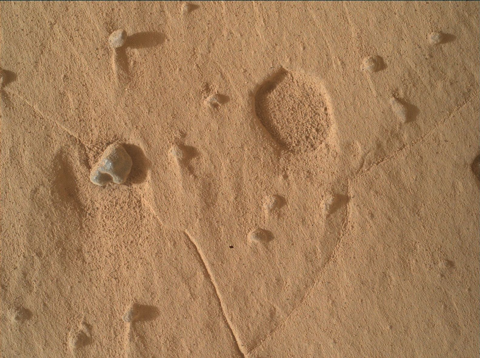
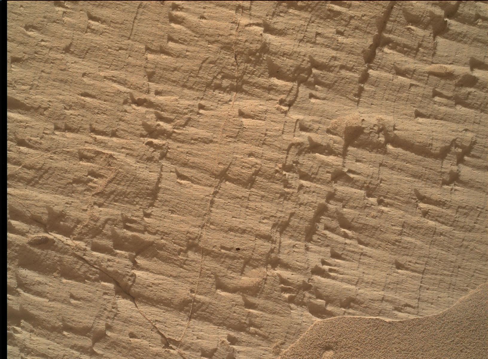
A close-up view of the Martian surface taken by the Curiosity rover. The terrain consists of fine, reddish-brown sand scattered with small rocks. On the center-left, a prominent pebble casts a distinct shadow to the right. In the upper right area, there is a shallow, circular depression in the soil, revealing the slightly rougher texture beneath the top layer of dust. Faint, straight lines or cracks are visible intersecting across the dusty terrain.
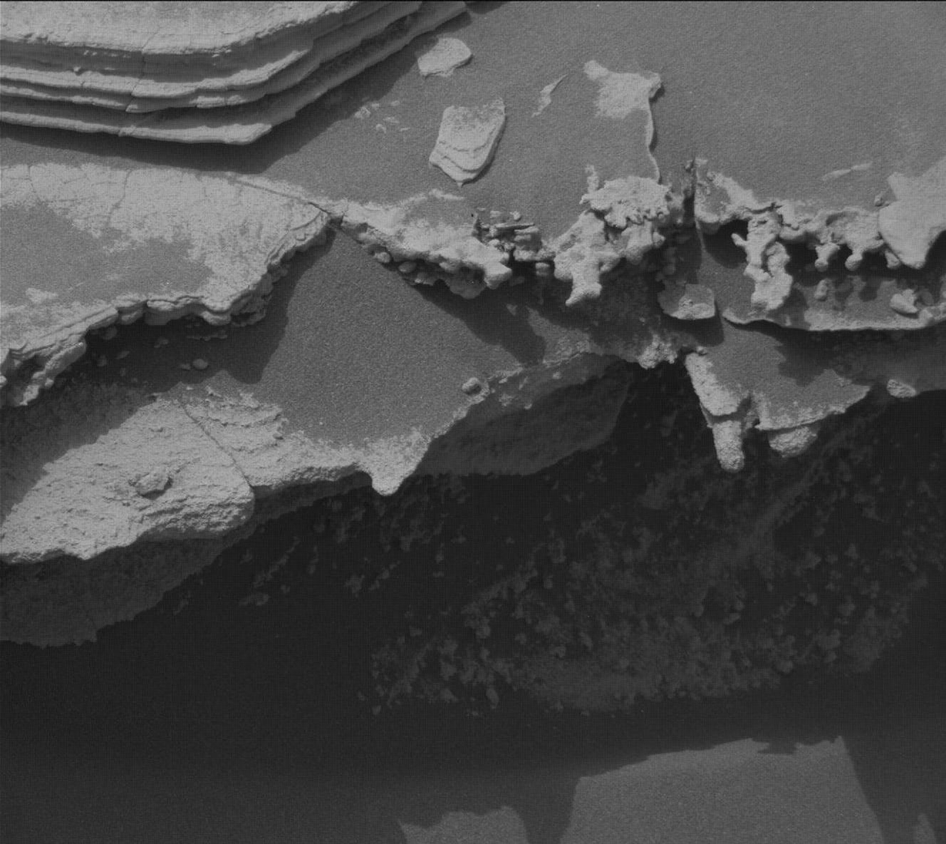
NASA’s Mars rover Curiosity acquired this image using its Mars Hand Lens Imager (MAHLI), showing an example of a broad pit that appeared in workspaces this week. The pit diameter is about 1 centimeter (0.39 inches). MAHLI is located on the turret at the end of the rover’s robotic arm, and uses an onboard focusing process to make a composite of images of the same target acquired at different focus positions, in order to make a single image that brings as many features into focus as possible. Curiosity created the composite on Aug. 19, 2026 — Sol 4989, or Martian day 4,989 of the Mars Science Laboratory mission — at 07:59:21 UTC.
NASA/JPL-Caltech/MSSS

Written by Michelle Minitti, MAHLI Deputy Principal Investigator

Earth planning date: Friday, Aug. 21, 2026

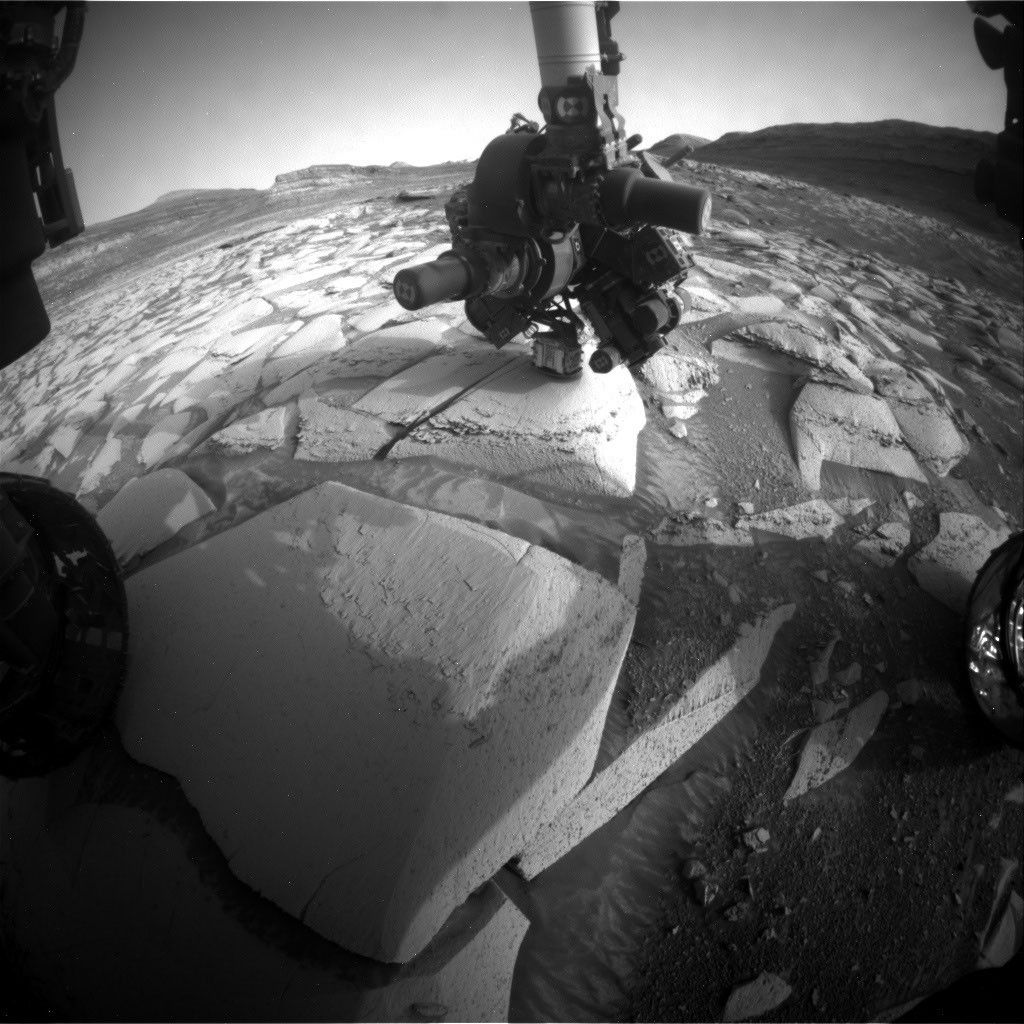
After Curiosity’s 14 years on the surface, Mars continues to surprise. Both of our workspaces this week contained features unlike quite anything we have seen in the past — broad, shallow pits (like the one in the image above) dotted across the bedrock. Pits are not uncommon — when resistant nodules or pebbles weather out of their host rock, they leave behind a void. But the pits of this week were much broader and shallower than past features and were not accompanied by obvious objects that were once in the pits. MAHLI and Mastcam were particularly interested in these features, acquiring stereo mosaics of them and tightly overlapping image sets that can be turned into a digital elevation model of their structure. They were a welcome new puzzle into the processes that have affected this particular section of rocks in the stratigraphy of Mount Sharp. 

The “typical” bedrock was anything but boring. Mastcam imaged and ChemCam rastered across complex packages of layers with changes in texture and structure over short vertical differences. These might be evidence of changes in depositional conditions captured in close proximity to one another. ChemCam, MAHLI, and APXS analyzed gray, rough, resistant layers that differed from the host bedrock, likely indicative of a different chemistry. ChemCam studied one of the gray float rocks (like the small, loose pebble in the image above) that have been scattered variably across our workspaces, to try to understand the origins of these stones. Farther afield, the “Cordillera” butte continued to garner attention, with a comprehensive Mastcam mosaic covering its entire visible face, and more focused ChemCam RMI mosaics aimed at specific horizons. The “Tolhuaca” and “Potosí” buttes, which are farther south down “Valle Grande,” were also targets, with ChemCam looking for potential crossbedding and assessing the mineralogy of dark material capping Potosí. 

Our environmental science team members were just as busy, planning REMS, Mastcam, and Navcam activities at a higher-than-usual cadence to monitor a potential regional dust storm. They found by the end of the week, however, that the storm appeared to be dissipating. 

We managed to accomplish all of this despite having lost one of our planning days due to a lost downlink. 
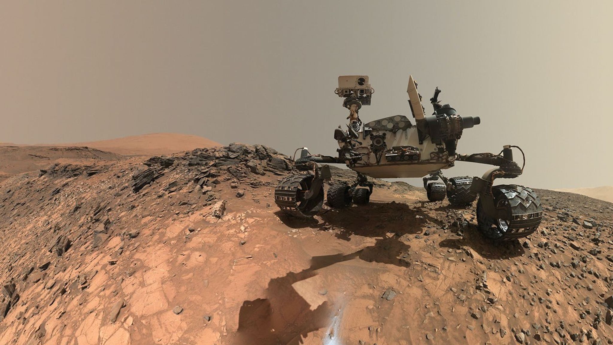
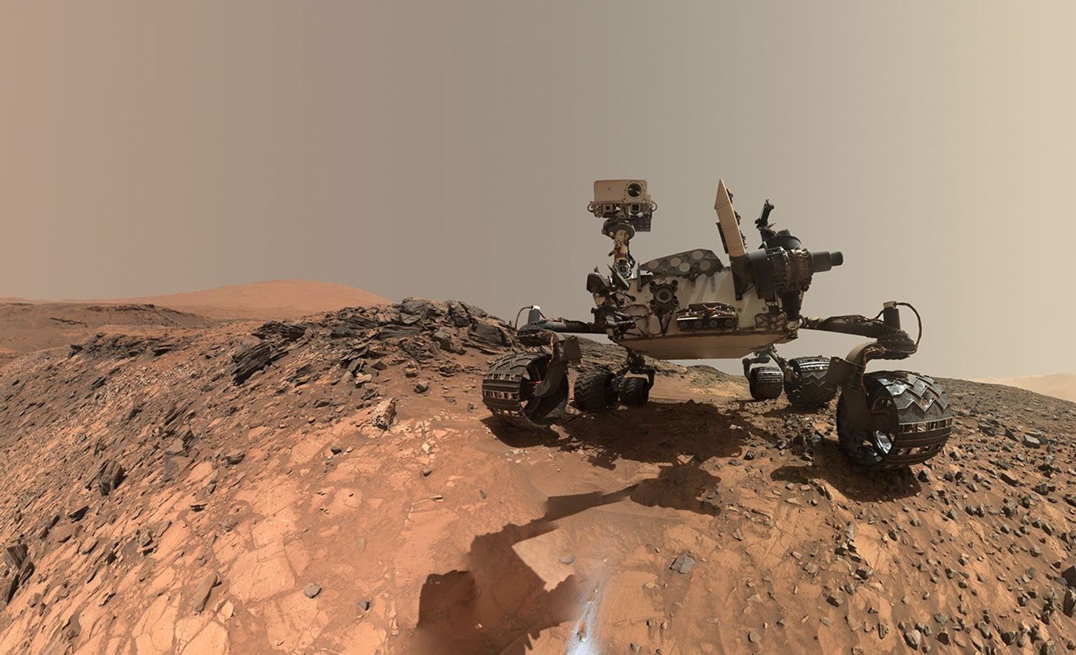
A rover sits on the hilly, orange Martian surface beneath a flat grey sky, surrounded by chunks of rock.
NASA’s Curiosity rover at the base of Mount Sharp
NASA/JPL-Caltech/MSSS

Details

Last Updated

Sep 03, 2026

Related Terms

Source: science.nasa.gov

NASA to Cover Progress 96 Spacecraft Launch, Docking

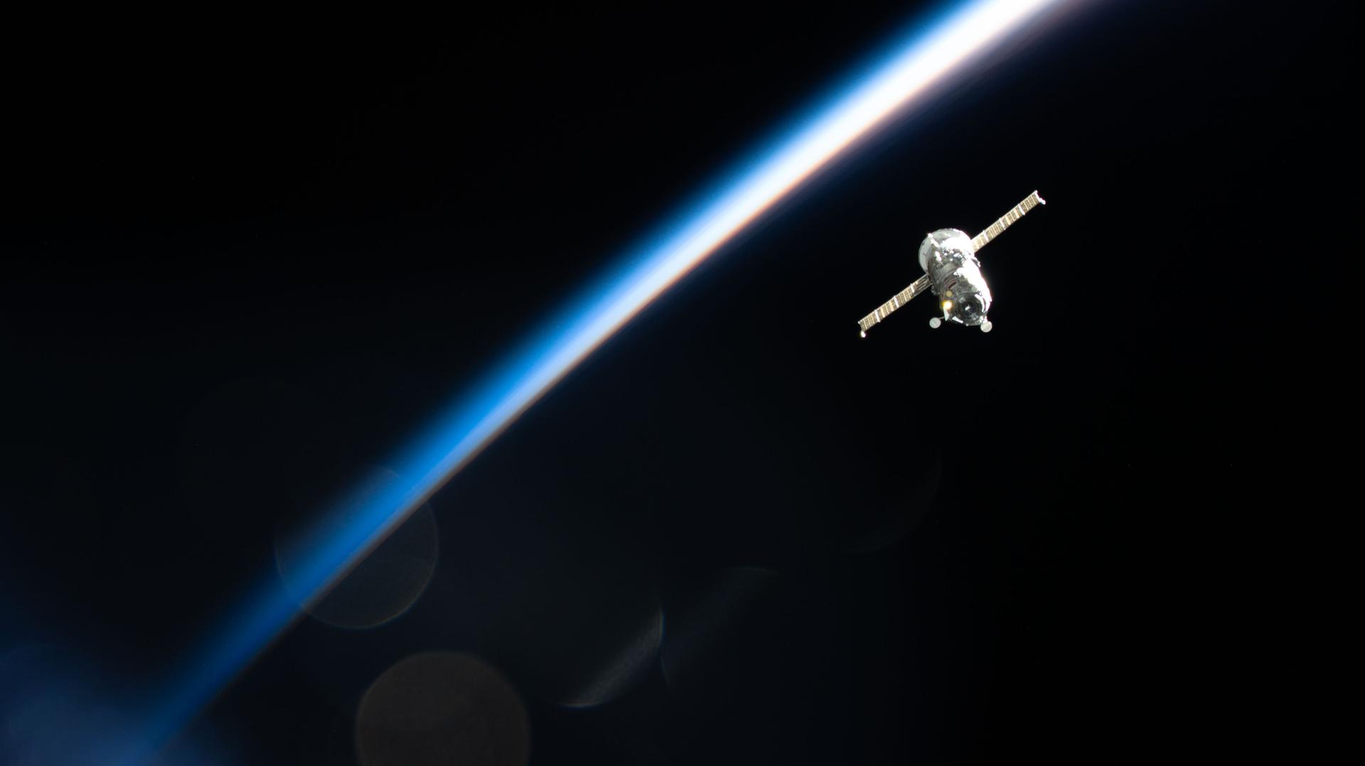
The Progress 92 cargo spacecraft from Roscosmos departs the International Space Station while soaring into an orbital sunset 267 miles above the Russia–Mongolia border.
The Roscosmos Progress 92 cargo spacecraft is photographed in March 2026 from the International Space Station as it flies into an orbital sunset 267 miles above Earth’s surface.
Credit: NASA

NASA will provide live coverage of the launch and docking of a Roscosmos cargo spacecraft carrying about three tons of food, fuel, and supplies for the crew aboard the International Space Station.

The unpiloted Progress 96 resupply spacecraft is scheduled to launch at 12:15 p.m. EDT (9:15 p.m. Baikonur time), Wednesday, Sept. 9, on a Soyuz rocket from the Baikonur Cosmodrome in Kazakhstan. NASA’s live launch coverage will begin at 12 p.m.

After a two-day trip to the space station, Progress will dock autonomously to the Poisk module’s space-facing port at 2:37 p.m., Friday, Sept. 11. NASA’s arrival coverage will begin at 1:45 p.m.

NASA will stream these events live through a variety of platforms. Learn where to watch online:

https://www.nasa.gov/live

The spacecraft will remain docked to the orbiting laboratory for about five months before departing to re-enter Earth’s atmosphere, where it will harmlessly burn up over the Pacific Ocean.

Before Progress 96 arrives, the Progress 94 spacecraft will undock from the space station at approximately 11:18 a.m., Monday, Sept. 7, for its departure and planned destructive re-entry. NASA will not stream coverage of Progress 94 undocking.

For more than 25 years, people have lived and worked continuously aboard the International Space Station, advancing scientific knowledge and making research breakthroughs not possible on Earth. The space station helps NASA understand and overcome the challenges of human spaceflight, expand commercial opportunities in low Earth orbit, and build on the foundation for long-duration missions to the Moon, as part of the Artemis program, and to Mars.

Learn more about the International Space Station, its research, and crew, at:

https://www.nasa.gov/station

-end-

Joshua Finch / Jimi Russell
Headquarters, Washington
202-358-1100
[email protected] / [email protected]

Sandra Jones
Johnson Space Center, Houston
281-483-5111
[email protected]

Details

Last Updated

Sep 03, 2026

Editor
Jessica Taveau

Source: www.nasa.gov

A Trio of Tropical Cyclones in the Pacific

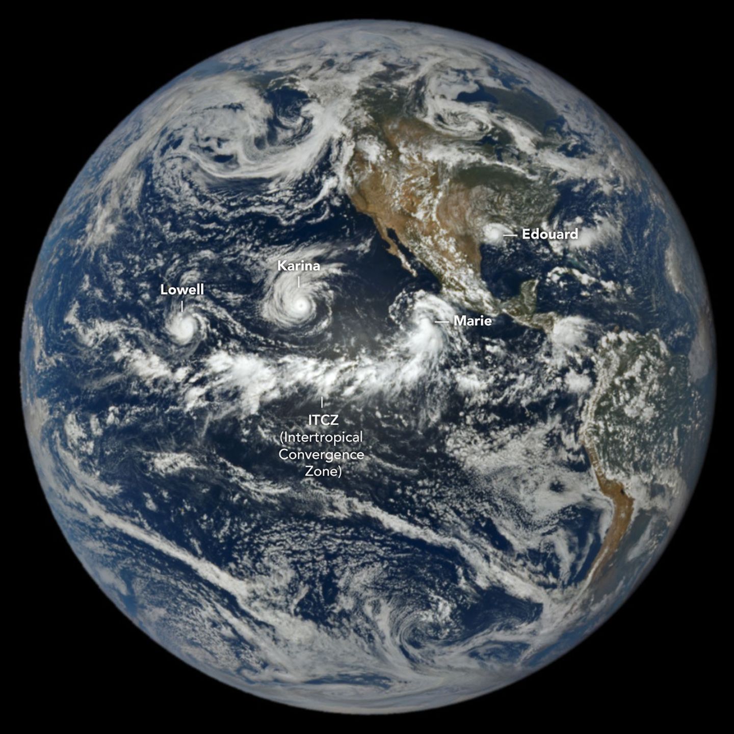
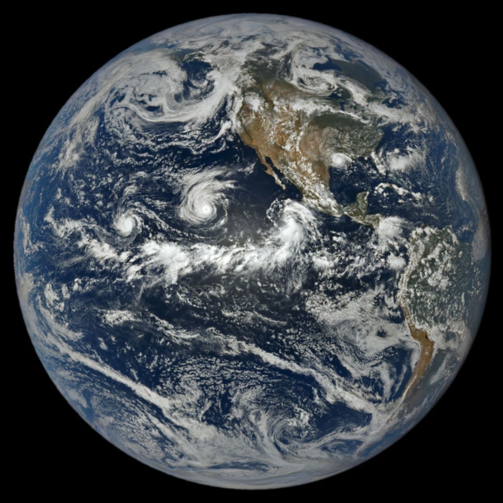
In a full-disk satellite view of Earth, three tropical cyclones—named Lowell, Karina, and Marie—swirl above the blue waters of the Pacific Ocean and to the west of Central America.

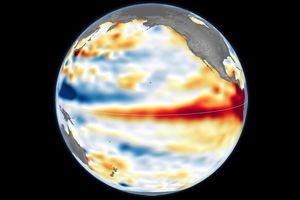
When hurricane forecasters released their seasonal outlooks in spring 2026, the El Niño brewing in the Pacific contributed to predictions of below-normal activity in the Atlantic basin but above-normal activity in the northeastern and central Pacific basins. In early September, near the climatological peak of hurricane season, those spring outlooks were on target, with the eastern Pacific buzzing with activity and the Atlantic notably quiet.

As of September 3, the Northeast Pacific had produced 15 named storms and six hurricanes, well above the norm for that point in the season. The Atlantic basin, meanwhile, laboring under unfavorable wind shear conditions, had produced just five named storms and no hurricanes. El Niño typically enhances hurricane activity in the eastern and central Pacific basins because of the unusually warm water temperatures it brings to those parts of the ocean. It tends to suppress hurricane activity in the Atlantic basin by shifting large-scale circulation patterns in a way that makes it harder to sustain storms there.

At 1:14 p.m. Pacific Daylight Time (20:14 Universal Time) on September 1, NASA’s EPIC (Earth Polychromatic Imaging Camera) on the DSCOVR (Deep Space Climate Observatory) satellite captured an image of three tropical cyclones churning simultaneously in the Pacific, along with one in the Atlantic. A band of clouds and thunderstorms associated with the Intertropical Convergence Zone (ITCZ) is visible to the south of the storms. The spacecraft was nearly 1 million miles from Earth and just shy of 93 million miles from the Sun when the image was acquired.

The trio of storms in the Pacific were Lowell, Karina, and Marie. Of the three, Lowell became the strongest, with winds reaching category 5 strength for several hours on September 2. Around the same time, Karina, spinning a few thousand kilometers to the east, achieved category 4 strength, a rare case of category 4 and 5 hurricanes occurring simultaneously in the area. Marie, spinning southwest of Baja California, was still a tropical storm when the image was acquired but was strengthening as it moved northwest.

In the Atlantic, Tropical Storm Edouard was visible to EPIC over Louisiana and Texas, shortly after the short-lived storm made landfall. It brought torrential rains and strong winds that downed trees and power lines. Some areas received 15 to 24 inches (38 to 61 centimeters) of rain, according to National Weather Service meteorologists.

As of September 3, the Atlantic basin’s total accumulated cyclone energy (ACE) index was 4.4, about 9 percent of normal for that date, according to statistics compiled by Colorado State University meteorologists. Meanwhile, the Northeast Pacific basin’s ACE was 130, about 50 percent above normal. The ACE index incorporates both the intensity and longevity of storms, making it easier to compare individual storms and seasons.

Several NASA Earth-observing platforms provide data that can aid in emergency preparedness before landfall and damage assessment and response afterward. Use the “Events” tab on NASA’s Worldview browser to track current hurricanes and explore related NASA data products.

NASA Earth Observatory image by Lauren Dauphin, using data from DSCOVR EPIC. Story by Adam Voiland.

References & Resources

You may also be interested in:

Stay up-to-date with the latest content from NASA as we explore the universe and discover more about our home planet.

Lala Batters Hawaii

3 min read

The powerful storm delivered extreme rainfall and damaging winds to the state, passing the Island of Hawaiʻi as a category…

Article

Tropical Storm Arthur

2 min read

The first named storm of the 2026 Atlantic hurricane season brought intense rainfall and the threat of flash flooding to…

Article

El Niño Is Underway

4 min read

Satellite observations of sea surface height indicated that the 2026 event continued to strengthen in early June.

Article

Source: science.nasa.gov

APOD: 2026 September 4 – Na Uhane Mahoe Huki Pu i ke Ola

APOD

Astronomy Picture of the Day

Discover the cosmos! Each day a different image or photograph of our fascinating universe is featured, along with a brief explanation written by a professional astronomer.

Two spiral galaxies colliding.

Nā ʻUhane Māhoe Huki Pū i ke Ola

Explanation: Nā ʻUhane Māhoe Huki Pū i ke Ola, is the Hawaiian name given to this image of a pair of spiral galaxies locked in a mutual gravitational embrace. Some 200 million light-years distant toward the high flying constellation Pegasus their spectacular, galactic scale merger is captured in sharp detail in the image from the 8.1 meter Gemini North telescope on Maunakea, Hawai‘i. The galaxy pair, known as NGC 7253 and Arp 278, was chosen as a target, researched, and given a Hawaiian name by high school students in the joint Gemini Observatory and University of Hawaiʻi Project Hōkūlani internship program. The name translates to “The Twin Spirits Pulling Together Creating Life”. That’s both culturally and astronomically appropriate for galaxy collisions that trigger a cosmic maelstrom of star formation from galactic reservoirs of elemental building blocks of life. These merging galaxies are found within a region of Pegasus identified as the Hawaiian navigational constellation Ka Lupe o Kawelo.

APOD’s main NASA site is moving: From apod.nasa.gov to science.nasa.gov/apod
Tomorrow’s picture: chasing shadows

Date September 4, 2026
Credit: Image Credit: International Gemini Observatory / NOIRLab/NSF/AURA
Image Processing: J. Miller & M. Rodriguez (International Gemini Observatory/NSF NOIRLab),
T.A. Rector (University of Alaska Anchorage/NSF NOIRLab), D. de Martin & M. Zamani (NSF NOIRLab)
Authors & editors: Jerry Bonnell, Cecilia Chirenti, Robert Nemiroff, Keighley Rockcliffe
A service of: ASD at NASA / GSFC,
NASA Science Activation & Michigan Tech. U.

Source: science.nasa.gov

Lunar Occultation of Venus

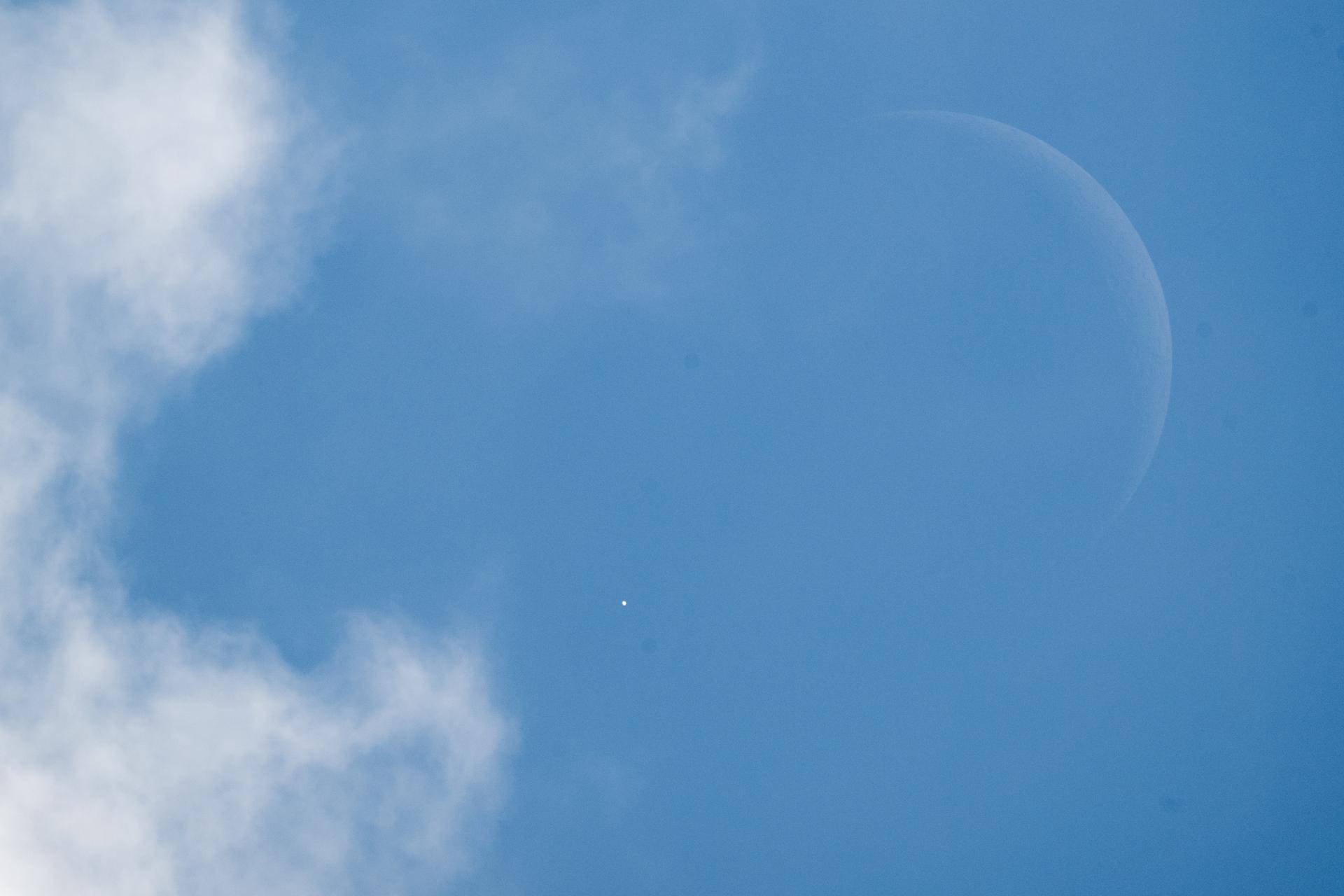
Venus is seen as it disappears behind the Moon at the start of the occultation on June 17, 2026, from the Mary W. Jackson NASA Headquarters building in Washington
NASA/Joel Kowsky

On Wednesday, June 17, skywatchers across the United States—and parts of Canada—enjoyed a rare event: a daytime lunar occultation of Venus. A lunar occultation occurs when the Moon moves directly in front of another celestial object from our viewpoint on Earth, briefly hiding it from sight.

This time, the Moon slipped in front of Venus for the first of three occultations happening this year, creating a striking daylight moment for those who caught it. If you missed it, there will be two more opportunities to see Venus disappear behind the Moon in 2026: Sept. 14, visible from parts of Asia, Africa, Europe, and western Russia; and Nov. 7, visible from southern South America.

Source: www.nasa.gov

NASA Hosts Virtual Artemis Webinar for Blind, Low-Vision Community

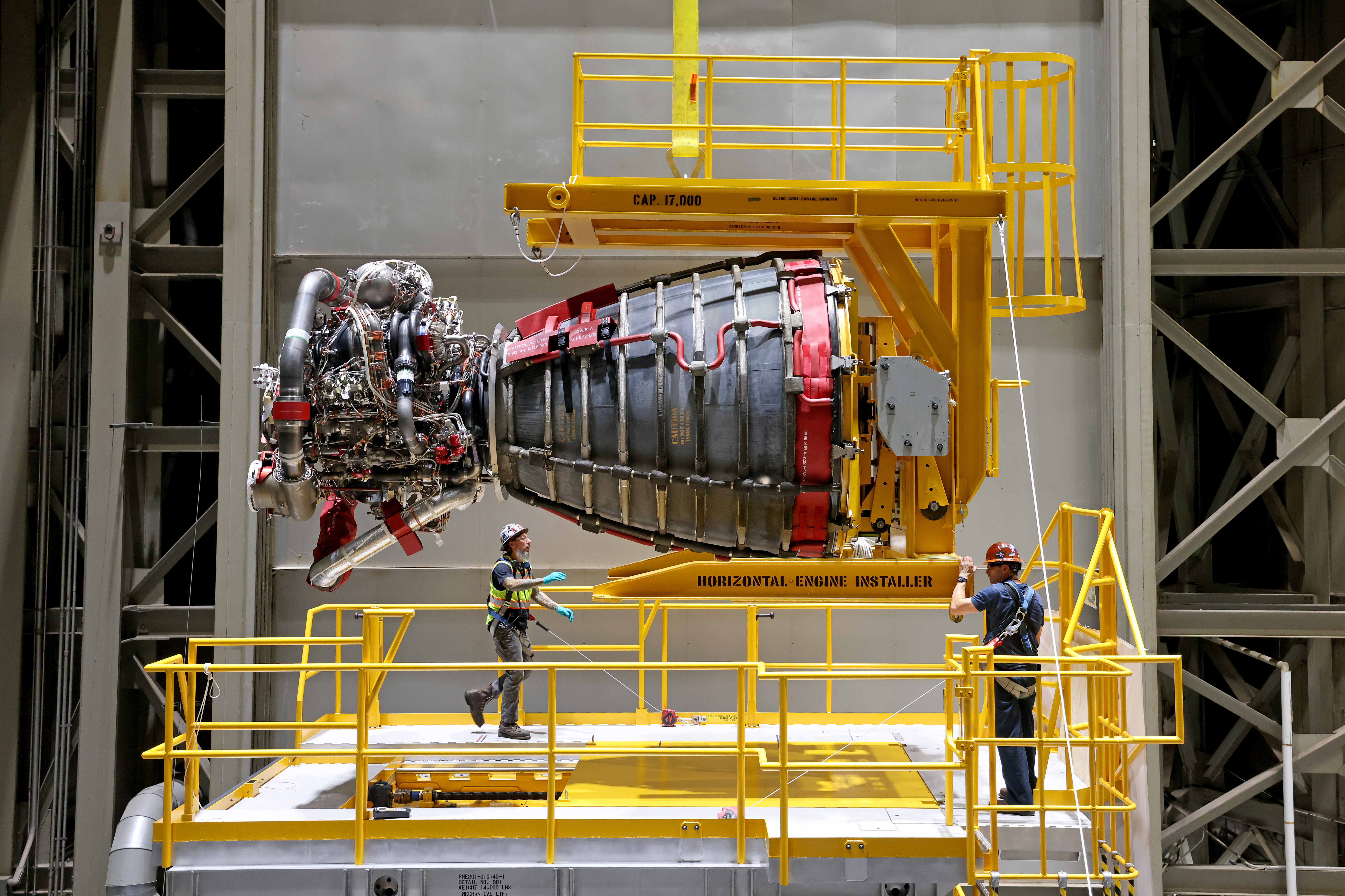
Two technicians at NASA’s Michoud Assembly Facility in New Orleans stand around one of the four RS-25 engines for the agency’s SLS (Space Launch System) rocket on Sept. 8, 2023. The RS-25 engine looks like a bell-shaped nozzle attached to a network of pipes. The engine is being lifted by the horizontal engine installer so it appears to be lying on its side. The RS-25 engine is about the size of a large pickup truck. The technicians are wearing hard hats and safety harnesses.
Credit: NASA/Michael Democker

NASA will host a virtual webinar at 2 p.m. EDT on Friday, Oct. 2, titled “The RS-25 Engine and the Future of Artemis Missions: An Accessible Webinar for the Blind and Low-Vision Community.” This webinar is open to the public, however it is tailored specifically for a blind and low-vision audience.

The webinar will last about two hours and include an audio-described video of an RS-25 engine test, a Q&A session with an Artemis engineer, and a panel about accessibility in space and science. The event will be hosted on the Zoom platform. 

Participants in the session include:

  • Dr. Kimberly Arcand, visualization scientist, NASA’s Chandra X-ray Observatory
  • Josh Greiner, test director, NASA’s Stennis Space Center in Bay St. Louis, Mississippi
  • Dr. Craig Moore, materials engineer, NASA’s Marshall Space Flight Center in Huntsville, Alabama
  • Dr. Robert Shelton, lead simulation engineer, NASA’s Johnson Space Center in Houston
  • Christine Malec, freelance writer and consultant

Those interested in attending the webinar must RSVP using this form by Friday, Sept. 25. Any questions can be directed to [email protected]. The details of the webinar will be emailed to registrants in the days leading up to the event.

NASA’s Artemis program will send astronauts on increasingly difficult missions to explore the Moon and establish a Moon Base on the lunar surface. For additional information on the Artemis missions, visit:

https://www.nasa.gov/artemis

Details

Last Updated

Sep 04, 2026

Related Terms

Source: www.nasa.gov

NASA Ames Fire Department Aircraft Firefighting Training

The fire department at NASA’s Ames Research Center in California’s Silicon Valley will perform training on the Moffett Federal Airfield beginning Tuesday, Sept. 8 through Friday, Sept. 11. The training will involve the use of a propane-fueled aircraft fire simulator and be conducted from 8 a.m. to 8 p.m. PDT.

Because the aircraft simulator is fueled by propane, very little smoke should be produced during the controlled training fires. However, flames may be visible to drivers on U.S. Highway 101. The training is intended to prepare Ames’ first responders to respond to a variety of realistic aircraft firefighting scenarios.

For more information about NASA’s Ames Research Center, visit:

http://www.nasa.gov/ames

-end-

Jeanne Neal
Ames Research Center, Silicon Valley
650-604-4789
[email protected]

To receive local NASA Ames news, email [email protected] with “subscribe” in the subject line. To unsubscribe, email the same address with “unsubscribe” in the subject line.

Source: www.nasa.gov

APOD: 2026 September 5 – Chasing the Moon’s Shadow

APOD

Astronomy Picture of the Day

Discover the cosmos! Each day a different image or photograph of our fascinating universe is featured, along with a brief explanation written by a professional astronomer.

A solar eclipse as viewed by a pilot from an aircraft cockpit.

Chasing the Moon’s Shadow

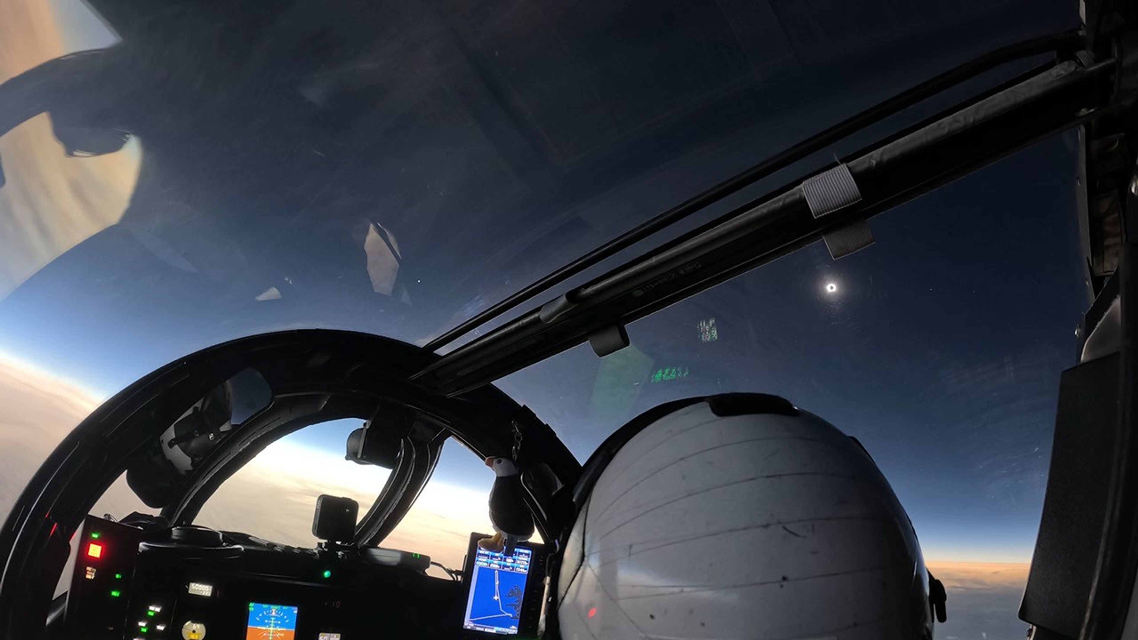
Explanation: Chasing the shadow of a New Moon, NASA’s WB-57F high altitude research aircraft took to the skies off the coast of Iceland on August 12 to observe a total solar eclipse. At 50,000 feet the aircraft was piloted along the precisely determined path of totality to maximize its time in the Moon’s shadow. A suite of high-resolution cameras on board was able to record eclipse data from above the clouds, dust, and atmospheric water vapor that interfere with observations made closer to the ground. This view from the cockpit, taken from an inflight video, captures the solar corona emerging at the beginning of totality. The sky appears dark in the shadow of the Moon. Venus is shining left of center in the video frame, while Jupiter and Mercury are just visible to the right of the eclipsed Sun. But the sky is bright along the distant horizon below, beyond the reach of the Moon’s shadow.

APOD’s main NASA site is moving: From apod.nasa.gov to science.nasa.gov/apod
Tomorrow’s picture: enhancing Pluto

Date September 5, 2026
Credit: NASA
Authors & editors: Jerry Bonnell, Cecilia Chirenti, Robert Nemiroff, Keighley Rockcliffe
A service of: ASD at NASA / GSFC,
NASA Science Activation & Michigan Tech. U.

Source: science.nasa.gov

A Bright Spot at Mount Michael

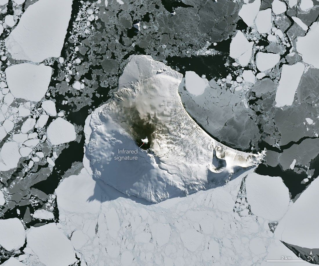
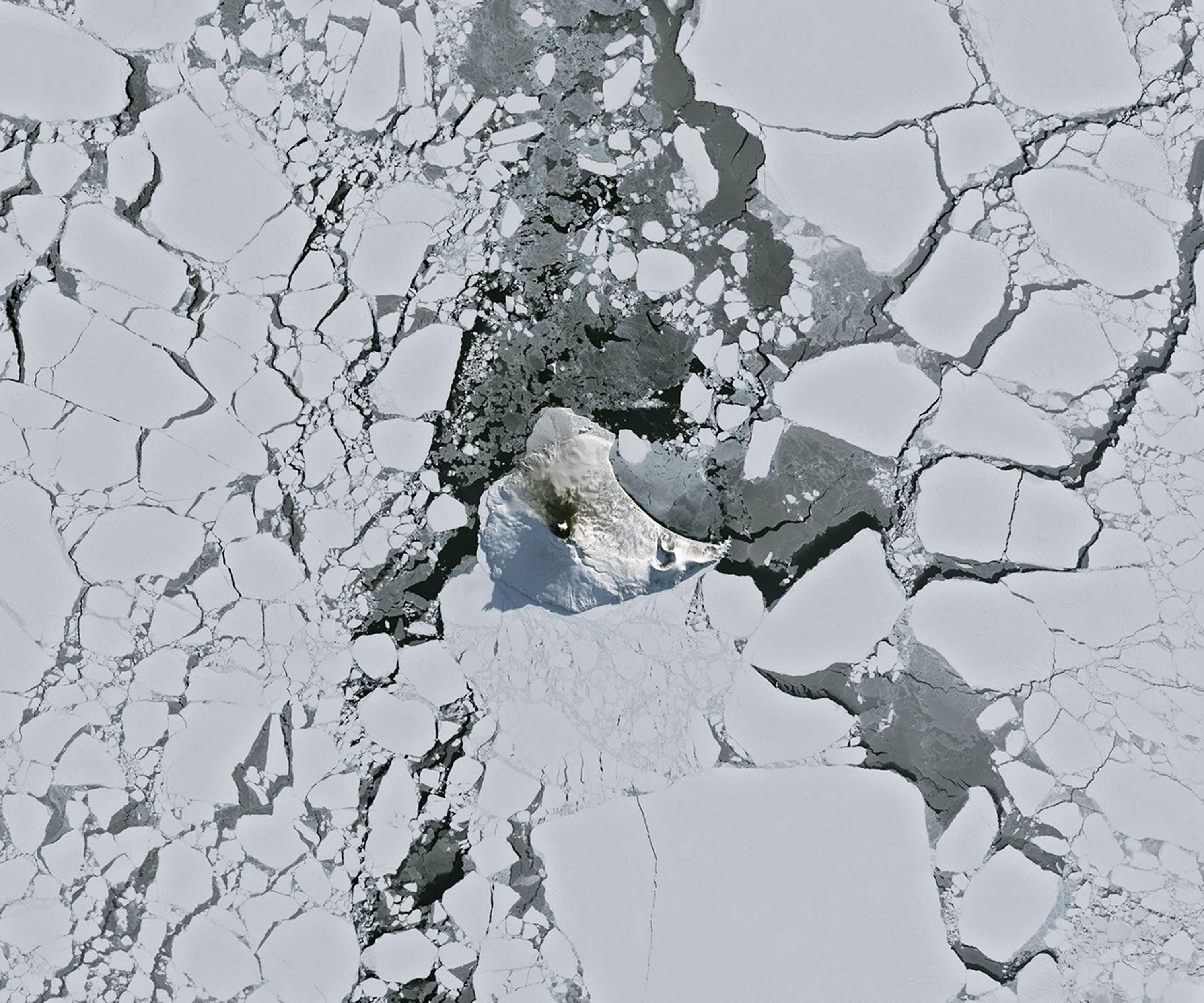
A small ice- and snow-covered island with an active volcanic crater at its center is surrounded by drifting pieces of sea ice. A thermal signal and small plume appear in the crater, and ash darkens the snow on the volcano’s northern slopes.
Mount Michael on Saunders Island, seen in this image acquired with the OLI (Operational Land Imager) on Landsat 8 on August 24, 2026, hosts a frequently active lava lake in its summit crater.
NASA Earth Observatory/Michala Garrison

Winter near the Antarctic Circle brings months of frozen darkness, when sea ice chokes ocean waters and many of its denizens hunker down to ride out the harsh conditions. But as winter began to release its icy grip, an uncommonly clear satellite image revealed that part of this remote realm was still very much awake, at least volcanically speaking.

Mount Michael, the stratovolcano at the center of Saunders Island, rises above the ice-filled South Atlantic Ocean in this image, acquired with the OLI (Operational Land Imager) on the NASA-USGS Landsat 8 satellite on August 24, 2026. The natural-color image is overlaid with an infrared signal (OLI bands 7-6-5), shown in red, revealing heat from the persistent lava lake in its summit crater. A puff of a volcanic plume hovering over the peak, along with darkened snow on its northern slopes, also suggests ongoing activity.

Saunders Island is one of the South Sandwich Islands, a string of small volcanic peaks about 350 kilometers (220 miles) long that formed from the South American plate subducting beneath the tiny South Sandwich plate. Regular eruptions, including at Mount Michael, have occurred on these islands in recent centuries.

Because of the volcanoes’ remoteness, scientists rely on satellite data to understand their activity. An analysis of thermal anomalies in Landsat, Sentinel, and ASTER (Advanced Spaceborne Thermal Emission and Reflection Radiometer) observations spanning 30 years led researchers to conclude that Mount Michael hosts a persistent lava lake in its summit crater. Only a handful of other volcanoes on Earth, including Kīlauea, Nyamulagira, and Erta Ale, are known to have similar, frequently active features.

Thermal observations from the MODIS (Moderate Resolution Imaging Spectroradiometer) and VIIRS (Visible Infrared Imaging Radiometer Suite) instruments have also enabled long-term monitoring of Mount Michael. Data provided through MIROVA, a near-real-time volcanic hot spot detection system, indicate that low-intensity activity has been ongoing at the volcano for the past several years. Other observations from NASA’s Aura satellite show that emissions of sulfur dioxide and other gases are common at Mount Michael.

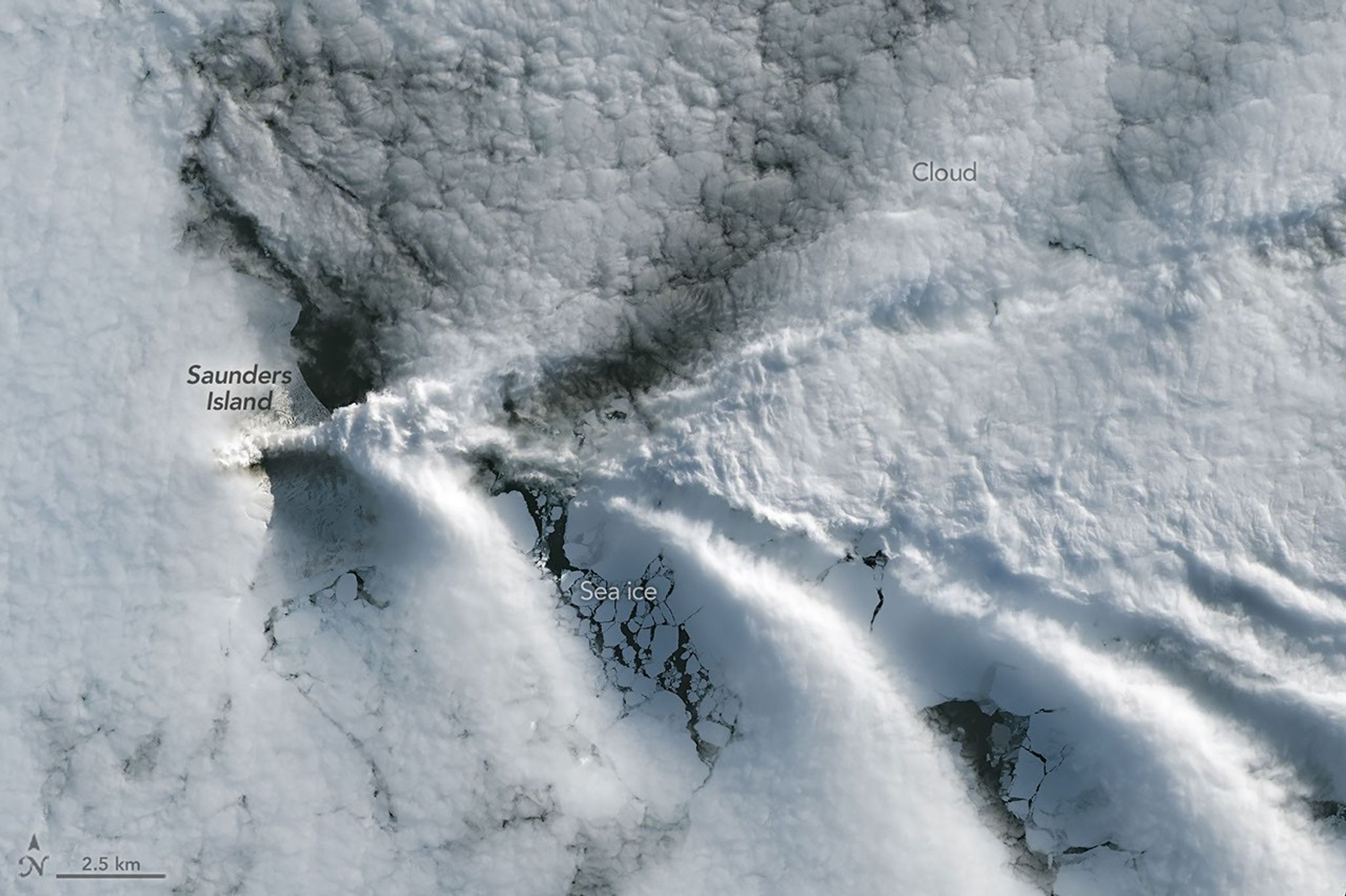
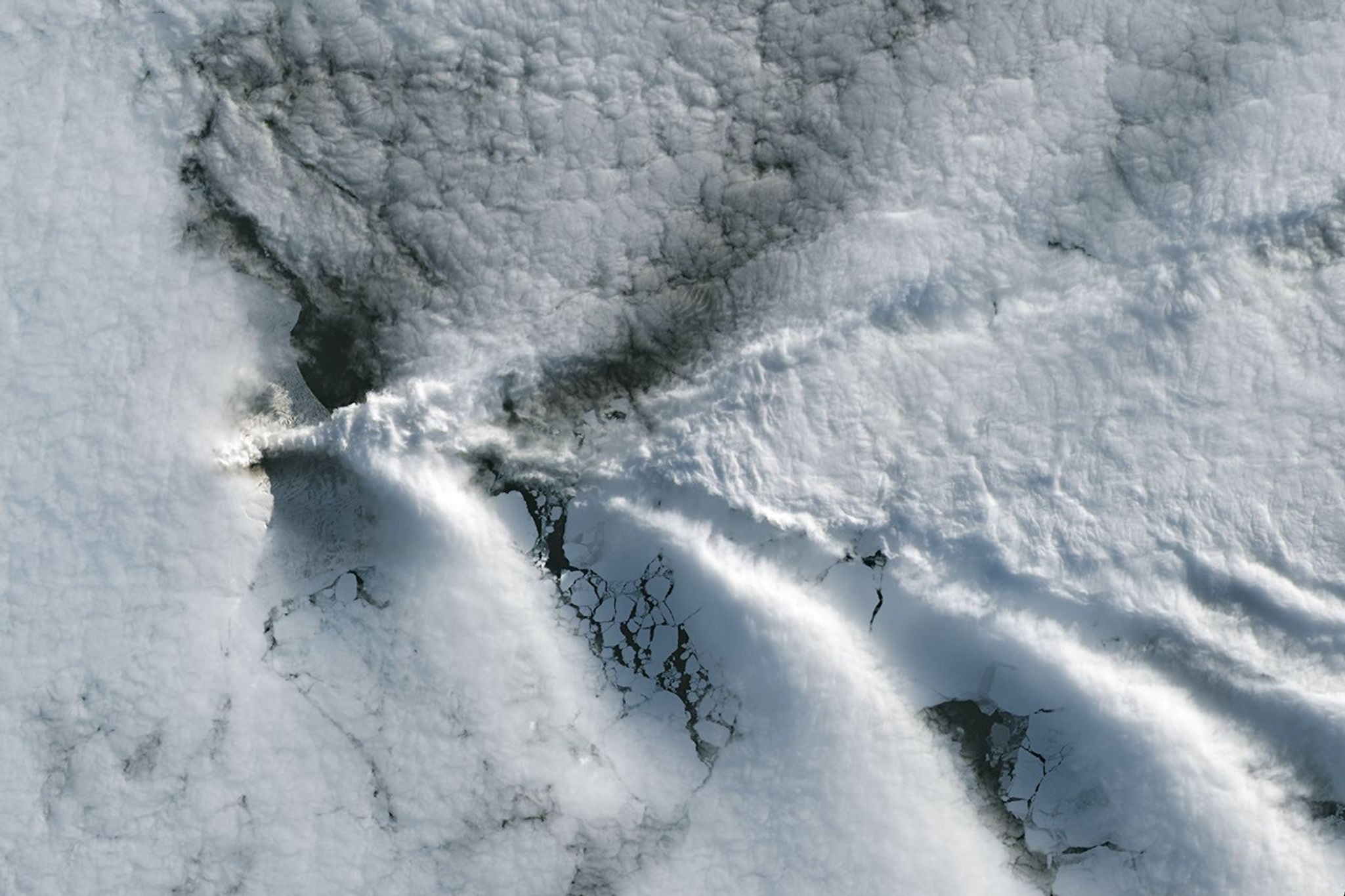
A series of V-shaped wave clouds appears over an ocean filled with pieces of sea ice.
Wave clouds form downwind of Saunders Island in this image acquired with the OLI (Operational Land Imager) on Landsat 9 on September 1, 2026.
NASA Earth Observatory/Michala Garrison

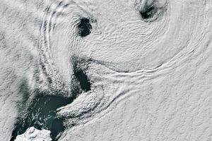
The cloud-free window over Mount Michael would close in short order. One week later, when Landsat 9 passed over the island, a more active atmosphere had returned. But the weather patterns interacted with the island to put on a spectacle of their own. The 843-meter-high (2,766-foot-high) peak jutting from the ocean disturbed passing winds to produce a series of wave clouds resembling the wake of a ship, a familiar phenomenon in this region. False-color imagery captured by NASA’s Aqua satellite indicates that a volcanic track caused by degassing sulfur dioxide was likely present as well.

NASA Earth Observatory images by Michala Garrison, using Landsat data from the U.S. Geological Survey. Story by Lindsey Doermann.

References & Resources

You may also be interested in:

Stay up-to-date with the latest content from NASA as we explore the universe and discover more about our home planet.

Ever Restless Mount Dukono Erupts

2 min read

The volcano on Indonesia’s Halmahera Island routinely ejects ash, volcanic gases, and volcanic bombs.

Article

A Sea of Spinning Clouds

3 min read

Icy, isolated Peter I Island stirred up a show in the atmosphere off the West Antarctic coast.

Article

America’s Emerald Isle

3 min read

Beaver Island is one in a string of verdant and scenic jewels in a northern Lake Michigan archipelago.

Article

Source: science.nasa.gov

APOD: 2026 September 7 – The Pelican Nebula in Gas, Dust, and Stars

APOD

Astronomy Picture of the Day

Discover the cosmos! Each day a different image or photograph of our fascinating universe is featured, along with a brief explanation written by a professional astronomer.

A busy starfield is dominated by red and blue glowing gas and dark filamentary dust. The nebula appears to some to have the shape of a pelican.

The Pelican Nebula in Gas, Dust, and Stars

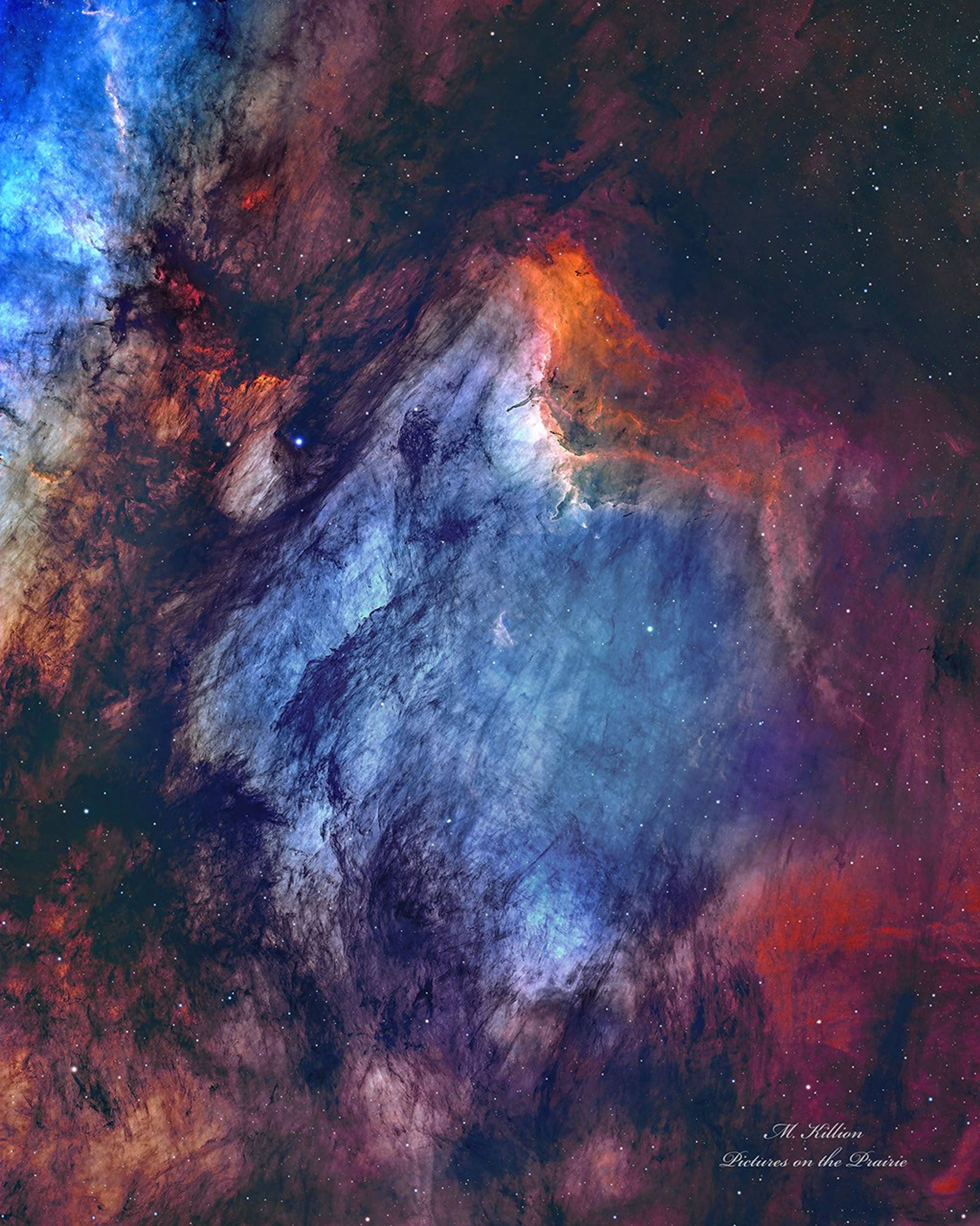
Explanation: The Pelican Nebula is slowly being transformed. IC 5070 (an official designation) is divided from the larger North America Nebula by a molecular cloud filled with dark dust. The deep featured picture from UtahUSA incorporates 25 hours of exposure and brings out great details of this filamentary dust. The Pelican Nebula receives much study because it is a particularly active mix of star formation and evolving gas clouds. The light from young energetic stars is slowly transforming the cold gas to hot gas, with the advancing boundary between the two, known as an ionization front, visible in bright orange on the upper right. Particularly dense tentacles of cold gas remain. Millions of years from now, the Pelican Nebula, bounded by dark nebula LDN 935, might no longer be known as the Pelican, as the balance and placement of stars and gas will surely leave something that appears completely different.

APOD’s main site is moving: From apod.nasa.gov to science.nasa.gov/apod
Tomorrow’s picture: geometric Saturn

Date: September 7, 2026
Credit & Copyright: Mark Killion
Authors & editors: Robert Nemiroff, Jerry Bonnell, Cecilia Chirenti, Keighley Rockcliffe
A service of: ASD at NASA / GSFC,
NASA Science Activation & Michigan Tech. U.

Source: science.nasa.gov