Discover the cosmos! Each day a different image or photograph of our fascinating universe is featured, along with a brief explanation written by a professional astronomer.
Solar Eclipses and Culture
Explanation: Pretend you have never heard of a solar eclipse. The Sun’s behavior has been predictable your whole life. One day, you witness the sky transform as it does in today’s spliced image spanning two hours of the August 12, 2026 solar eclipse. The Sun disappears, leaving behind a bright, empty ring. What would you think had happened? Humans have interpreted eclipses in countless ways throughout history, embedding beliefs about connection, rebirth, or danger into culture. “Eclipse” comes from the Greek word “ékleipsis” meaning “abandonment”. In ancient Greece, the solar eclipse marked the anger of the gods and the Sun abandoning humanity. To the Diné people, this celestial alignment is a time of renewal. Out of respect and to avoid the danger of sunlight, the Diné stay inside until the Sun and Moon separate. The Batammariba people of Benin and Togo believe that the Sun and Moon fight during an eclipse, so the community encourages peace among themselves. Eclipses are an example of the longstanding connection between astronomy and society.
NASA Revamps Challenge Linking Community College Studies to Aerospace Careers
Community college students across the U.S. now have another opportunity to discover how their education can lead to fulfilling roles at the forefront of aerospace, science, engineering, and technology. The updated NASA Community College Aerospace Scholars (NCAS) student challenge invites students to learn about the agency and its missions, engage with NASA experts, and explore aerospace jobs while competing for monetary awards.
The applications period is currently open.The deadline to register is Monday, Sept. 28.
“What makes this opportunity unique is that it’s one of few that is specifically for community college students,” said Alicia Baturoni Cortez, project manager for NASA’s Minority University Research and Education Project, which administers NCAS. “The NCAS student challenge is designed to meet their needs and broaden their career awareness so they can either go right into the workforce or expand their goals to include a four-year degree in STEM.”
A launch pad for new possibilities
Kim Alexander, left, and Ashley Rodriguez pose for a photo at NASA’s Glenn Research Center in Cleveland on their first day as interns in January 2024.
NASA/Erik Lopez
For NASA interns Kim Alexander and Ashley Rodriguez, NCAS became an unexpected springboard from community college to new careers.
After eight years as a bartender, Alexander was looking for a way to launch her career. She enrolled at Riverside Community College in Riverside, California, originally intending to pursue graphic design – but fell in love with math instead. Alexander participated in NCAS hoping it would look good on her resume and university transfer application. She ended up on a winning team that designed a human mission to Mars. The experience influenced her entire career trajectory.
“I was just completely overwhelmed by how amazing the program was,” said Alexander, who went on to participate in other NASA student opportunities. “But NCAS was the most monumental, because I really started thinking, ‘Hey, I could pursue a career in this. This is feasible.’”
Rodriguez grew up in South Florida, where she watched space shuttle launches but never considered a career at NASA. Instead, she gained experience in various roles and was parenting a toddler by the time she went back to school at Miami-Dade Community College seeking an IT degree. That’s where she first heard about NCAS, which ultimately set her on a path to a career in strategic communications.
“I did an infographic on laser relay communications. I knew nothing about it, then I felt like a pro by the end.”
Ashley Rodriguez
NASA Intern
The experience showed her the importance of strategic communications at NASA and helped her to discover a field she enjoys.
In January 2024, Rodriguez and Alexander started NCAS-funded NASA internships in the agency’s Aerosciences Evaluation and Test Capabilities Portfolio Office, where they met their mentor, Data and Analytics Manager Erik Lopez.
Today, both have earned university degrees and are starting NASA Pathways internships that could lead directly to full-time NASA employment. Rodriguez is working as a strategic communications intern in the Engineering Performance Management Office at the agency’s Kennedy Space Center in Florida, while Alexander is beginning an engineering role supporting the Flight Demonstrations and Capabilities Project at the agency’s Armstrong Flight Research Center in Edwards, California.
“They were the first two NCAS alumni interns; they literally onboarded together,” Lopez said. “And the fact that they now both get to come back to the agency as Pathways interns just brings me so much joy.”
NCAS relaunches with updated mission, prize potential
Stories like Alexander’s and Rodriguez’s illustrate the impact NCAS can have, and underscore why the program’s updated mission aims to reach even more community college students.
This school year, NCAS is launching with a two-part mission. The cohort phase, which runs through fall, calls on students to participate in live virtual experiences with NASA experts and submit materials detailing a connection between their current coursework and a role at NASA. Faculty members are key to encouraging students who might not envision themselves in a NASA role. Up to 1,000 submissions will be eligible for a $500 award.
Those who successfully complete this phase will be invited to take part in the next phase, a spring virtual NCAS career fair linking them to experts and industry career opportunities. Upon completion of the career fair, students may submit additional materials for prizes of $250, for up to 500 of the top submissions.
“What NCAS does is bring the stars down to ground level. It allows students a risk-free exploration of what could be.”
Alicia Baturoni Cortez
Project Manager, NASA’s Minority University Research and Education Project
The latest addition to the 100th Security Forces Squadron’s military working dog pack is 3-year-old Mmoab, a black Belgian Malinois who joined the U.S. Air Force canine team at Royal Air Force Mildenhall, England.
Discover the cosmos! Each day a different image or photograph of our fascinating universe is featured, along with a brief explanation written by a professional astronomer.
A Plane Lunar Eclipse
Explanation: Did you need to be on the right side of this airplane to see this eclipse? No. Lunar eclipses are routinely seen from the half of the Earth facing the Moon when the eclipse occurs, making them some of the most commonly witnessed astronomical events. You don’t even need any special equipment to see one — just your unaided eyes. Lunar eclipses are also some of the mostphotographedastronomicalevents because, unlike with a solar eclipse, your eyes and camera do not have to look toward the bright Sun. However, considering the featured image taken last week from Portugal, if you were on the left side of that airplane during takeoff, you might have trouble seeing it — at first. But even then, after takeoff, since lunar eclipses typically last for hours, you might soon be able to safely cross the aisle(s) to see it.
A satellite view shows the iceberg after it pivoted out of the fjord into Nares Strait, wedged against a small, brown island.
NASA Earth Observatory / Lauren Dauphin
A satellite view shows a large tabular iceberg at the junction of its home fjord and Nares Strait.
NASA Earth Observatory / Lauren Dauphin
A satellite view shows the iceberg after it pivoted out of the fjord into Nares Strait, wedged against a small, brown island.
NASA Earth Observatory / Lauren Dauphin
A satellite view shows a large tabular iceberg at the junction of its home fjord and Nares Strait.
NASA Earth Observatory / Lauren Dauphin
AUGUST 24
AUGUST 23
An iceberg from Petermann Glacier encounters Joe Island in northwestern Greenland, visible in images captured by the OLI (Operational Land Imager) on Landsat 9 on August 23, 2026 (right), and August 24, 2026 (left). NASA Earth Observatory images by Lauren Dauphin.
Summer is prime iceberg season in Greenland’s glacier-fed fjords, and 2026 was no exception. Especially notable was the berg that broke from the Petermann Glacier along Greenland’s northwest coast in August. Roughly the size of St. Thomas in the U.S. Virgin Islands, it was the largest calving event by any Arctic glacier since 2020.
Iceberg calving is a routine part of an outlet glacier’s life cycle. Scientists watch the process closely, however, along with numerous other observations of the ice and its environment, for longer-term signs of instability. Petermann is one of Greenland’s largest marine-terminating glaciers and acts as a gatekeeper for ice flowing from the ice sheet into the ocean. Its future stability has implications for sea level rise.
The calving event of summer 2026 was spotted on August 4 by Adam Garbo, a doctoral student in glaciology at the University of Ottawa, in imagery from the European Space Agency’s Sentinel-1 mission. Garbo and an international team of colleagues have been using remote sensing to study and track the glacier’s ice tongue.
The team reported that the large tabular iceberg, or “ice island,” measured just over 76 square kilometers (29 square miles) at the time it calved—the largest to break from the glacier since the ice island of 2012 (130 square kilometers). The 2012 calving followed earlier major events in 2008 (31 square kilometers) and 2010 (just over 250 square kilometers).
The August 2026 event could have been even bigger. Garbo and colleagues had been expecting a major calving once one of the large rifts they were monitoring finally cut all the way across Petermann’s ice tongue. “What surprised us was that the calving instead followed a different fracture, producing a smaller ice island than we had originally anticipated,” Garbo said. As of late August, two large rifts remained and were expected to eventually produce new ice islands of roughly 94 square kilometers and 84 square kilometers, though the timing remained uncertain.
August 24, 2026
NASA Earth Observatory/Lauren Dauphin
Glaciologist Mauri Pelto of Nichols College has also been tracking the iceberg, using images from NASA-USGS Landsat satellites, as it drifted down Petermann Fjord toward Nares Strait. In the week since it calved, the berg drifted an average of 3 kilometers per day. It continued toward the fjord’s junction with Nares Strait, where it rammed into a small rocky outcrop known as Joe Island (Joe Ø). The brief encounter is visible in images captured by the OLI (Operational Land Imager) on Landsat 9 on August 23 (top right) and August 24 (top left). A detailed view of the August 24 image is shown above.
Joe Island sits at the mouth of Petermann Fjord, making it one of the first obstacles a departing ice island meets. Collisions with it—like the one that split the 2010 ice island in two—often mark the start of a berg’s breakup. Petermann bergs tend to be thinner and more fragile than those calved by glaciers such as Greenland’s Jakobshavn and Helheim, and thinner still than Antarctica’s behemoths, Pelto noted.
“We were certainly watching closely as it interacted with Joe Island and were impressed that it survived the interaction without further fragmentation,” Garbo said.
The ice island was estimated to be less than 150 meters thick at the time of calving. Wind and surface currents have swept it out of the fjord, and satellite images show it pivoting away from Joe Island and continuing southwest through Nares Strait. As it drifts, it will fracture into smaller pieces as tides, winds, currents, and melting continue to weaken the ice.
Thicker bergs that calve from tidewater glaciers without floating ice-shelf extensions can drag and even become grounded on the seafloor within the fjord, while ice islands, like those from Petermann, might run aground later in their drift. Many ice islands have become “grounded” off the coasts of Coburg and Baffin islands.
Garbo and colleagues noted that ice islands and their fragments have been known to travel considerable distances, posing potential hazards to marine activities and infrastructure while also distributing freshwater through the ocean as they melt.
NASA Earth Observatory images by Lauren Dauphin, using Landsat data from the U.S. Geological Survey. Story by Kathryn Hansen.
Turkish Minister of Industry and Technology, Mehmet Fatih Kacır, 3rd from left, signs the Artemis Accords for the Republic of Türkiye as NASA Administrator Jared Isaacman, left, U.S. Deputy Assistant Secretary of State for Space and Environment Connor Tomlinson, and Turkish Space Agency President, Yusuf Kıraç, right, look on, Monday, August 31, 2026, at the Mary W. Jackson NASA Headquarters building in Washington.
NASA/Bill Ingalls
During a ceremony hosted by NASA Administrator Jared Isaacman at the agency’s headquarters in Washington on Monday, the Republic of Türkiye signed the Artemis Accords, joining the growing international coalition of like-minded nations dedicated to peaceful, transparent space exploration.
“It is my privilege to welcome the Republic of Türkiye as the 71st signatory of the Artemis Accords,” said Isaacman. “Last year, President Trump directed NASA to accelerate its return to the lunar surface and establish humanity’s first enduring presence on another world, a Moon Base, as well as lay the foundation for the manned exploration of Mars. NASA never undertakes these grand endeavors alone. On the Moon Base, we’re taking the Artemis Accords principles and putting them into practice on the lunar surface. NASA has invited every signatory to take part in this endeavor, creating opportunities for nations to contribute major pieces of hardware, scientific payloads, technology demonstrations, CubeSats, and other capabilities to future Artemis missions.”
Turkish Minister of Industry and Technology Mehmet Fatih Kacır signed on behalf of Türkiye. The President of the Turkish Space Agency Yusuf Kıraç, and the U.S. Deputy Assistant Secretary of State for Space and Environment Connor Tomlinson, also participated in the event.
Türkiye’s recent achievements in human spaceflight underscore its commitment to space exploration. In 2024, the country’s first astronaut, Alper Gezervaci, traveled to the International Space Station on Axiom Mission 3 and conducted scientific research alongside NASA astronauts. That same year, a second Turkish astronaut, Tuva Atasever, flew on Virgin Galactic 07 suborbital mission, conducting experiments and physiology research.
Türkiye will soon launch its first lunar mission, AYAP-1, joining the small but growing group of countries building and launching their own satellites to the Moon.
The country’s signing also comes as the country prepares to host the International Astronautical Congress in Antalya this October. Dozens of Artemis Accords signatories are expected to attend to discuss the future of peaceful and transparent space exploration.
In 2020, NASA and the State Department joined with seven other founding nations to establish the Artemis Accords, responding to the growing interest in lunar activities by both governments and private companies. They introduced the first set of practical principles aimed at enhancing the safety and coordination between nations as they explore the Moon, Mars, and beyond, committing nations to:
explore peaceably and transparently
render aid to those in need
enable access to scientific data
ensure activities do not interfere with those of others
preserve historically significant sites and artifacts by developing best practices
By signing the Artemis Accords, nations open the door to opportunities for future lunar exploration with NASA, advancing humanity’s return to the Moon, and shaping the Golden Age of space exploration and innovation.
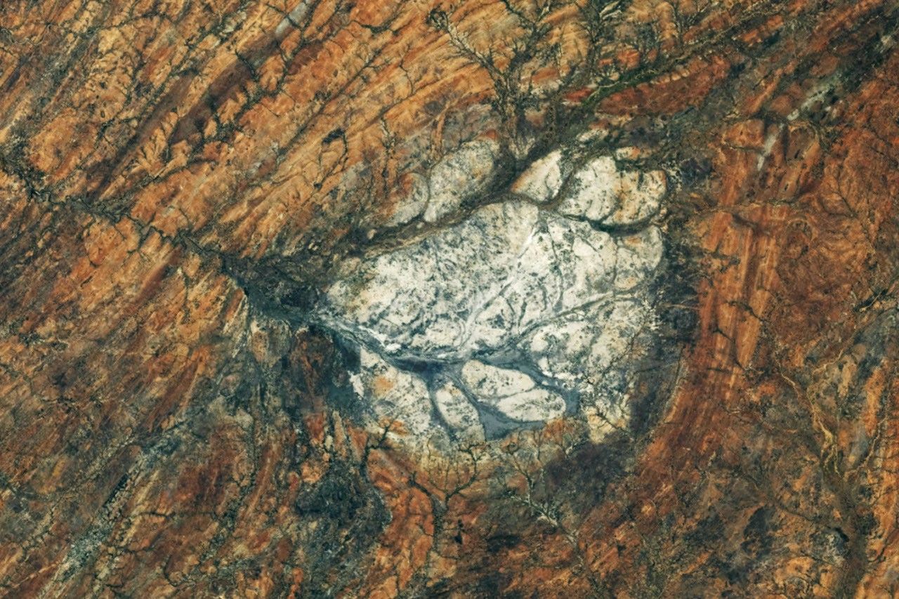
Every month, NASA Earth Observatory features a puzzling satellite image. The September 2026 puzzler appears above.
Your Challenge Identify the location shown in this satellite image. Share what clues you see, where you think it is, and what makes this place interesting or unique to you.
How to Answer Submit your response using this form and select “Puzzler Answer” as the topic. Please include your preferred name or alias.
You can keep it simple and just guess the location. Want to impress us? Tell us which satellite and instrument captured the image, which spectral bands were used, or point out a subtle detail about the geology or history of the area. If something catches your eye, or if this is your home or means something to you, we’d love to hear about it.
The Prize We can’t offer prize money or a trip to space to see Earth like satellites and astronauts do. But we can offer something almost as rewarding: puzzler bragging rights.
About a week after the challenge, we’ll post the answer at the top of this page, along with a link to an Earth Observatory Image of the Day story that explains the image in more detail. We’ll recognize the first person who correctly guesses the location, and we may also highlight readers who share especially thoughtful or interesting answers. By submitting a response, you acknowledge that your comments may be edited, excerpted, and published on this page.
Until then, zoom in, look closely, and enjoy the challenge. See you at the reveal!
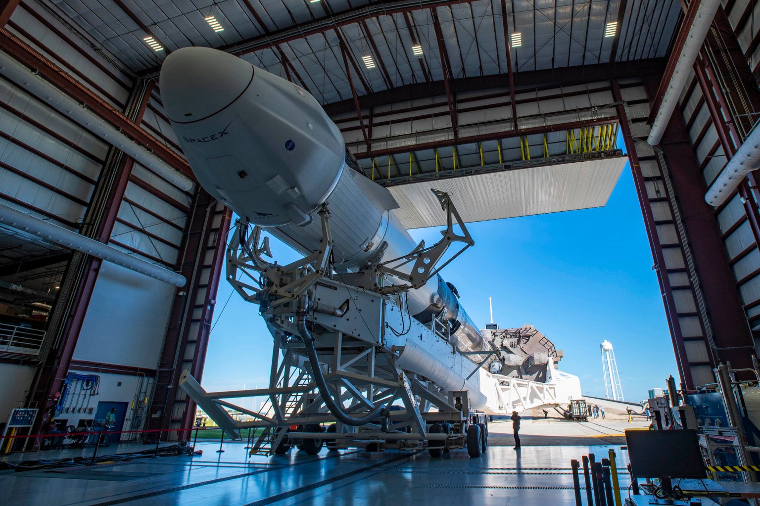
NASA’s Nancy Grace Roman Space Telescope, aboard a SpaceX Falcon Heavy rocket, transits the Sun during launch from the agency’s Kennedy Space Center in Florida on Aug. 30, 2026. Roman is named after the agency’s first chief astronomer.
Roman will survey billions of stars and galaxies with a field of view far larger than Hubble’s, helping scientists study dark energy, exoplanets, and the evolution of the universe.
Beauty pass of Roman, coming around from behind with high-gain antenna rotating.
Credits: NASA’s Goddard Space Flight Center/Conceptual Image Lab
Where is Roman?
Roman is making its three-month journey from Earth to Sun-Earth Lagrange Point 2, or L2. Along the way, Roman is undergoing a process called commissioning, where systems are turned on, adjusted, calibrated, and prepared for science operations. Commissioning is the time for scientists and engineers to make sure that Roman is performing as expected. The schedule is subject to change as the team assesses and adjusts as needed.
An hour and 23 minutes after launch, Roman began to emerge from the tight configuration that allowed it to fit in the rocket fairing. The solar panels and sunshade deployed, shading the rest of the observatory and providing power to the systems. Within the upcoming days, the antenna will swing out and the visor-like deployable aperture cover will move into place to permanently reveal and shade the primary mirror.
Roman’s Orbit
This visualization shows the stable, halo orbit that Roman will have around L2. At this location, the gravity of the Sun and Earth, together with an object’s motion around the Sun, let it stay lined up with Earth as they orbit, allowing Roman to have a relatively steady orbit without using much fuel. This location also offers exceptionally stable optical performance and a constant, unobstructed view of a wide swath of the sky; Earth won’t block much of Roman’s view since it will be so distant. And at L2, heat from Earth, the Sun, and the Moon have less effect on infrared telescopes, which “see” heat.
Unable to render the provided source
Explore the Roman Systems
Learn more about the systems that are getting turned on, tested and calibrated.
Discover the cosmos! Each day a different image or photograph of our fascinating universe is featured, along with a brief explanation written by a professional astronomer.