NASA to Help Unlock Mysteries of Mars’ Moons in Upcoming Mission

NASA is playing an important role in JAXA’s (Japan Aerospace Exploration Agency) MMX (Martian Moons eXploration) mission, to advance our understanding of Mars’ moons and build on the agency’s long history of exploring the Red Planet.

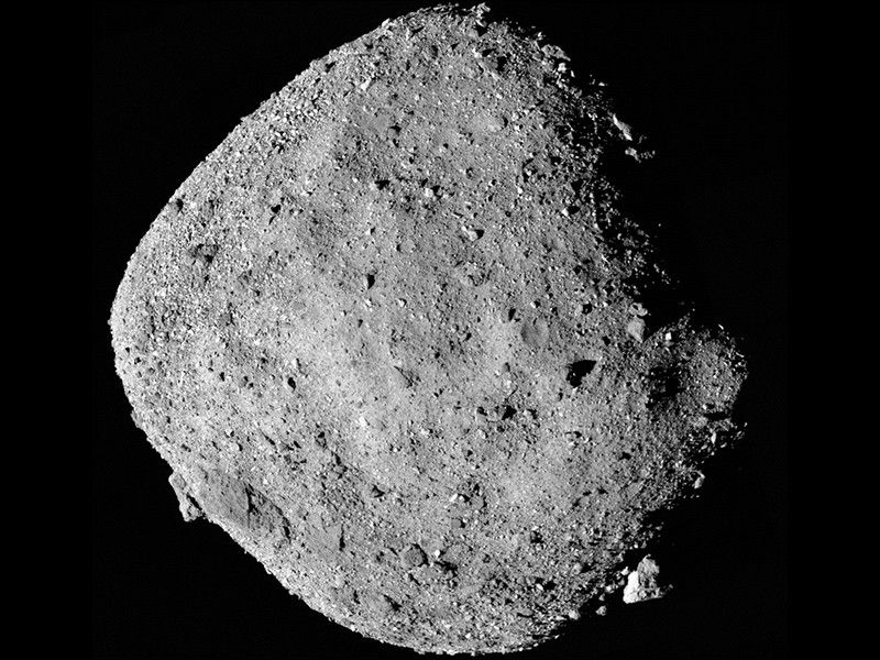
The mission aims to characterize and determine the origin of Mars’ moons Phobos and Deimos and deliver a sample of Phobos to Earth. The MMX spacecraft is targeting launch from JAXA’s Tanegashima Space Center in Japan at 3:41 p.m. EDT on Monday, Oct. 19 (4:41 a.m. JST on Tuesday, Oct. 20).
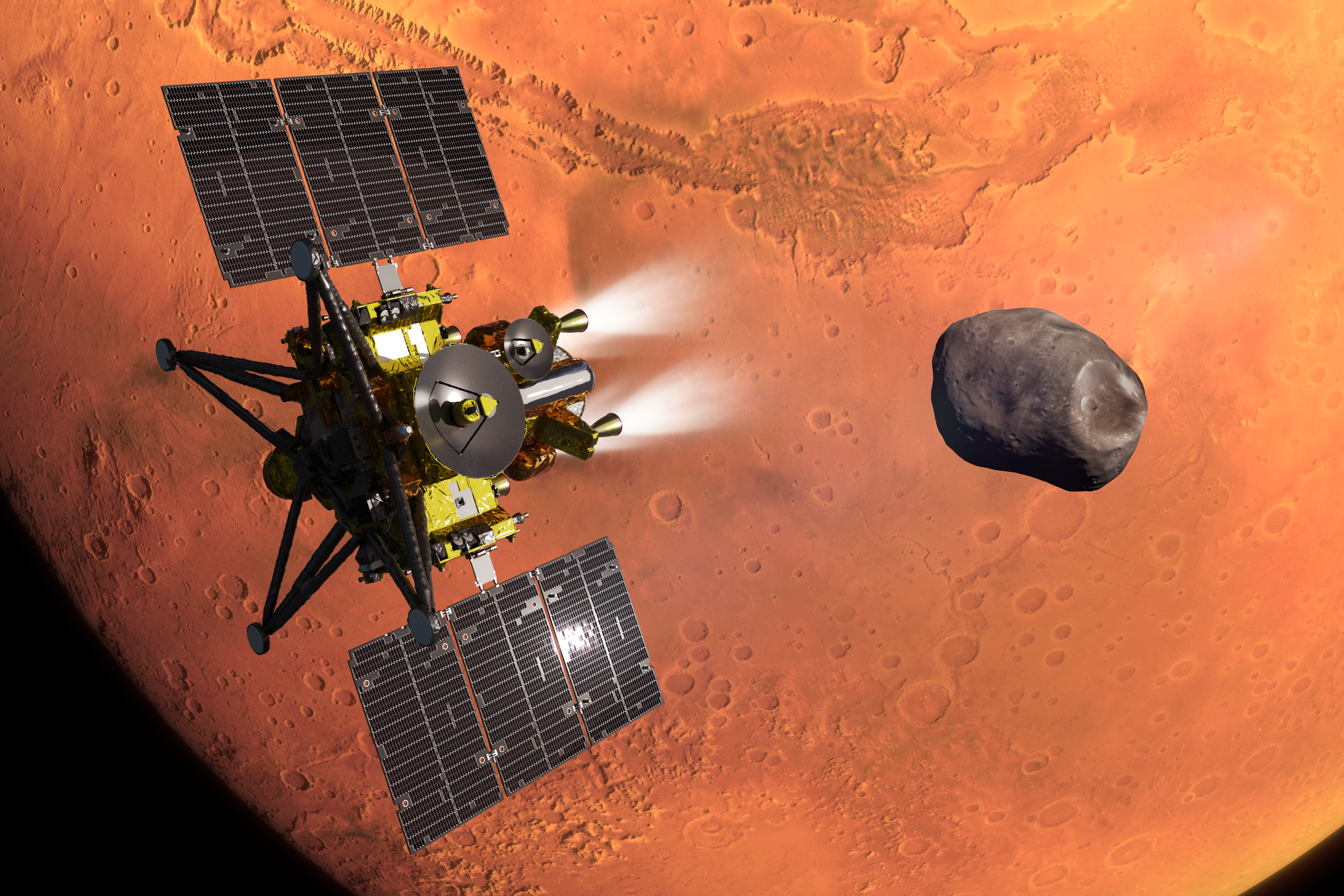
Artist's concept of JAXA's MMX spacecraft with the Martian moon Phobos and planet Mars in the background
An artist’s concept of JAXA’s MMX spacecraft during its Mars’ orbit insertion. The Martian moon Phobos, which MMX will explore and sample, is in the background.
JAXA

“The samples from MMX will bring forth paradigm-shifting science on the Mars system for generations to come, especially as NASA prepares to send the first humans to Mars,” said Nicky Fox, associate administrator, Science Mission Directorate, NASA Headquarters in Washington. “The NASA-JAXA sample curation partnership is extremely valuable, and I am proud that NASA Science is supporting MMX sample curation and will be sharing portions of these samples for study as we continue to expand humanity’s understanding of the universe for the benefit of all.”

NASA’s contributions to the mission include the Mars-moon Exploration with Gamma rays and Neutrons (MEGANE) spectrograph instrument, the Pneumatic Sampler (P-Sampler) technology demonstration, and communications and navigation support from the agency’s Deep Space Network, as well as funding United States scientists participating on the MMX science team.

Scientists have long debated the origin of Mars’ two moons. The data and samples collected by the MMX mission will help answer essential questions about the origins of these moons and the history of the solar system.

“Phobos and Deimos may be the remains of a massive impact on Mars that sent material into orbit around the planet, or they could be ancient asteroids that were captured by Mars’ gravity billions of years ago,” said Tom Statler, MMX program executive and program scientist at NASA Headquarters. “Having the answer will help illuminate that early era when Earth and the other inner planets may have been acquiring much of their water and organic compounds.”

The MEGANE (pronounced meh-GAH-nay, the Japanese word for eyeglasses) spectrograph will help scientists “see” what Phobos is made of by measuring neutrons and gamma rays emitted from the moon’s surface and determining its chemical elemental composition, which will provide important clues about its origin.

Mounted on one of the spacecraft’s landing legs, the P-Sampler is designed to collect a ground sample from Phobos. The system gathers surface material using bursts of high-pressure nitrogen gas, complementing JAXA’s C-Sampler, which will extract cores from a few inches deeper. NASA will obtain and curate about 15% of the total returned sample at the agency’s Johnson Space Center Astromaterials Lab in Houston, making it available for research for decades.

Another key part of NASA’s contribution to MMX is its scientific partnership with JAXA. NASA-supported researchers are working alongside international colleagues to help reveal the story of Phobos and will use mission data and returned samples to uncover new clues about the moon’s origin and the evolution of the Mars system.

The MMX spacecraft will arrive at Mars in August 2027 to begin its survey of the Red Planet’s two moons. After surveying Phobos in detail, the spacecraft will collect a sample of the moon’s surface no earlier than December 2028 and deliver it to Earth in 2031.

The MEGANE instrument was developed by the Johns Hopkins Applied Physics Laboratory. Honeybee Robotics, a Blue Origin company, developed the spacecraft’s pneumatic sampler mechanism. NASA’s contributions to the MMX mission were developed under the agency’s Discovery Program. The Discovery Program is managed by NASA’s Marshall Space Flight Center in Huntsville, Alabama, for the agency’s Science Mission Directorate in Washington.

For more information about the MMX mission, visit:

https://science.nasa.gov/mission/mmx

Karen Fox / Alana Johnson
Headquarters, Washington
240-285-5155 / 202-672-4780
[email protected] / [email protected]

Source: science.nasa.gov
NASA’s Hubble Spies Spiral’s Edge

2 min read

NASA’s Hubble Spies Spiral’s Edge

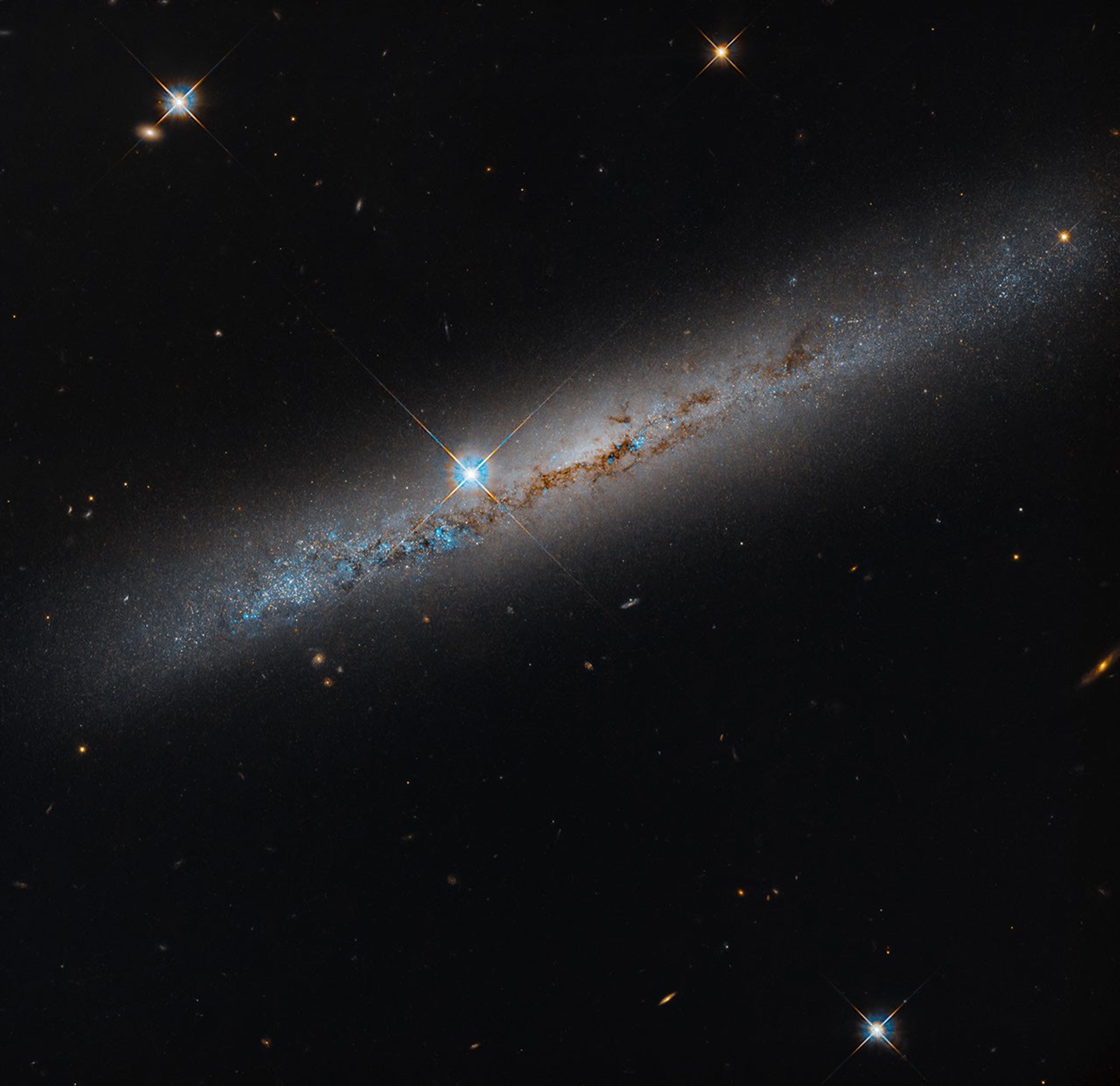
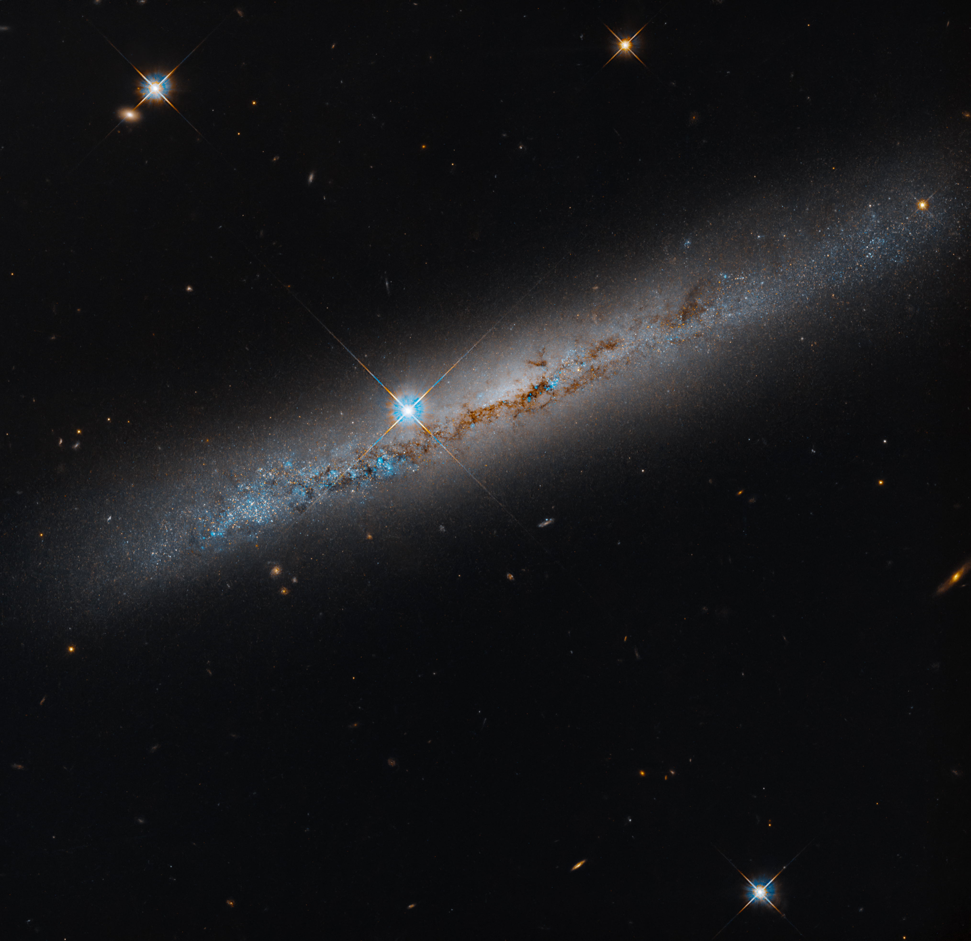
An edge-on spiral galaxy. Its rusty-brown dust lanes bisect the galaxy lengthwise. Bright-blue points dot the galaxy and seem to be more dense on its left side. A bright foreground star shines just to the left of the galaxy's center. The background is black and dotted with distant galaxies and a smattering of foreground stars, which are easily identified by their diffraction spikes.
This NASA Hubble Space Telescope image features the edge-on, intermediate spiral galaxy NGC 1827. Its rusty-brown dust lanes bisect the galaxy lengthwise. Look for distant galaxies that dot the black background, while a smattering of foreground stars are easily identified by their diffraction spikes.
NASA, ESA, Michael Jones (California Institute of Technology); Image Processing: Gladys Kober (NASA/Catholic University of America)

This NASA Hubble Space Telescope image features the edge-on, intermediate spiral galaxy NGC 1827, located roughly 37 million light-years away in the constellation Columba, the Dove. Hubble captured the image as part of a survey looking at 260 satellite galaxies around 22 Milky Way-like host galaxies within a radius of about 32 million light-years from Earth. Hubble has already observed 111 of these satellite galaxies. The remaining galaxies will take an additional 149 Hubble orbits, one orbit for each galaxy, to observe.

The image, taken with Hubble’s Advanced Camera for Surveys, reveals bright-blue regions along the galaxy’s disk dotted with dark dust lanes where new stars are likely forming. A bright foreground star appears just to the left of the galaxy’s bright central bulge but is located between us and the galaxy. Its four diffraction spikes are the result of light bending around the internal supports that hold Hubble’s secondary mirror.

Low-mass galaxies like the ones in this Hubble observing program provide a way to test the predictions of cosmological models on small scales, which struggle to match observations. The data Hubble gathers will help us better understand and characterize the properties of low-mass galaxies in Milky Way-like systems, allowing researchers to refine cosmological models.

Media Contact:

Claire Andreoli
NASA’s Goddard Space Flight Center, Greenbelt, MD
[email protected]

Source: science.nasa.gov

Artemis II Heat Shield After Splashdown

The Orion spacecraft's heat shield dominates this underwater photo. Due to the water, the heat shield appears to be teal-colored.
US Navy

Shortly after NASA’s Artemis II mission splashed down on April 10, 2026, U.S. Navy divers captured underwater imagery of the Orion spacecraft’s heat shield. In the months after, the agency measured whether the thermal protection system effectively safeguarded the crew and Orion systems as the spacecraft reentered Earth’s atmosphere. This rigorous analysis confirmed that the heat shield performed as expected.

Learn how Orion’s heat shield was examined.

Image credit: US Navy

Source: www.nasa.gov

I Am Artemis: Allison Mjoen

3 Min Read

I Am Artemis: Allison Mjoen

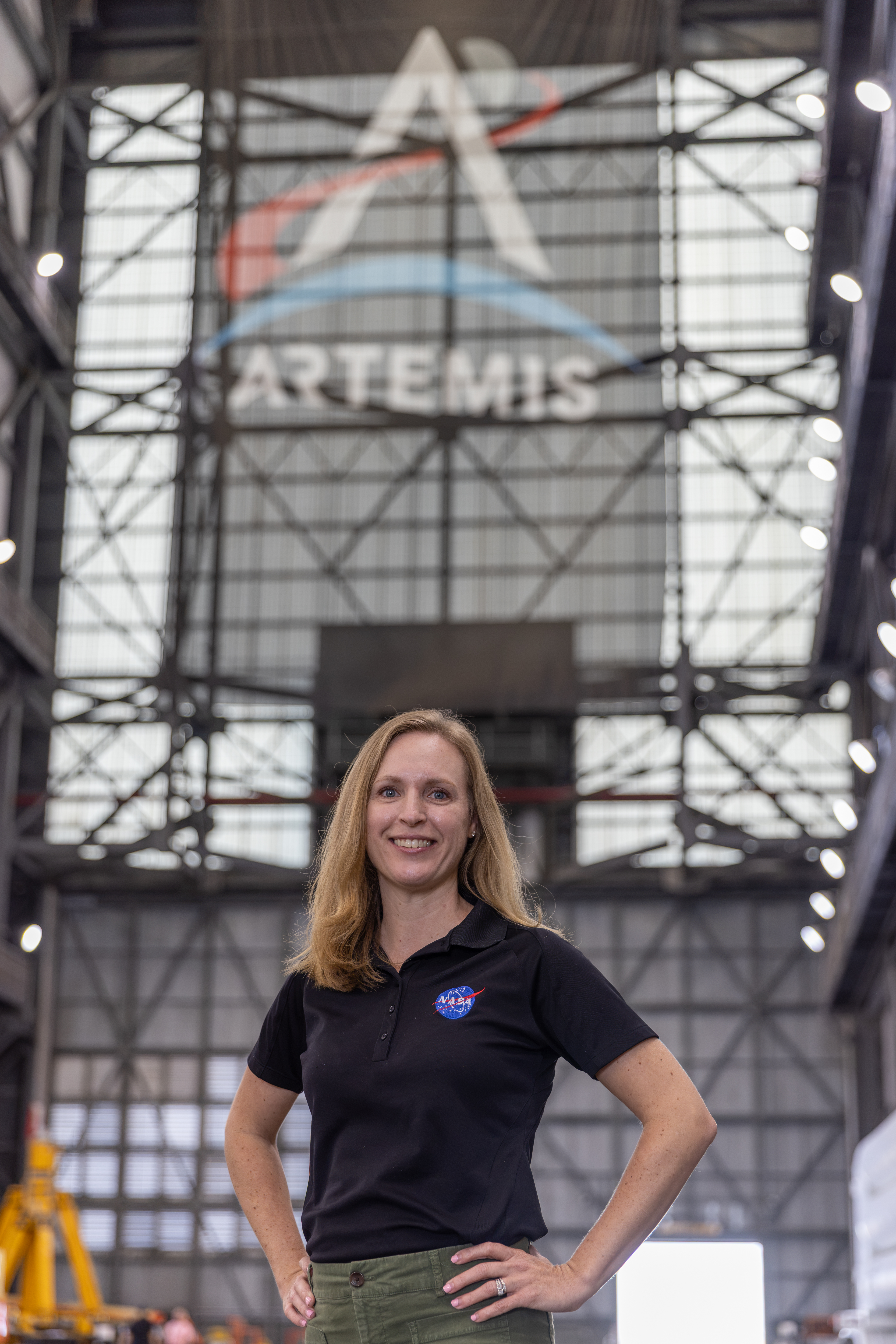
Portrait of Allison Mjoen inside the Vehicle Assembly Building

As the supercooled propellant flowed into the core stage, and NASA’s SLS (Space Launch System) rocket roared to life, Allison Mjoen and her family watched with awe and pride. Mjoen, NASA’s operations manager for the agency’s Exploration Ground Systems Program, helped shape the systems and ground operations that will one day send humans back to the Moon. Over her 20-year career at NASA’s Kennedy Space Center in Florida, she supported missions across the Space Shuttle Program, the International Space Station, and now she is applying that experience to Artemis.

April 1, 2026, was a bright, crystal-clear day along the Florida Space Coast. The sunlight seemed to sharpen every color along the horizon. As Mjoen and her children counted down and the crowd’s voices rose around them, the rumble of the SLS rocket intensified beneath their feet. For her children, it was the chance to see what their mom had helped make possible. For Mjoen, it was a moment she would never forget.

That moment also offered a pause for reflection on the work that led her there. As the spacecraft offline operations manager, Mjoen coordinates the work that happens long before launch day. By supporting the ground systems’ senior vehicle operations manager, Matt Czech, she develops integration plans and oversees ground operations for Artemis vehicle processing, focusing on booster and Orion spacecraft operations.

Allison Mjoen poses for a photo inside the Vehicle Assembly Building.
Allison Mjoen, NASA’s operations manager for the agency’s Exploration Ground Systems Program, helped shape the systems and ground operations that will one day send humans back to the Moon.
NASA/Amber Jean Notvest

Mjoen began her career as a flight crew systems engineer with United Space Alliance supporting the Space Shuttle Program. Her team handled mission-specific cabin configurations, including the food, spacesuits, cargo, and payloads astronauts needed aboard the shuttle.

After the Space Shuttle Program retired, she supported the International Space Station Program as a payload integration engineer. In this role, she connected experiment investigators with the organizations developing their hardware. She later worked in the Project Office on the Test and Operations Support Contract before joining NASA’s Operations Project Engineering Office, where she served as the Spacecraft Payloads Integration and Evolution Element lead for Artemis I.

“Early on, I thought every decision had to be perfect, but everything is an opportunity to learn, especially the tasks that seem unrelated at the time. It’s about staying curious, working hard, building relationships, and trusting that each step is preparing you for the next one.

Allison Mjoen

Allison Mjoen

Operations Manager, NASA's Exploration Ground Systems

That preparation took on new meaning when she first supported integrated firing room operations as a certified operations project engineer during Artemis I. Earning the certification was a milestone. Applying it during real time operations brought a new level of responsibility.

“Every decision and communication directly supported the integrated team’s ability to execute safely and properly implement the test procedure,” said Mjoen.

Working at the integration console underscored the importance of preparation, collaboration and trust — lessons she carries into her work coordinating across teams today.

“I get to collaborate everyday with incredibly talented and dedicated people who are all working toward the same goal. It’s especially rewarding to know that our collective efforts directly contribute to the success of the mission.”

Allison Mjoen

Allison Mjoen

Operations Manager, NASA's Exploration Ground Systems

For Mjoen, the shared experience is part of what makes Artemis so important. As the Artemis program continues, she looks forward to another moment families will be able to share as astronauts return to the lunar surface.

“That single moment captured the imagination of people around the world and showed what is possible when we come together for a bold goal,” she said of the first Apollo Moon landing. “Artemis is creating that kind of moment for a whole new generation, and this time to stay.”

About the Author

Matina Douzenis

Communication Strategist

Source: www.nasa.gov

APOD: 2026 October 16 – Chasing the International Space Station

APOD

Astronomy Picture of the Day

Discover the cosmos! Each day a different image or photograph of our fascinating universe is featured, along with a brief explanation written by a professional astronomer.

Chasing the International Space Station

Explanation: Blasting into the predawn sky on Tuesday, October 13, a Falcon 9 rocket and Dragon spacecraft are headed for low Earth orbit in this stunning timelapse video captured from Indian Harbour Beach, Florida. Starting with a launch from Space Launch Complex 40 at Cape Canaveral Space Force Station, Falcon and Dragon are chasing the International Space Station on NASA’s 35th Commercial Resupply Services mission. On cue, the space station itself enters the frame from the top. Almost 8 seconds into the 30 second timelapse. the bright streak of the ISS appears heading “down” toward the horizon. The first and second stages of the Falcon 9 are separating as the spectacular exhaust plume jellyfish grows, already catching the light of the rising Sun. The visible sequence of first stage boost back, re-entry, and landing burns begins around 20 seconds into the video. With the second stage following the ISS toward the distant horizon, the jellyfish plume continues to drift in the predawn sky, even after the successful first stage landing at planet Earth’s Landing Zone 40.

Tomorrow’s picture: pixels in space

Date October 16, 2026
Video Credit: Eric Holland
Authors & editors: Jerry Bonnell, Cecilia Chirenti, Robert Nemiroff, Keighley Rockcliffe
A service of: ASD at NASA / GSFC,
NASA Science Activation & Michigan Tech. U.

Source: science.nasa.gov
NASA Satellites Observe Historic 2026 El Niño

6 Min Read

NASA Satellites Observe Historic 2026 El Niño

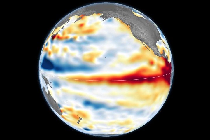
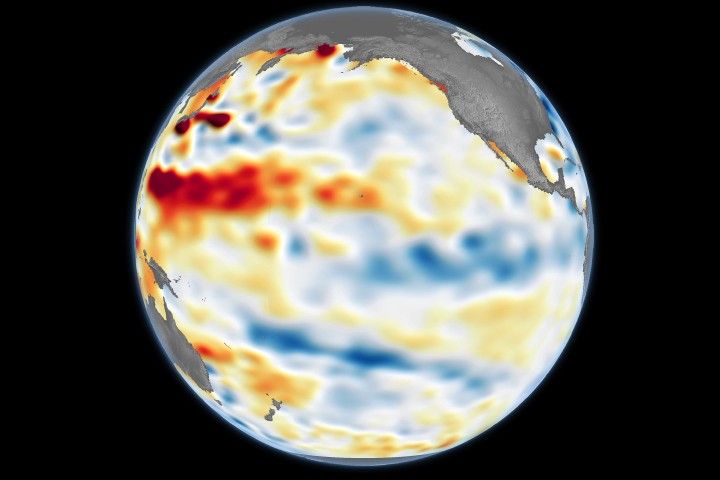
This visualization compares three ocean data products, sea surface temperature anomaly, apparent visible wavelength, and sea surface height anomaly, over the same months in 2025 and 2026. Signals of El Niño in each map are highlighted with pop-up labels.

Credits:
NASA’s Scientific Visualization Studio

A phenomenon rarer than a solar eclipse and more powerful than any single storm system is unfolding this fall, and NASA is tracking it closely.

El Niño is a natural climate pattern that emerges roughly every two to seven years marked by warmer-than-normal water temperatures in parts of the equatorial Pacific. NASA scientists are keeping watch as it flips trade winds, redistributes ocean heat, scrambles rain patterns, and raises sea surface height across parts of the Pacific.

As of October, the National Oceanic and Atmospheric Administration (NOAA) has said that there’s an 83% chance that the strongest El Niño since 1950 is currently unfolding. People around the world, including farmers, firefighters, and coastal communities, are already experiencing the effects in different ways.

Follow along with these maps as NASA tracks El Niño from its epicenter in the equatorial Pacific Ocean.

Sea surface height in flux 

Lower-than-normal sea level conditions appear blue, and higher areas are orange and red in this map, which compares the ocean in 2025 (a weak La Niña year) and 2026. The map was created using altimetry data from the Sentinel-6 satellites, which measure water height for the entire ocean every 10 days, down to fractions of an inch.
Credit: NASA’s Scientific Visualization Studio

One of the first clues appeared in satellite imagery in January 2026, when a swell of warm water called a Kelvin wave was spotted near Micronesia in the western Pacific. Kelvin waves are slow-moving pulses of water thousands of miles long. Like underwater freeways, they transfer heat from west to east across the Pacific. The warm water heats the air directly above it, making it rise. The change in air pressures weakens or even reverses the trade winds that typically blow in the opposing direction, from the Americas toward Asia, causing sea levels in the eastern Pacific to rise further, and waters to warm even more. This chain reaction signifies the start of an El Niño.

The map above shows that by early April, those Kelvin waves had reached the eastern Pacific, and sea surface temperatures had begun to warm. Warm water expands in volume, elevating local sea levels in some areas by as much as 1 to 1.3 feet (30 to 40 centimeters). The higher-than-normal water can be seen sloshing toward South America then moving up the coast to California. Sea levels that are six to eight inches (15 to 20 centimeters) lower than normal are visible around Indonesia and northern Australia.

“Kelvin waves are like the heartbeat of El Niño,” said Josh Willis, project scientist for sea level missions at NASA’s Jet Propulsion Laboratory in Southern California. “And our sea level satellites let us peer into the ocean and watch every beat.”

Scientists have used satellite altimetry to track the height of the ocean with ultraprecision since 1993. That unbroken data record continues today with the Sentinel-6 satellites. State-of-the-art radar altimeters aboard these satellites survey millions of square miles of ocean in a single day, complementing NOAA’s fleet of ocean sensors and buoys drifting and diving through the water below.

Warming Pacific waters 

The map above compares sea surface temperatures in 2025 (a weak La Niña year) and 2026. Data are acquired from satellite instruments, buoys, and ship sensors.
Credit: NASA’s Scientific Visualization Studio

Warmer-than-normal seawater is one of the best-known indicators of El Niño. Already, sea surface temperatures in the eastern Pacific are about 3 degrees Fahrenheit (1.7 degrees Celsius) warmer than the long-term average and could jump another fraction of a degree in the coming months, Willis said. 

Satellites carrying microwave and infrared radiometers can see through and around clouds to measure heat energy at the sea surface. Satellites in 2026 mapped the band of warmer-than-normal water as it expanded throughout the spring. The band, seen in dark red, stretches for millions of square miles from the heart of the Pacific to the coast of South America.  Ocean temperatures can influence weather patterns around the world. Air above the water’s surface carries heat and moisture into the atmosphere, seeding rainstorms and rearranging weather patterns across the globe.

Ocean gets bluer

The map above compares Apparent Visible Wavelength from 2025 (a weak La Niña year) and 2026. Apparent Visible Wavelength is a data product from NASA’s PACE satellite utilizing ocean color data from the Ocean Color Instrument.
Credit: NASA’s Scientific Visualization Studio

El Niño’s warm waters also change the color of the ocean. A NASA satellite is tracking these subtle shifts in hues, as equatorial Pacific waters have become measurably more blue over the last several months.

“Some people think of water as being just blue, but it’s amazing the multitude of colors the ocean can be,” said Matthew Kehrli, a lead research scientist for the PACE (Plankton, Aerosol, Cloud, ocean Ecosystem) satellite team at NASA’s Goddard Space Flight Center in Greenbelt, Maryland.

This spectrum is in part thanks to microscopic plants called phytoplankton, which form the basis of the marine food web. There are thousands of different species of phytoplankton, which come in shades like teal, brown, or green. This year, in areas of the Pacific Ocean along the equator that are typically lush with phytoplankton and greener as a result, these hues are waning.

This is an expected effect of El Niño. Phytoplankton thrive in cool, nutrient-rich waters, but during an El Niño, the weakening trade winds reduce the upwelling of nutrient-rich deep water to the ocean surface. With limited food supply, phytoplankton abundance drops. This decline can trigger cascading effects across the marine food web, forcing other marine life to relocate to new feeding grounds.

This year’s El Niño is the first since PACE launched in 2024, providing new views of the phenomenon. The Ocean Color Instrument aboard PACE observes the ocean in hyperspectral color — across several hundred different wavelengths of visible, near-infrared, and ultraviolet light — monitoring phytoplankton and other ocean-color changes in near-real time. With PACE data, researchers calculate the average color of the ocean, simplifying spectra of light into a single number, known as apparent visible wavelength.

The 2026 map above shows the green area along the equator in the western Pacific Ocean shrink as a bluer shade fills in, indicating fewer phytoplankton. In contrast, the map from 2025 shows how the green-hued section stays steady over time.

“You have expectations of what you would think would happen,” Kehrli said. “But to visually see the results with the data products that you’re working with in real time is gratifying.”

NASA scientists will continue to monitor the signs and impacts of this El Niño with its fleet of Earth-observing satellites.

“El Niño touches almost all of us in some way every time it occurs,” Willis said. “While many have seen what it can do, we look to the ocean to understand why.”

View and download these data visualizations here.

Source: science.nasa.gov
Power Up: Roll Out Solar Arrays Boost Space Station Power Supply

2 Min Read

Power Up: Roll Out Solar Arrays Boost Space Station Power Supply

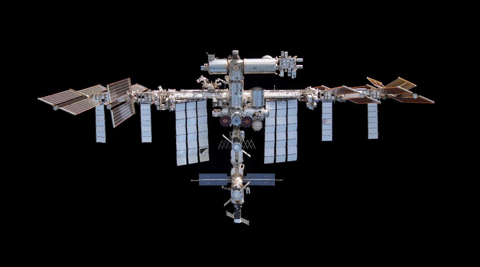
From the International Space Station’s unique position 250 miles above Earth, the Sun is a vital source of energy. Solar power supports the station’s life support systems, daily activities, and hundreds of research investigations that improve life on Earth and prepare humans for deep space exploration. Over the past five years, NASA augmented the station’s power generation and distribution capability with next-generation International Space Station Roll Out Solar Arrays (IROSAs).

An International Space Station Roll Out Solar Array deploys in 2022. 
NASA

In 2017, a technology demonstration conducted aboard the space station tested the effectiveness of the arrays. The lightweight, compact design launches as a cylinder and unfurls like a yoga mat after installation. This advanced design reduces mass and volume at launch and uses an autonomous, self-deploying system that minimizes risks during rollout.

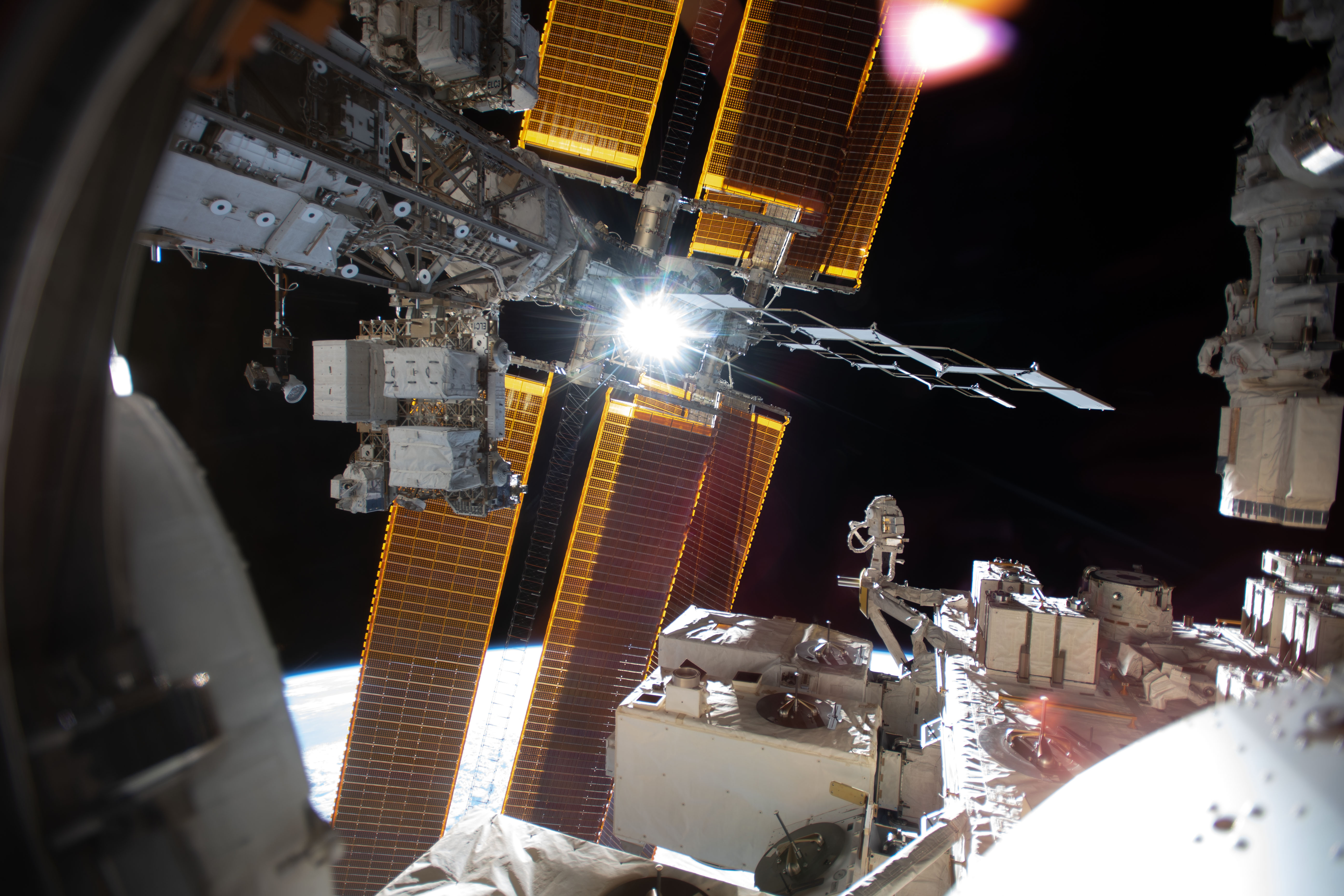
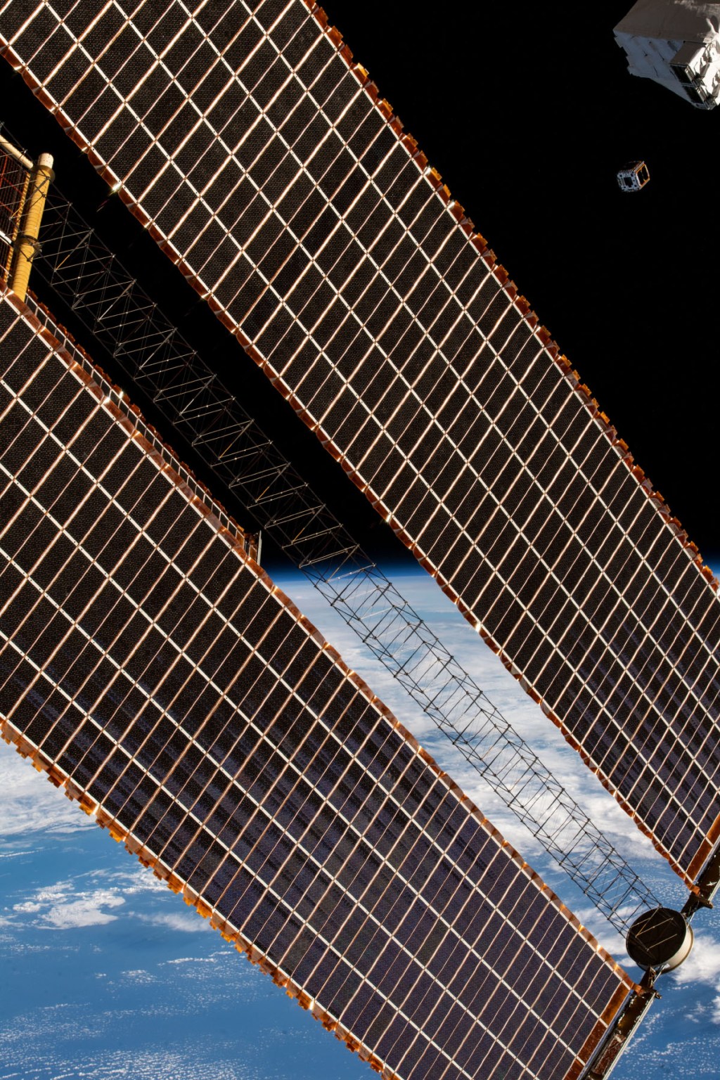
Illuminated solar arrays and structural trusses of the International Space Station are shown against the darkness of space, with sunlight flaring near the center of the frame and Earth’s curved horizon visible below.
Sunlight flares across the International Space Station’s solar arrays. 
NASA

The technology is also scalable to meet mission requirements. The IROSAs are about half the size of the station’s legacy arrays. Despite being smaller, the arrays are capable of producing about 28 kilowatts of additional power.

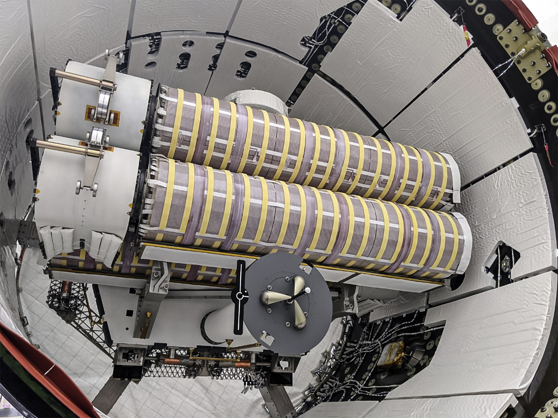
Two cylindrical Roll Out Solar Arrays wrapped in striped insulation are secured in the trunk of a SpaceX Dragon Cargo vehicle surrounded by structural supports and cables.
The first two International Space Station Roll Out Solar Arrays loaded in a SpaceX Dragon’s trunk before delivery to the orbiting laboratory during the company’s 22nd commercial resupply services mission for NASA in 2021.
SpaceX

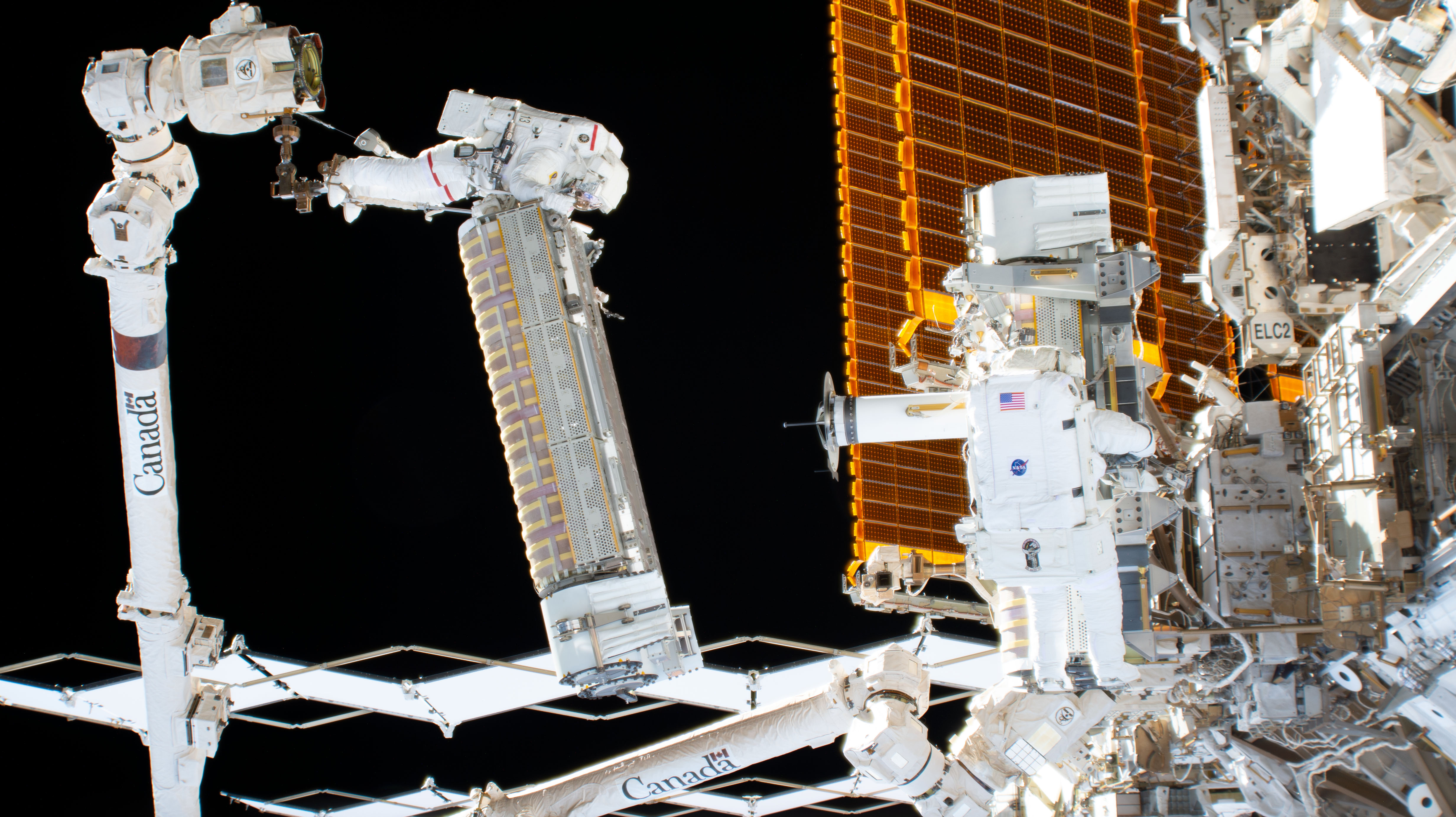
Six IROSAs were installed outside of the space station between 2021 and 2023. In 2023, power projections prompted a request for another set of IROSAs, which launched in Dragon spacecraft’s trunk during the SpaceX 35th commercial resupply services mission to space station for NASA. Together, the eight IROSAs will increase power by more than 160kW for research and operations.

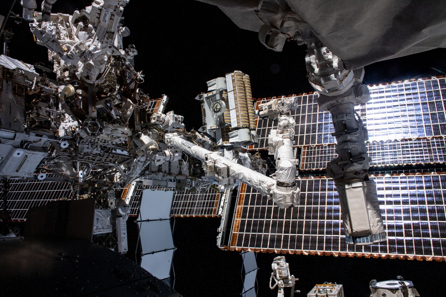
Two NASA astronauts in white spacesuits work outside the International Space Station, with one holding a rectangular hardware unit while robotic arms assist near the station’s orange solar arrays.
NASA astronauts perform a spacewalk to install an International Space Station Roll Out Solar Array with the assistance of the Canadarm2 robotic arm in 2022.
NASA

With the full upgrade in place, the space station’s revitalized power system not only supports NASA’s legacy in low Earth orbit but also helps advance technology that will extend the agency’s reach into the solar system. From planetary defense demonstrations, like the Double Asteroid Redirection Test, to future human exploration efforts, the space station is an essential testbed for the technologies needed for expeditions beyond Earth’s orbit.

Source: www.nasa.gov

NASA to Conduct Low-Altitude Flights Over Texas Farmland

A NASA Dynamic Aviation A200 aircraft will conduct low-flying research flights over farmland near Transit, Texas, from Thursday, Oct. 22, through Monday, Nov. 9. These flights will measure gaseous and particulate emissions from animal feeding operations.

A two engine aircraft sitting in front of a hangar.
A photo of the Dynamic Aviation A200 aircraft, which will conduct low-flying research flights over farmland near Transit, Texas, to measure emissions in October and November 2026.
Dynamic Aviation

Agricultural emissions represent an important and understudied part of Earth’s land and atmosphere systems. The FarmFlux mission will deploy more than a dozen sensors to measure ozone, methane, ammonia, particulates, and other pollutants rising from crop lands and livestock farms and their interaction with the Earth’s atmosphere. The mission is jointly led by NASA’s Goddard Space Flight Center in Greenbelt, Maryland; Colorado State University; and Boston University.

Additional low-altitude research flights with a NASA P-3 Orion aircraft are scheduled for the March to July 2027 growing season in the Midwest and California’s Central Valley with a focus on cropland.

For more information about the FarmFlux mission, visit:

https://science.nasa.gov/mission/evs-4/farm-flux/

By Sharon Teitelbaum

NASA’s Ames Research Center in California’s Silicon Valley

Source: www.nasa.gov

NASA Welcomes All Ages, Experience Levels for Space Apps Challenge

Registration is open for the 2026 NASA Space Apps Challenge, a two-day global event on Saturday, Nov. 14 and Sunday, Nov. 15, where teams work to create solutions inspired by NASA’s most ambitious exploration goals and making use of the agency’s free and open data. The annual challenge, often called a hackathon, is an intensive, collaborative problem-solving experience where participants tackle real-world challenges created by NASA subject matter experts.

This year’s Space Apps Challenge collectively supports three major focus areas: returning humans to the Moon, preparing for missions deeper into the solar system, and expanding understanding of the universe. Participants do not have to be programmers. Students, scientists, engineers, designers, storytellers, technologists, and space enthusiasts of all ages and experience levels can contribute their skills.

“At NASA, science is for everyone, and we’re inviting the next generation to help tackle some of humanity’s most critical challenges in space through the NASA Space Apps Challenge,” said Nicky Fox, associate administrator, Science Mission Directorate, NASA Headquarters in Washington. “Everything in NASA Science is interconnected, and this year, students from around the world can use NASA’s powerful data sets to help us build the ultimate interplanetary survival guide – supporting the science that will enable astronauts to thrive on the Moon and, eventually, Mars, while also inspiring ideas that improve everyday life on Earth and in space for the benefit of all.”

Supporting lunar exploration, Artemis planning

NASA continues to advance plans for a sustained human presence on the Moon through the Artemis program and Moon Base. Several of this year’s Space Apps challenges relate to analytical tools, operational considerations, and human‑system needs relevant to lunar missions. These include work related to surface operations at the Moon’s South Pole, the management of environmental constraints such as sunlight and communications windows, as well as approaches for evaluating the logistical and scientific demands of long‑duration lunar stays. Broader system‑level modeling challenges, such as those that simulate outpost operations or consider astronaut health and safety, mirror the complexity of planning for human activity on the lunar surface.

Strengthening readiness for Mars, deep space

NASA’s exploration strategy includes continued robotic exploration of the outer solar system and preparing for future human missions to Mars. Several challenges involve operational concepts for Martian surface activities, integrating data from multiple Mars missions, or reflecting the mission‑design trade‑offs required for deep‑space exploration. Others address fundamental concerns for long‑duration travel, such as monitoring physiological and behavioral health indicators, or examining how engineering and scientific choices shape mission execution in environments far from Earth.

Some of these challenges also align with NASA’s broader exploration portfolio, which includes ongoing work on future missions to destinations such as Jupiter’s moon Europa and Saturn’s moon Titan. By simulating mission‑design decisions or evaluating environmental analogs on Earth, certain challenges offer frameworks related to how NASA prepares for complex operational scenarios throughout the solar system.

Enhancing access to astrophysics

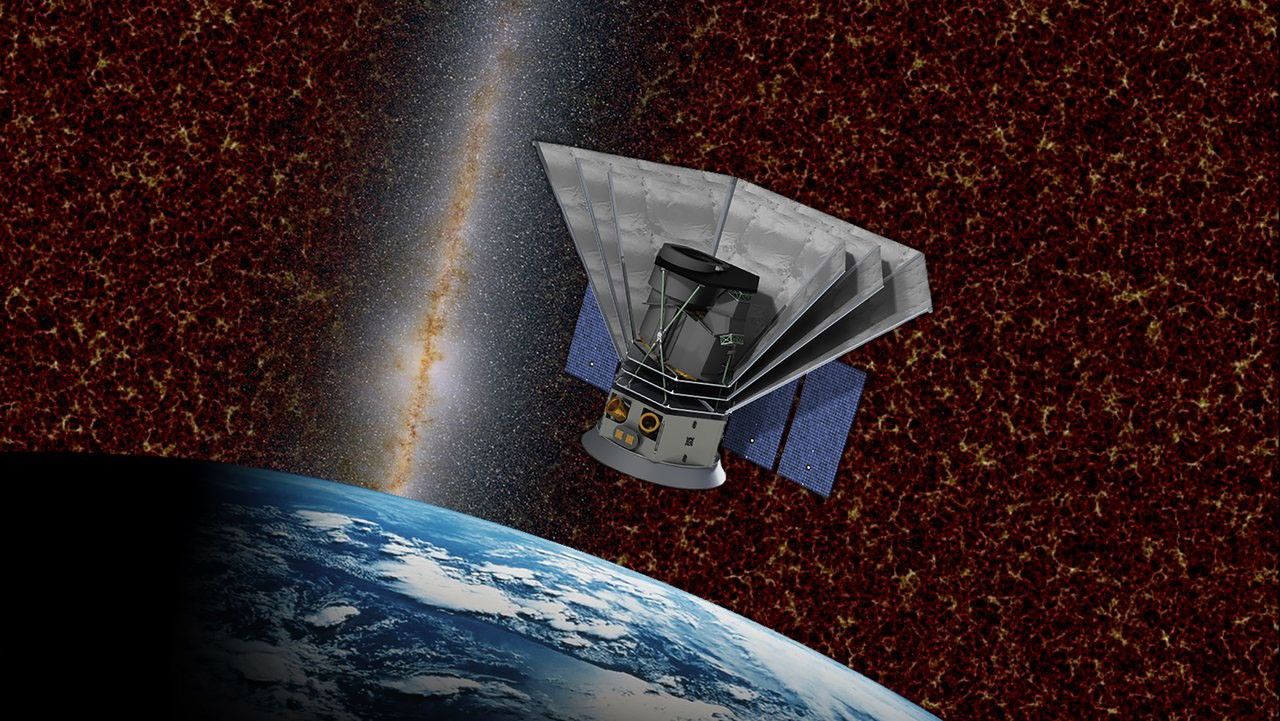
NASA’s astrophysics missions contribute to understanding the structure and history of the universe. In 2026, this includes active missions like Spectro-Photometer for the History of the Universe, Epoch of Reionization and Ices Explorer (SPHEREx), which is conducting a full‑sky spectral survey, as well as the continued development and deployment of observatories designed to investigate cosmic evolution and exoplanet, which are planets outside our solar system, populations.

Challenges associated with these efforts focus on improving public access to mission data, designing tools that help visualize changes in the sky over time, and supporting broader engagement with the scientific products derived from these missions.

Broader impact across NASA’s mission landscape

Together, these challenges illustrate how NASA’s open data ecosystem enables gold standard science, by freely offering such a wide breadth of information and research. By engaging with the Space Apps event, the entire nation can interact with the kind of real‑world needs defined by the agency.

Registration is available at the NASA Space Apps Challenge. Participants can join in one of 500+ local events, join a team, and select the challenge that they are most interested in addressing during the November hackathon.

Source: science.nasa.gov
NASA Awards Enable Research, Technology to Build Future Workforce

3 Min Read

NASA Awards Enable Research, Technology to Build Future Workforce

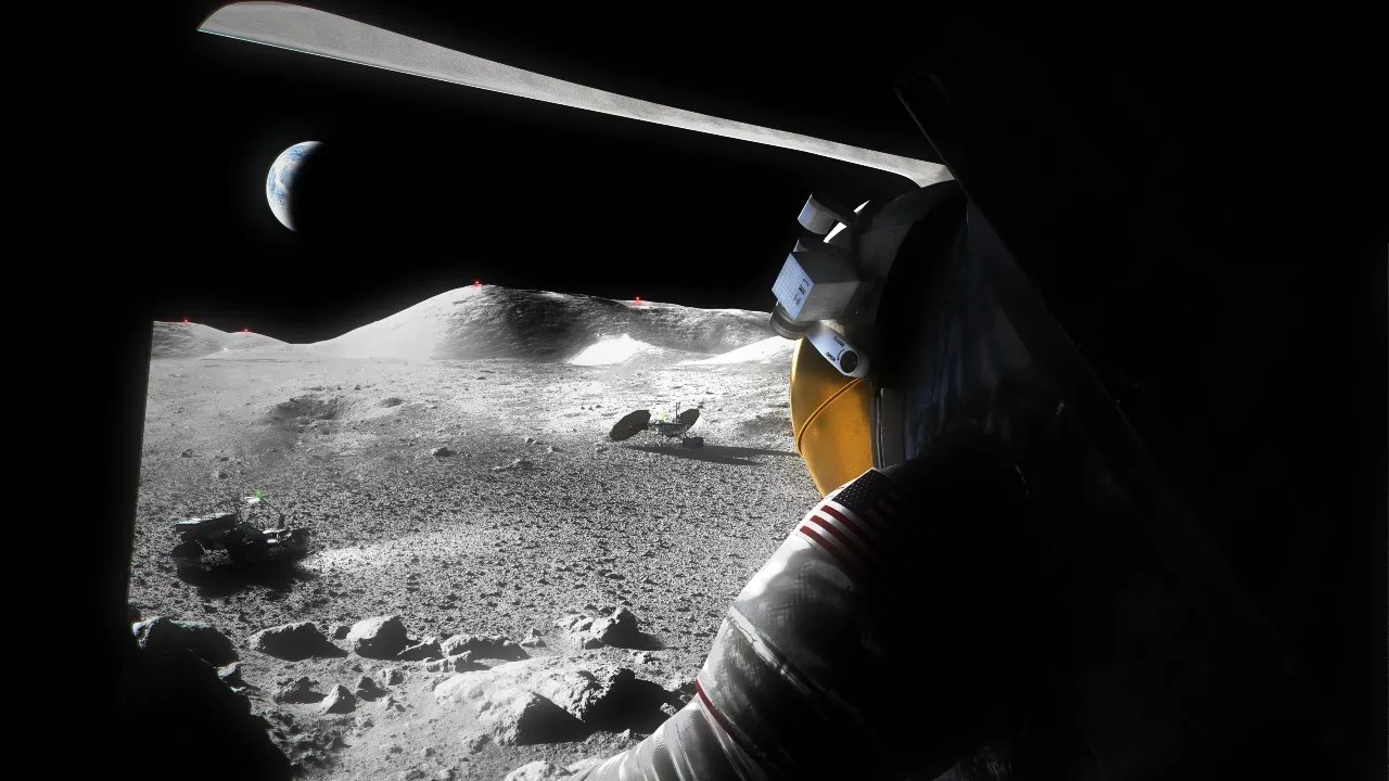
An illustration of a suited Artemis astronaut looking out of a Moon lander hatch across the lunar surface, the Lunar Terrain Vehicle and other surface elements.

An illustration of a suited Artemis astronaut looking out of a Moon lander hatch across the lunar surface, a Lunar Terrain Vehicle and other surface elements.

Credits:
NASA

NASA has selected 12 U.S. institutions to receive $12 million to accelerate academic research and technology development in support of the agency’s priorities for exploring the Moon, Mars, and deep space.

Through NASA’s Minority University Research and Education Project (MUREP) Space Technology Artemis Research (M‑STAR) initiative, selected institutions will each receive up to $1 million to grow their scientific and engineering capabilities, enhance faculty and student engagement in aerospace research, and expand their ability to compete for future federal and commercial research awards.

“We are excited to launch this new cohort of M-STAR investigators,” said Alicia Baturoni Cortez, MUREP program manager in the agency’s Office of STEM Engagement. “NASA investments in our Nation’s research institutions create real opportunities for students and faculty to build skills, knowledge, and infrastructure, while helping NASA close technology gaps for long-duration operations on the Moon and eventually, Mars.”

As NASA enters a Golden Age of innovation and exploration, the M-STAR initiative supports the agency’s mission to develop innovative technologies that improve space transportation, human exploration, robotic discovery, and the growing space economy.

The awardees and their projects are as follows:

California State University, Sacramento
Adaptive Vision-Language-Action Models for Resilient Multi-Robot Collaboration in Unstructured Planetary Environments

University of Central Florida, Orlando
M-FAST: Multi-Fidelity Aerothermal Simulation & Testing for Artemis

University of Hawaii at Manoa
HI-STRIDE: Hawai’i Student Training in Radiation Instrumentation, Detection, and Exploration

University of Houston
RODEO: Rover-carried On-surface Deployables for Exploration Operations

University of Texas, San Antonio
Characterizing Physical and Mechanical Properties of Regolith at Cryogenic Conditions Using the Multi-Planetary Surface Simulator (MPS2)

Kean University, Union, New Jersey
Integrating Terrain Understanding of AI Models With Robust Control for Autonomous Path Planning

Virginia Commonwealth University, Richmond
BNNT-Reinforced Multifunctional Composites for Radiation-Tolerant, Hydrogen-Compatible Nuclear Thermal Propulsion (NTP) Secondary Hardware

Shaw University, Raleigh, North Carolina
Project ARES (Advanced Regenerative Environmental Systems): A Materials-by-Design Research and Workforce Development Platform for Environmental Control and Surface Infrastructure

Howard University, Washington
LumSHRS: Lunar monolithic Spatial Heterodyne Raman Spectrometer for Minirover In-Situ and Standoff Remote Sensing

Prairie View A&M University, Prairie View, Texas
Functionally Graded Interfaces for Directed-Energy-Deposition Repair of Copper-to-Superalloy Propulsion Hardware: An Integrated AI/ML Design-to-Validation Research Capability at Prairie View A&M University

University of New Mexico, Albuquerque
POWER-Artemis: Extreme-Environment Batteries and Fuel Cells for Sustained Moon and Mars Operations

Fayetteville State University, North Carolina
From Documents to Models: Method-Compliant Generative AI for Bootstrapping Model-Based Systems Engineering in NASA’s Artemis Enterprise (Doc2Model)

NASA’s Office of STEM Engagement fosters an ecosystem across education, industry, and government to cultivate a well‑prepared talent pool, while the agency’s Research and Technology Mission Directorate develops the transformative space technologies that enable future NASA missions and ensure U.S. leadership in aerospace. Together, they accelerate mission readiness by aligning cutting edge technological innovation with the workforce needed to carry it forward.

Source: www.nasa.gov