Map Showing Potential Origins of Martian Meteorite Teghaza 001

1 Min Read

Map Showing Potential Origins of Martian Meteorite Teghaza 001

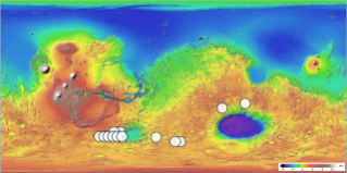
A colorful topographic map of Mars displaying planetary elevations from low blue basins to high red volcanic plateaus, marked with white circular dots across the southern hemisphere.

PIA26802

Credits:
NASA/JPL-Caltech/USGS

Description

This global map of Mars shows 13 locations that match the mineralogy and chemistry of Teghaza 001, one of the most ancient Martian meteorites ever found on Earth. While scientists can never know for sure where a Martian meteorite originated, Teghaza 001 includes clues that link it to highlands in the southern hemisphere of the Red Planet.

The base map of this image was produced with data from the Mars Orbiter Laser Altimeter instrument aboard NASA’s Mars Global Surveyor mission. Scientists used data from NASA’s Mars Reconnaissance Orbiter to identify areas of the map (noted with white circles) that have similar mineralogy and chemistry as Teghaza 001.

Source: science.nasa.gov

Vega Island Frozen in Fright


March 22, 2025
October 10, 2026

Part of an ice-covered Antarctic island has the appearance of a grinning skull in profile, with a rock outcrop as an eye socket and lateral moraine as a mouth.
NASA Earth Observatory / Lauren Dauphin

Part of an ice-covered Antarctic island has the appearance of a grinning skull in profile. Some of the face has a gray appearance where seasonal snow is gone and bare ice is exposed.
NASA Earth Observatory / Lauren Dauphin


March 22, 2025

October 10, 2026


Shrouded in ice in the lonely Weddell Sea, Vega Island is an eerie sight to behold. On this speck of land east of the Antarctic Peninsula, ice, rock outcrops, and glacial moraines combine to create the appearance of a smirking skull in profile looking toward Devil Island.

These images show Vega Island’s creepy countenance at the start of austral autumn (left) and in spring (right). They were acquired with the OLI (Operational Land Imager) on Landsat 9 on March 22, 2025, and October 10, 2026, respectively. (Clouds obscured the island in March 2026.) A nunatak jutting out of the ice has the appearance of an eye socket, a lateral moraine forms a mouth, and Bahía del Diablo (Devil’s Bay) Glacier constitutes a jawbone. In the March 2025 image, a layer of snow coats the ice, which is typical of the region’s wettest month. That contrasts with the October 2026 image, when snow is absent from large areas and darker ice surfaces are visible.

Above-average temperatures in winter 2026—particularly in June—were partly responsible for so much bare ice in October, said glaciologist Mauri Pelto of Nichols College. The ice exposed on Vega and nearby islands indicates limited new snow accumulation over the winter, further reduced by sublimation and wind scouring, he said. “The winter season was no treat for these glaciers.”

The melt season ahead may also be more trick than treat. Bare ice is darker than snow and absorbs more solar energy, meaning that melting is poised to speed up as the days grow longer and warmer. “Even a thin cover of new snow from a spring storm would be helpful in the short run,” Pelto said. “When entombed in snow and ice, the skull is preserved. But when exposed to melt, it weathers away, which will lead to a changing jawline and expanding eye socket.”

Part of an ice-covered Antarctic island has the appearance of a grinning skull in profile. Some of the face has a gray appearance where seasonal snow is gone and bare ice is exposed.
October 10, 2026
NASA Earth Observatory/Lauren Dauphin

The first comprehensive mapping of Vega Island’s ice was aided by Landsat imagery. In a study published in 1982, scientists described the island’s four ice caps with protruding rocky cliffs and outlet glaciers. They leveraged early Landsat observations along with aerial photos and topographic maps to catalog 29 glaciers on Vega.

Of those glaciers, Devil’s Bay Glacier has been closely monitored since the austral summer of 1998-1999, with researchers measuring an overall decline in its mass. Satellite images acquired in recent decades show ice loss from other glaciers on the island as well, with increased areas of exposed bedrock.

Long before scientists began tracking its glaciers, Vega was a bright spot in a tale of terror born out of early exploration of the area. The Swedish Antarctic Expedition of 1901-1903 set out to study the geography, geology, climate, and wildlife on and around the eastern Antarctic Peninsula. The party became split into three groups during their explorations, isolated for a winter in different locations. Adding to the horror, they lost their ship to the pack ice. Cape Well-met, as it would come to be known, off the “forehead” of the Vega Island skull, was the site of a happy reunion of two of the groups in spring 1903. Soon thereafter, an Argentinean expedition rescued the survivors of the ordeal.

NASA Earth Observatory images by Lauren Dauphin, using Landsat data from the U.S. Geological Survey. Story by Lindsey Doermann.

References & Resources

You may also be interested in:

Stay up-to-date with the latest content from NASA as we explore the universe and discover more about our home planet.

Ice Island Survives Run-In With Joe Island

5 min read

In summer 2026, a substantial iceberg calved from Petermann Glacier in northwest Greenland and swiftly drifted into Nares Strait, colliding…

Article

A Bare Summer for Barnes Ice Cap

4 min read

The expanse of glacial ice on Canada’s Baffin Island lost its snow cover quickly and early in summer 2026, revealing…

Article

Pasterze Hangs on as Austria’s Largest Glacier

4 min read

One narrowing icefall remains the linchpin for the Alpine glacier—and it may not be long for this world.

Article

Source: science.nasa.gov

APOD: 2026 October 30 – Haunting the Cepheus Flare

APOD

Astronomy Picture of the Day

Discover the cosmos! Each day a different image or photograph of our fascinating universe is featured, along with a brief explanation written by a professional astronomer.

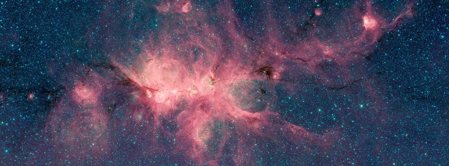
Interstellar dust clouds and dark nebulae in the Cepheus molecular cloud.

Haunting the Cepheus Flare

Explanation: Spooky shapes seem to haunt this dusty expanse, drifting through the night in the royal constellation Cepheus. Of course, the shapes are cosmic dust clouds visible in dimly reflected starlight. Far from your own neighborhood, they lurk above the plane of the Milky Way at the edge of the Cepheus Flare molecular cloud complex some 1,200 light-years away. Over 2 light-years across and brighter than most of the other ghostly apparitions, vdB 141 or Sh2-136 is also known as the Ghost Nebula. It lies at lower right in the starry field of view. Inside the Ghost Nebula are reddish telltale signs of dense cores collapsing in the early stages of star formation. With the eerie hue of interstellar dust reflecting bluish light from hot young stars of NGC 7023, the Iris Nebula stands out against the dark just left of center. In the broad telescopic frame, these fertile interstellar dust fields stretch almost six full moons across the sky.

Tomorrow’s picture: night on a spooky planet

Date October 30, 2026
Credit & Copyright: Mirko Tondinelli
Authors & editors: Jerry Bonnell, Cecilia Chirenti, Robert Nemiroff, Keighley Rockcliffe
A service of: ASD at NASA / GSFC,
NASA Science Activation & Michigan Tech. U.

Source: science.nasa.gov

NASA Explores Potential Commercial Servicing for Hubble Telescope

Hubble orbiting above earth
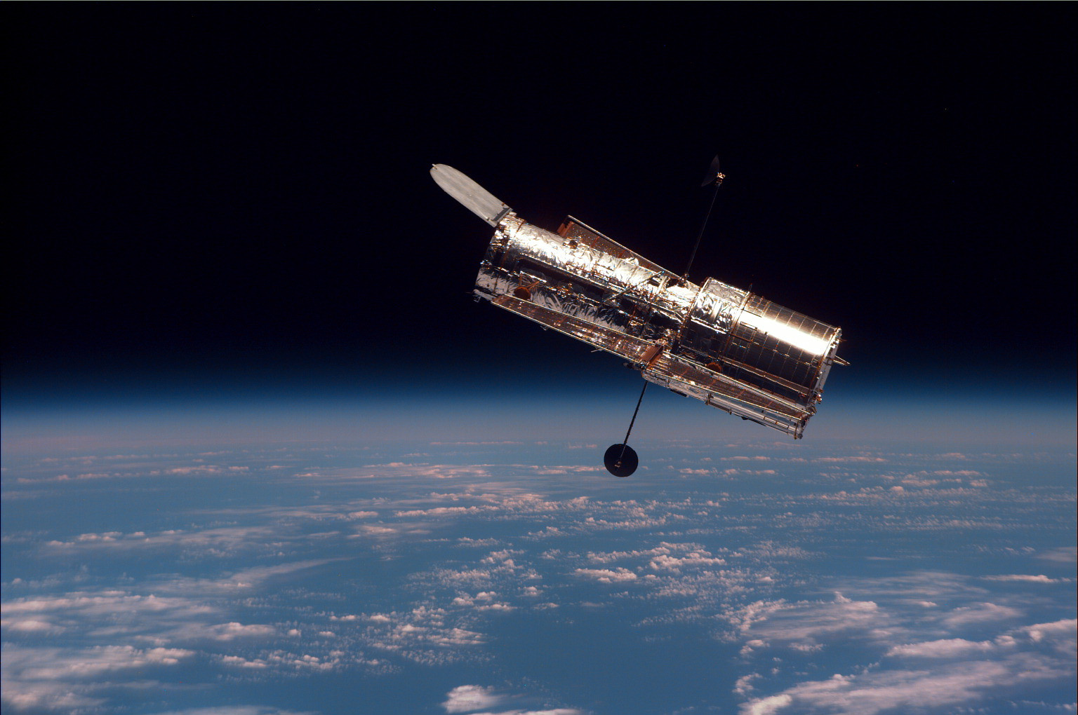
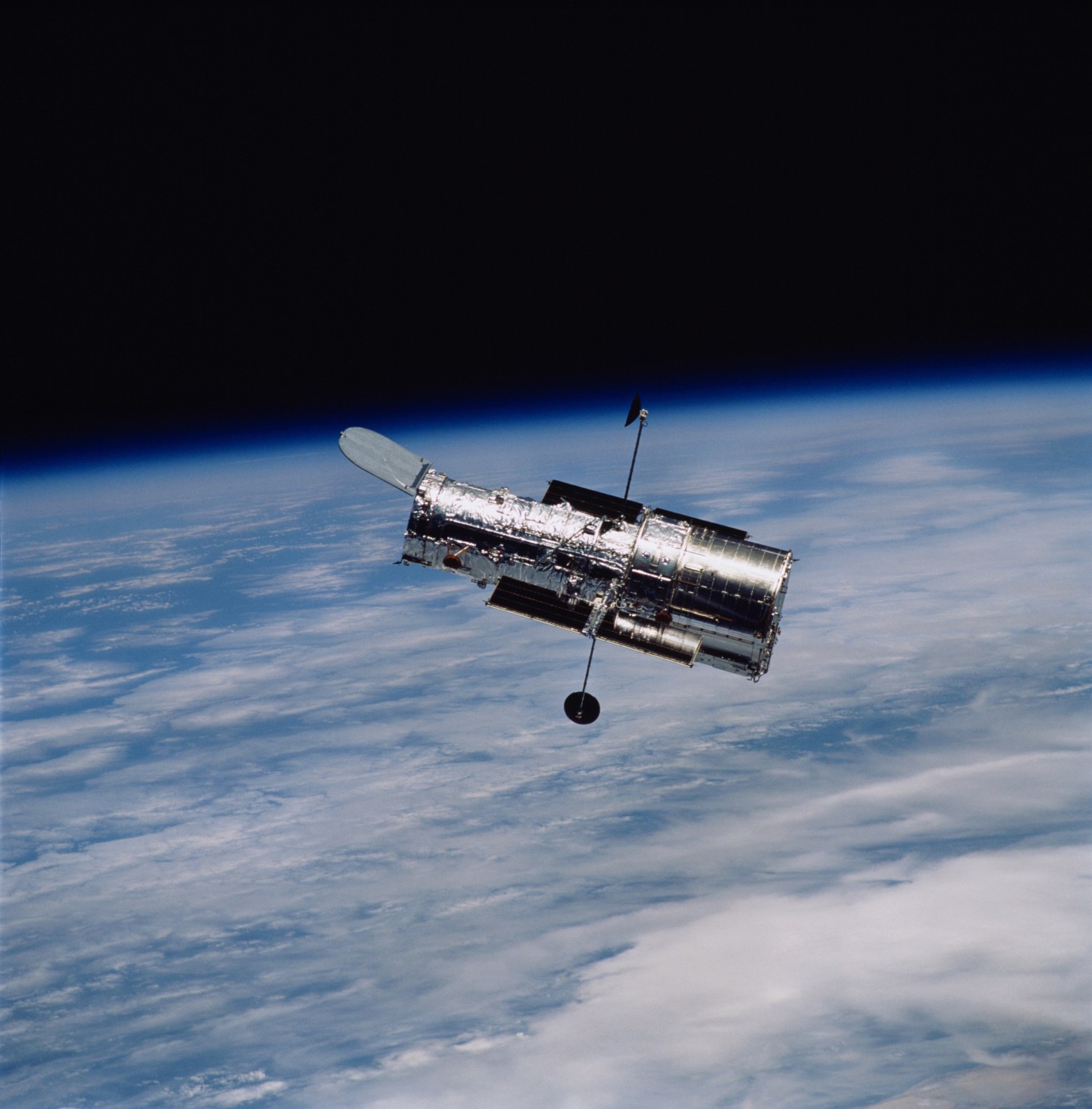
The Hubble Space Telescope returns to orbit as an improved telescope after its second servicing mission in February 1997.
NASA

NASA issued a Request for Information Oct. 29 to learn more about industry capabilities for in-space servicing to support the agency’s Hubble Space Telescope.

“Hubble still has important science ahead of it, and we should be looking at every reasonable opportunity to keep it delivering for as long as possible,” said NASA Administrator Jared Isaacman. “If there are innovative and cost-effective ways to extend the life of an asset already on orbit, we owe it to the American taxpayer and the scientific community to explore them. Extending Hubble’s life would mean more discoveries, more science, and more opportunities to expand our understanding of the universe.”

The Request for Information seeks commercial interest in: potentially conducting a mission to boost Hubble to a higher altitude to extend its science lifetime; servicing Hubble to enhance its capabilities; or performing a safe, controlled re-entry into Earth’s atmosphere or orbital disposal at the end of Hubble’s mission.

“Hubble is a national icon that has fundamentally changed how humanity views our universe for more than 35 years,” said Nicky Fox, associate administrator, Science Mission Directorate, NASA Headquarters in Washington. “Commercial industry has rapidly evolved in recent years to offer new capabilities for in-space satellite capture and servicing. Given the time we have until Hubble’s anticipated re-entry, we are eager to explore the breadth of possibilities to boost Hubble to a higher orbit while we develop the flagship mission to follow.”

The Request for Information is available online and will remain open for responses until 3 p.m. EST, Monday, Nov. 30.

Like all spacecraft in low Earth orbit, Hubble’s altitude is slowly decreasing over time because of atmospheric drag. Hubble does not have a propulsion system to maintain its own orbit, and analysis predicts Hubble is likely to re-enter the atmosphere in the 2033 to 2034 timeframe. As such, NASA anticipates that a mission would need to take place by 2032.

The Hubble Space Telescope has been operating for more than three decades and continues to make ground-breaking discoveries that shape our fundamental understanding of the universe. Hubble is a project of international cooperation between NASA and ESA (European Space Agency). NASA’s Goddard Space Flight Center in Greenbelt, Maryland, manages the telescope and mission operations. Lockheed Martin Space, based in Denver, also supports mission operations at Goddard. The Space Telescope Science Institute in Baltimore, which is operated by the Association of Universities for Research in Astronomy, conducts Hubble science operations for NASA.

To learn more about NASA’s Hubble Space Telescope, visit:

https://www.nasa.gov/hubble

Media Contacts:

Alise Fisher
Headquarters, Washington
202-358-2546
[email protected]

Claire Andreoli
Goddard Space Flight Center, Greenbelt, Md.
202-286-1940
[email protected]

Source: science.nasa.gov

NASA’s James Webb Space Telescope Captures Eerie Cat’s Head

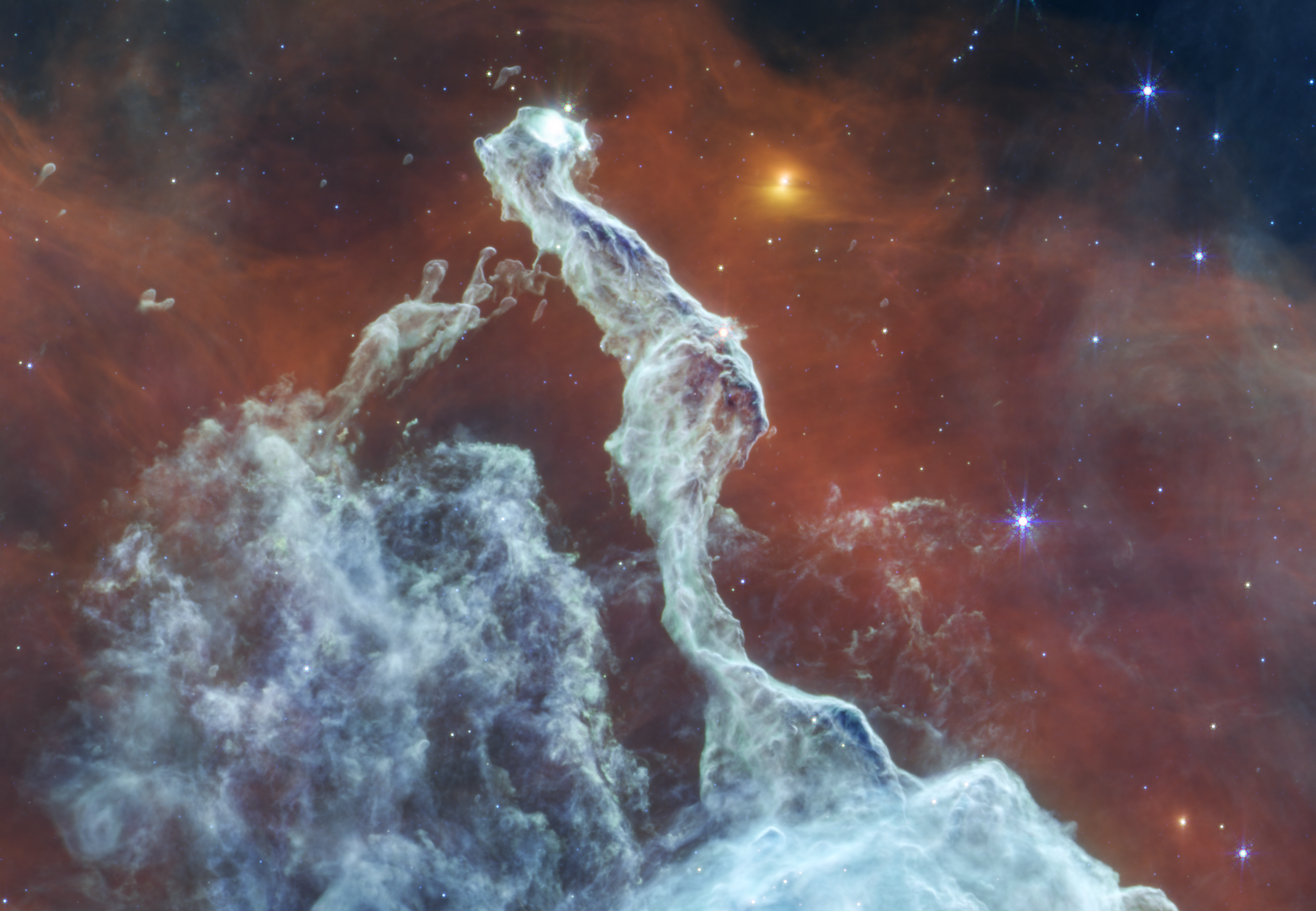
Mid-infrared image of the Cat’s Head Nebula by the James Webb Space Telescope. A bluish-gray filament of dust is in the center, stretching from the bottom to almost the very top. It has a narrow, irregular shape that resembles a cat sitting with its back toward the viewer and a tail extending downward. The tail ends at the lower one-third of the image and widens to a triangular peak of dust. The cat’s head is turned toward the right, revealing a white glowing eye. The background is mostly red, with the top left and right corners revealing the black background of space. On the cat’s left is a dome-shaped grouping of faint filaments of dust. Scattered throughout the view are yellow and blue stars, some with Webb’s signature eight-point diffraction spikes.
NASA, ESA, CSA, STScI; Image Processing: Joseph DePasquale (STScI)

Intricate structures within the Cat’s Head Nebula are illuminated in this mid-infrared view from NASA’s James Webb Space Telescope released on Oct. 29, 2026. The distinctive “cat’s head” shape of the nebula was likely sculpted over time by the intense ultraviolet radiation and winds from massive stars in the Carina Nebula. As this stellar feedback erodes the surrounding gas and dust, denser material within the feline-shaped pillar resists erosion, at least for now.

Image credit: NASA, ESA, CSA, STScI; Image Processing: Joseph DePasquale (STScI)

Source: www.nasa.gov

NASA Releases MAX POWER Key Events for Media, Participants

Looking up, three white and black fighter jets fly in formation across a bright, blue sky.
NASA’s Freedom 250 F-5 team, including NASA Administrator Jared Isaacman, performs a flyover during the national anthem at an NFL game between the Cleveland Browns and the Carolina Panthers at Huntington Bank Field, Sept. 27, 2026, in Cleveland.
Credit: NASA/Jordan Cochran

America’s newest aerospace expo and air show – MAX POWER – is fast approaching, and NASA has announced key events beginning Friday, Nov. 6, and running through Sunday, Nov. 8, hosted on and near the agency’s Kennedy Space Center in Florida.

Through multiple park experiences at MAX POWER, NASA and a variety of external collaborators will showcase the newest aircraft, autonomous vehicles, technologies, and more defining the future of air and space. NASA will display its quiet supersonic X-59 plane, and agency partners will showcase Moon rovers, spacecraft, and more. The expo also is a culmination of the agency’s recent Inspiration Tour, which included numerous flyovers to highlight NASA’s fleet of aircraft.

A current schedule of events is available on the agency’s website.

MAX POWER includes opportunities to meet leadership, astronauts, engineers, scientists, and other subject matter experts during the family-friendly public events with gates opening at 9 a.m. EST on Nov. 7 and Nov. 8.

NASA also will share multiple news updates during the weekend, including hosting a news conference at 5 p.m. on Nov. 7, to provide its latest Moon Base update. Located near the lunar South Pole, the Moon Base is humanity’s first outpost for long-term lunar exploration.

Live coverage of the news conference will stream on a variety of platforms online. Learn where to watch:

https://www.nasa.gov/live

Join NASA for Key Events

Media credentialing for this event is closed. Media approved for this event must request interviews in advance. Space in the news conference is limited, and first come, first served. Media also may participate in the news conference virtually. To request call details or an interview, please contact Lauren Low in the NASA Headquarters newsroom at: [email protected].

A short list of key NASA activities during MAX POWER are listed below. All times are listed in Eastern standard time, and are subject to change.

Friday, Nov. 6:

  • 2 p.m., to 4 p.m.: Media one-on-one opportunities to preview weekend MAX POWER activities
    • Location: NASA Press Site

Saturday, Nov. 7:

  • 10 a.m.: Nuclear NASA media gaggle
    • Location: UP.Summit Main Stage
    • Cynthia Simmons, director, Space Reactors Division
  • 11:30 a.m.: Opening air show remarks featuring NASA Deputy Administrator Matt Anderson
    • Location: Air Dot Show Main Stage
  • 11:58 a.m.: F-5 flyover in the Air Dot Show featuring NASA Administrator Jared Isaacman
  • 12:45 p.m.: Meet the Astronauts: NASA’s Artemis III Crew
    • Location: Air Dot Show Main Stage
    • Participants include:
      • NASA astronaut Randy Bresnik (mission commander)
      • ESA (European Space Agency) astronaut Luca Parmitano (pilot)
      • NASA astronaut Frank Rubio (mission specialist)
      • NASA astronaut Bob Hines, backup crew member
    • NASA will host a media gaggle with crew immediately following this event.
  • 1:31 p.m.: MiG-29 flyover featuring Isaacman
  • 2 p.m.: Learn about NASA’s Roman Space Telescope
    • Location: Kennedy Space Center Visitor Complex (Journey to Mars Theater)
    • Participant:
      • Remarks by Julie McEnery
  • 5 p.m. Moon Base News Conference
    • Location: Press Site Auditorium
    • Participants:
      • NASA Administrator Jared Isaacman
      • Carlos García-Galán, director, Moon Base
      • Nicky Fox, associate administrator for Science, NASA Headquarters
      • Dayna Ise, director, Utility and Infrastructure, Moon Base Program
    • NASA subject matter experts will be available for one-on-one interviews following this announcement.

Sunday, Nov. 8:

  • 9 a.m. NASA’s X-59 media gaggle
    • Location: UP.Summit Exhibit Area
    • Participants:
      • Laurie Grindle, director, NASA Aeronautics Division
      • Peter Coen, NASA Quesst mission manager, NASA Langley
      • Jim “Clue” Less, test pilot, X-59, NASA Armstrong
  • 10 a.m.: Student challenge announcement
    • Location: Kennedy Space Center Visitor Complex, Rocket Garden
    • Participants:
      • NASA Administrator Jared Isaacman
      • Carlos García-Galán, director, Moon Base Program
    • NASA experts may be available for interviews at this location. Media interested in attending must contact Lauren Low by 5 p.m. on Thursday, Nov. 5, at: [email protected].
  • 11:58 a.m.: F-5 flyover in the Air Dot Show featuring Isaacman
  • 12:45 p.m.: United States Space Academy
    • Location: UP.Summit Main Stage
    • NASA Deputy Administrator Matt Anderson
  • 12:45 p.m.: Meet the Astronauts: NASA’s SpaceX Crew-12
    • Location: Air Dot Show Main Stage
    • Participants:
      • NASA astronaut Jessica Meir
      • NASA astronaut Jack Hathaway
  • 1:31 p.m.: MiG-29 flyover featuring Isaacman

For more information about MAX POWER, including the latest schedule of events and how to attend, visit the agency’s website:

https://www.nasa.gov/maxpower

-end-

George Alderman / Cheryl Warner
Headquarters, Washington
202-358-1600
[email protected] / [email protected]

Source: www.nasa.gov

Slice of Martian Meteorite Teghaza 001

1 Min Read

Slice of Martian Meteorite Teghaza 001

A microscopic cross-section of a rock specimen set against a black background, displaying a heavily fractured, mosaic-like mineral texture in shades of gray and black with a 1-millimeter scale bar in the top-left corner.

PIA26801

Credits:
NASA/JPL-Caltech

Description

This slice of Teghaza 001, one of the most ancient Martian meteorites ever found on Earth, was used to determine the age of the rock. Reflected light images like these serve as a scientist’s road map, helping them find minerals of interest to analyze by different instruments.

A microscopic cross-section of a rock specimen set against a black background, displaying a heavily fractured, mosaic-like mineral texture in shades of gray and black with a 1-millimeter scale bar in the top-left corner.
Figure A

Figure A is the same image with annotations showing minerals like iron-titanium oxides (brighter grains) and pyroxene (medium gray), both of which tell a story about the formation of Mars’ crust and mantle. Shocked plagioclase (darker gray) is created by extreme pressures during impacts, including the one that sent Teghaza 001 flying through space to Earth. The alteration represents fine grain carbonate, sulfate and clay minerals formed on Earth.

Source: science.nasa.gov

November’s Night Sky Notes: Light-Day Away

2 min read

November’s Night Sky Notes: Light-Day Away

A fleet of spacecraft zoom across Jupiter and Saturn is this futuristic take on racing posters.
NASA’s Voyager mission took advantage of a once-every-175-year alignment of the outer planets for a grand tour of the solar system. The twin spacecraft revealed details about Jupiter, Saturn, Uranus and Neptune – using each planet’s gravity to send them on to the next destination. Voyager set the stage for such ambitious orbiter missions as Galileo to Jupiter and Cassini to Saturn. Today both Voyager spacecraft continue to return valuable science from the far reaches of our solar system.
NASA/JPL-Caltech

Twin Travelers

In 1977, NASA launched twin spacecraft Voyager 1 and 2, taking advantage of a once-every-175-year planetary alignment of the four largest planets in our solar system: Jupiter, Saturn, Uranus, and Neptune. Using six gravity assists between them, this Grand Tour gave us up-close views of the gas and ice giants, including several moons. By the 1980s, the two probes went their separate ways at Saturn. As Voyager 2 continued toward Uranus and Neptune, Voyager 1 grabbed one more portrait of the solar system (excluding Mercury and Mars), including a final image of the pale blue dot we call home.

A round gold plate featuring diagrams that explain how to play a phonograph record and the location of Earth.
The Golden Record Cover
NASA/JPL-Caltech

Playlist

“Hello from the children of planet Earth.”

Every good road trip needs some music to match. In this case, each craft carries the Golden Record, a 12-inch phonograph record with spoken greetings in 55 languages, 27 musical tracks, 116 images, and other sounds from Earth. Each record is protected by an outer cover featuring etchings showing our Sun’s location relative to 14 pulsars, along with instructions on how to play it. The design used various metals to protect the information encoded from space radiation: the record used copper and gold plating, and the cover used aluminum. The cover was electroplated with an ultra-pure sample of the isotope uranium-238. Uranium-238 has a half-life of 4.468 billion years.

Are We There Yet?

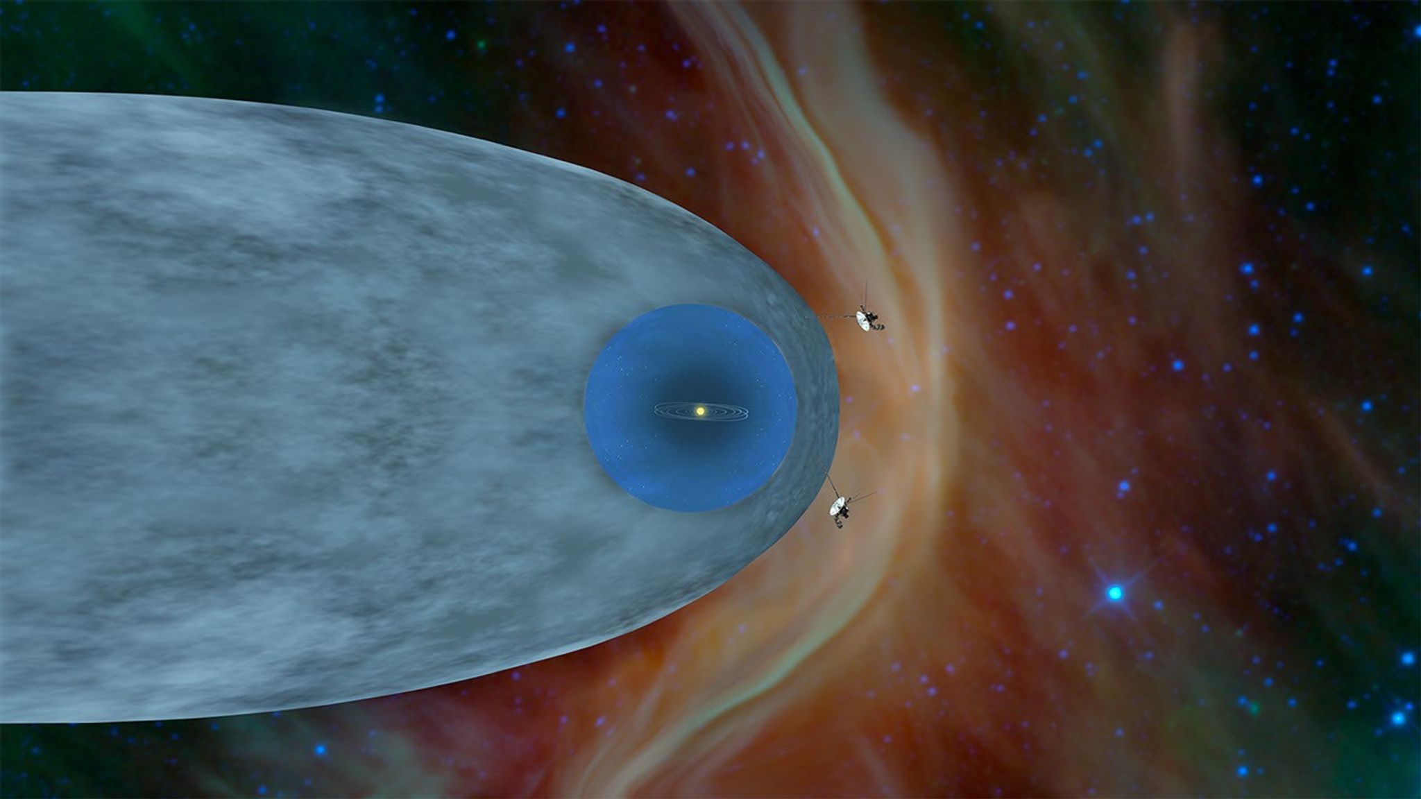
Did you know that a light-minute is a measure of distance, not time? In August 2012 and November 2018, Voyager 1 and 2 crossed the heliopause, the boundary where the Sun’s solar wind meets the interstellar medium. Using NASA’s Deep Space Network, Earth communicates with both spacecraft and tracks each on its journey. At the time of this article, the Canberra antenna tracked Voyager 1 at 25.80 billion km, or just over 16 billion miles.

This graphic shows the position of NASA's Voyager 1 and Voyager 2 probes, outside of the heliosphere, a protective bubble created by the Sun that extends well past the orbit of Pluto.
This graphic shows the position of NASA’s Voyager 1 and Voyager 2 probes, outside of the heliosphere, a protective bubble created by the Sun that extends well past the orbit of Pluto.
NASA/JPL-Caltech

On November 18, 2026, 49 years after its launch, Voyager 1 will cross the one-light-day mark, 16.1 billion miles from the Sun. You may have heard the term light-year in your favorite sci-fi movie or show, or when stargazing and referring to an object outside of our solar system. This video best demonstrates the different distances between the inner solar system, outer solar system, and beyond, using light measurements. Additionally, track each Voyager spacecraft here.

You can get a real understanding of what a gravity assist might be like with our Gravity Assist activity and learn what it’s like to measure a “light minute” with our Measuring a Kid Minute activity guide!

Source: science.nasa.gov