NASA Selects Blue Origin as Mars Telecommunications Network Provider

NASA insignia.
Credit: NASA

NASA awarded Blue Origin a contract Tuesday to develop the agency’s Mars Telecommunications Network, a next-generation communications system that will enable reliable, high-bandwidth communications and navigation services for current and future Mars missions.

The firm-fixed-price contract has a maximum potential value of approximately $700 million to deliver a high-performance Mars telecommunications orbiter to NASA no later than Dec. 31, 2028.

Blue Origin will design, develop, integrate, launch, and operate the network as a part of the agency’s broader space communications and navigation infrastructure. The architecture will consist of a high-performance telecommunications spacecraft orbiting Mars, transmitting science data, imagery, navigation information, and critical mission communications for spacecraft operating on and around the planet.

The award marks a milestone in NASA’s strategy to expand communications and navigation services beyond Earth and the Moon, establishing the foundation for sustained exploration of Mars in the coming decades.

Under the Artemis program, NASA is sending astronauts to explore the Moon and prepare for missions to Mars. Robotic missions will pave the way for human exploration of the Red Planet, and as these missions expand, demand for data will continue to increase. To meet this need, NASA is pursuing a purpose-built network capable of supporting a growing number of missions while providing greater capacity, reliability, and operational flexibility.

The selection follows NASA’s request for proposal issued in May. As the agency increasingly taps commercial partners for transportation and communications services in Earth orbit and to develop the Moon Base, the Mars Telecommunications Network initiative similarly seeks to harness private-sector capabilities while enabling NASA to focus on exploration and scientific discovery.

The network, managed by NASA’s Space Communications and Navigation program, is expected to be operational at Mars by 2030 and will support both current and future missions to the Red Planet, as NASA ventures deeper into space.

For more information about NASA’s space communications efforts, visit:

https://www.nasa.gov/communicating-with-missions

-end-

Rob Margetta
Headquarters, Washington
202-358-0918
[email protected]

Rob Garner
Goddard Space Flight Center, Greenbelt, Md.
301-286-5687
[email protected]

Source: www.nasa.gov

NASA Rocket Takes First Multi-Point Look Inside Radio-Disrupting Clouds

High above Earth, thin veils of metallic haze drift through the edge of space. Known as sporadic E layers, these high-altitude “clouds” form from the vaporized dust of burnt-up meteors, earning their name from the unpredictable way they emerge and then dissipate. Now, new results from a NASA sounding rocket — a suborbital research rocket — that flew five detectors through one of these layers simultaneously reveal unexpected complexity in the layer for the first time.

Though invisible to the eye, sporadic E layers make their presence known to the radio signals we rely on for long-distance communication. When present, sporadic E can send those signals ping-ponging off in unexpected directions, rendering the technology temporarily unreliable.

Scientists have long sought a fuller understanding of these radio-disrupting clouds, but until recently, they had only sampled them one narrow slice at a time. The rocket, called the sporadic E Electrodynamics Demonstration, or SpEED Demon for short, launched from NASA’s Wallops Flight Facility in Virginia on Aug. 24, 2022, and demonstrated the first concurrent, multi-point view inside sporadic E.  Its results, from a team led by Embry-Riddle Aeronautical University, are described in a new study in the Journal of Geophysical Research: Space Physics.

Sporadic E layers form in the ionosphere, a region of the upper atmosphere beginning around 40 miles (60 kilometers) up where the neutral gases begin to transform into plasma, or ionized gas. Some of the particles there come from meteors, which burn up and leave behind traces of iron, magnesium, and other metals. These metals occasionally clump into dense, cloud-like sheets — the sporadic E layers — that reflect radio waves.

Digital illustration of a curved Earth with green land and blue clouds representing sporadic E layers. Two communication towers stand on the surface, sending and receiving zig-zagging magenta beams of radio signals against a starry, glowing dark blue nebula sky. Two labels appear, sporadic e layers (on the clouds) and ionosphere, above the clouds, representing the intended target of the radio beams.
An animated illustration depicts Sporadic-E layers forming in the lower portions of the ionosphere, causing radio signals to reflect back to Earth before reaching higher layers of the ionosphere.
NASA’s Goddard Space Flight Center/Conceptual Image Lab

“Sporadic E layers are, in one sense, giant mirrors of radio frequency waves in the sky,” said Aroh Barjatya, the mission’s principal investigator and a professor of engineering physics at Embry-Riddle in Daytona Beach, Florida.

When a sporadic E layer forms, signals meant to travel out to space can ricochet back toward the ground. Air traffic controllers and marine radio users may pick up distant transmissions as though they were nearby, and radars scanning beyond the horizon can register so-called “ghosts,” or false targets. The effects reach everyday technology, too.

“The biggest source of error in the GPS in your phone, for example, is from the plasma in the ionosphere, and sporadic E layers can contribute to this uncertainty,” said Henry Valentine, the study’s lead author, who conducted the work at Embry-Riddle and is now a researcher at the U.S. Naval Research Laboratory.

Because sporadic E layers hover around 60 miles (100 kilometers) up—too high for weather balloons, too low for satellites — and form and dissipate unpredictably, they have long been the province of sounding rockets, which can be launched on short notice to catch one in the act. But a single rocket flies a single path, taking measurements only along a line. Barjatya likens the situation to viewing a scene through a crack in a wall. One can only observe what is happening along that narrow slit, missing out on the crucial context of whatever is occurring to the left or right of one’s view.

The SpEED Demon mission changed that. The mission was the first to deploy ejectable probes, called dropsondes, inside a sporadic E layer. Once inside, the rocket released four dropsondes that flew away from the main payload and from one another, each measuring the plasma along its own track and beaming its measurements back to ground stations. Together with the main payload, the probes sampled the layer in a total of five places at the same moment.

A group of people in blue lab coats stands around a tall, metallic rocket component inside an industrial facility with beige protective curtains.
The SpEED Demon team poses with payload section during testing at NASA’s Wallops Flight Facility.
NASA Wallops/Berit Bland

“Now with multiple sensors, we’ve turned that crack into a picket fence,” Barjatya said.

The data revealed surprising complexity inside the sporadic E layer. Rather than a smooth, dense pancake of metallic particles, the layer that SpEED Demon flew through appeared uneven and structured, shaped by turbulent winds moving through the neutral air around it.

“A lot of times you think of sporadic E as this single sharp density layer, but what we saw in ours is it’s interacting with neutral wind and these swirling atmospheric turbulences,” Valentine said. “Rather than a flat pancake, it’s closer to a cinnamon roll.”

On the way down, the layer even split into two distinct peaks. The team found that shape was consistent with modulation by Kelvin-Helmholtz billows, the curling, wave-like instability that produces breaking-wave patterns in ordinary clouds. Because the flight was unable to measure the local winds and electric fields directly, the researchers are careful to call the billow explanation plausible rather than confirmed.

The SpEED Demon mission was designed as a technology demonstration — a test of whether the dropsonde technique would work at all. It did, and the team was quick to apply it again. Barjatya’s team used a similar multi-probe strategy to launch rockets into the paths of the October 2023 annular eclipse and April 2024 total solar eclipse, studying how the sudden darkness disturbed the upper atmosphere. In June 2025, they flew SpEED Demon’s most direct descendant, Sporadic-E ElectroDynamics, or SEED, into sporadic E layers from Kwajalein Atoll in the Marshall Islands, studying them at lower latitudes. Papers from those missions are in preparation.

A rocket launches at night, surrounded by bright flames and smoke, with a tall supporting structure visible and the dark sky in the background.
A sounding rocket launch testing science instruments for future missions was successfully conducted at 9:16 p.m. EDT, Aug. 23, 2022, from NASA Wallops Flight Facility in Virginia.
NASA

After years of study, sporadic E layers are no longer as unpredictable as they once were. “They have a seasonality to them, with peak occurrence happening in the local summer,” Barjatya said.

Questions about how and when they form are increasingly fine-grained. The new deployable multi-point rocket sensor methodology, along with ground-based measurements, is likely to bring the picture even closer to completion. “The science community as a whole is now in its final stretches of fully understanding these giant radio frequency mirrors in the sky,” Barjatya said.

By Miles Hatfield 
NASA’s Goddard Space Flight Center, Greenbelt, Md. 

About the Author

Miles Hatfield

Miles Hatfield

Keep Exploring

Discover More Topics From NASA

Source: science.nasa.gov

NASA’s Hubble Tracks New Decagon Encircling Saturn’s South Pole

5 min read

NASA’s Hubble Tracks New Decagon Encircling Saturn’s South Pole

Side-by-side comparison of two views of the gas giant Saturn, labeled “August 29, 2025” at the top left corner. At left is a straight-on view of Saturn, a globe with pale yellow horizontal bands at the equator and orange and pink at the mid-latitudes. Some bands towards the north and south pole have a light blue hue. There are prominent horizontal rings circling at the equator. At right, labeled “Saturn’s south pole,” the south-polar view of Saturn shows concentric bands in its atmosphere, mostly tan and orange, surrounding a dark central region that has a 10-sided outline. A small, dashed circle at the very center of the pole with an “X” inside denotes missing data.
Recent NASA Hubble Space Telescope images show the gas giant Saturn and its southern pole, where astronomers have discovered a 10-sided atmospheric wave. Observations show the decagon extends through multiple layers of Saturn’s atmosphere.
Image: NASA, ESA, STScI, Agustin Sánchez-Lavega (UPV), Amy Simon (NASA-GSFC), Michael Wong (UC Berkeley); Image Processing: Alyssa Pagan

Recent observations with NASA’s Hubble Space Telescope have revealed a giant, evolving, 10-sided atmospheric wave encircling Saturn’s south pole. This discovery marks the first time a large, regular-sided jet pattern has been observed in the planet’s southern hemisphere. The feature appears remarkably similar to Saturn’s famous hexagon at its northern pole, but is also distinctly different, suggesting scientists may be witnessing a new atmospheric phenomenon develop on the iconic gas giant.

The results published Wednesday in the journal Science Advances. 

By piecing together several years of Hubble observations dating back to 2023, researchers found subtle hints of the structure beginning to emerge before it became a clearly defined pattern. Those observations were taken as part of Hubble’s Outer Planet Atmospheres Legacy (OPAL) program, which has photographed the outer planets annually for more than a decade

“We’ve never seen anything quite like this in Saturn’s southern hemisphere,” said Amy Simon, study co-author and OPAL principal investigator, NASA’s Goddard Space Flight Center in Greenbelt, Maryland. “The northern hexagon has been there every time we’ve looked for more than 40 years. This feature is different — it appears to be strengthening, giving us the rare opportunity to watch a giant atmospheric pattern develop.”

The discovery was possible because Saturn’s changing seasons gradually brought the planet’s south pole back into view from Earth, where astronomers who collectively analyze images of Saturn from ground-based observatories first identified it.

Agustín Sánchez-Lavega, lead author of the new study, is a researcher at the University of the Basque Country in Spain. The university manages a website, called Planetary Virtual Observatory Laboratory, that accepts ground-based images of solar system planets contributed by observers all over the world. It was in those images, first in 2024, that Sánchez-Lavega and amateur astronomers Trevor Barry and Jean-Paul Oger noticed a subtle undulating band along the southern pole. Additional 2025 imagery taken from the ground hinted even more strongly toward this decagon structure.

That’s when the Hubble observations come into the picture. Hubble’s view from space offers unmatched image sharpness and spatial resolution over full rotations of Saturn, without smearing by Earth’s atmosphere. 

“Given Saturn’s symmetry in its north-south jet stream system, we have been searching for a counterpart to Saturn’s northern hexagon on the south pole in Hubble images since 1990,” Sánchez-Lavega said. “Images from NASA’s Cassini spacecraft, which orbited Saturn between 2004 and 2017, showed no inkling of a long-lived formation, either. The Hubble data confirmed the feature’s presence back to 2023.”

A black and white view of Saturn’s south pole, labeled “August 29, 2025” and “F763M.” The south-polar view of Saturn shows concentric bands of its atmosphere, transitioning from bright outer bands to a dark central region outlined in a 10-sided pattern. This outline is labeled “decagon.” A small, dashed circle at the very center of the pole with an “X” inside denotes missing data.
A single filter from NASA’s Hubble Space Telescope distinctly shows a 10-sided wave encircling Saturn’s south pole, labeled “decagon”. An “X” denotes where data was not captured.
Image: NASA, ESA, STScI, Agustin Sánchez-Lavega (UPV), Amy Simon (NASA-GSFC), Michael Wong (UC Berkeley); Image Processing: Alyssa Pagan

The wave sits within one of Saturn’s powerful jet streams and extends through multiple layers of the atmosphere, indicating it is not just a cloud-level feature, but a vertically extended atmospheric structure. The decagon’s apparent position shifts slightly, because Hubble captures images from different wavelengths. Those different wavelengths probe different altitudes in Saturn’s atmosphere.

“The most intriguing part to me is that this seems to have just formed recently,” said Simon. “The question is, why did it suddenly form now when we haven’t seen one before?” 

The authors say further study is needed from Hubble and NASA’s James Webb Space Telescope, as well as analysis of computer models, to understand how the decagon formed, how long it may last, and how it compares to the long-lived hexagon in the north.

Hubble’s long duration in operation has allowed astronomers to track changes over time in solar system planets and other astronomical objects as well.

Rather than providing a single snapshot, the OPAL program allows scientists to follow seasonal changes, track short-lived storms, and identify other atmospheric features that evolve slowly over time.

“When we started the OPAL program, we expected compelling surprises, but we didn’t know what to expect specifically,” said Mike Wong, study co-author, University of California, Berkeley. “A lot of the discoveries we see coming from OPAL are not just based on one observation, but on years and years of data. Regular observations over time are enabling a lot of new findings.”

The team plans to continue observing Saturn to determine whether the decagon settles into a long-lived, stable configuration like the northern hexagon or continues to evolve. Future observations also could help scientists determine what drives the wave, what it reveals about the atmospheric dynamics of giant planets throughout the solar system, and how they may relate to those we see here on Earth.

The Hubble Space Telescope has been operating for more than three decades and continues to make ground-breaking discoveries that shape our fundamental understanding of the universe. Hubble is a project of international cooperation between NASA and ESA (European Space Agency). NASA’s Goddard Space Flight Center in Greenbelt, Maryland, manages the telescope and mission operations. Lockheed Martin Space also supports mission operations at Goddard. The Space Telescope Science Institute in Baltimore, which is operated by the Association of Universities for Research in Astronomy, conducts Hubble science operations for NASA.

Details

Last Updated

Sep 02, 2026

Editor
Andrea Gianopoulos
Contact

Media

Claire Andreoli
NASA’s Goddard Space Flight Center
Greenbelt, Maryland
[email protected]

Hannah Braun
Space Telescope Science Institute
Baltimore, Maryland

Source: science.nasa.gov

9 Things to Know About NASA’s Nancy Grace Roman Space Telescope

NASA’s Nancy Grace Roman Space Telescope is set to launch at 7:26 a.m. EDT on Sunday, Aug. 30. While you wait to watch the launch, brush up on some key facts about this wide-view mission.

Roman observatory being encapsulated
Teams inside the Payload Hazardous Servicing Facility at NASA’s Kennedy Space Center in Florida encapsulate the agency’s Nancy Grace Roman Space Telescope within the payload fairing on Friday, Aug. 21, 2026, ahead of mating to a SpaceX Falcon Heavy rocket. Encapsulation shields the spacecraft during rollout, ascent, and the early phases of flight. Roman will investigate dark energy and dark matter, conduct a statistical census of planetary systems, and enable a broad range of additional astrophysics research. Liftoff from Launch Complex 39A at Kennedy is targeted for no earlier than Sunday, Aug. 30, 2026.
NASA/Sydney Rohde (Rocz)

  • 01

    The mission is named after NASA’s first chief astronomer, Dr. Nancy Grace Roman.

    Roman is named after Dr. Nancy Grace Roman (1925–2018), NASA’s first chief of astronomy. She championed space-based observatories that could study the universe above Earth’s hazy atmosphere while making their data broadly available to the scientific community.
     
    While she’s known as the “mother” of the Hubble Space Telescope, Roman played an even broader role as the driving force behind NASA’s entire Great Observatories program, which included Hubble along with the Chandra X-ray Observatory and the retired Compton Gamma Ray Observatory and Spitzer Space Telescope.
     
    Her vision and leadership helped establish NASA as a world-class scientific institution and laid the foundation for generations of space telescopes that continue to expand humanity’s understanding of the cosmos.

  • 02

    Roman will transform our view of the cosmos by showing us the bigger picture.

    Roman will pair a large field of view with crisp infrared vision to scan vast, deep swaths of sky. This flagship mission is designed to help astronomers explore dark matter, dark energy, and planets outside our solar system, called exoplanets.
     
    Since each of Roman’s surveys will sample such a large volume of the cosmos, the mission will also offer practically limitless opportunities for astronomers to conduct a broad range of additional science. From objects in our outer solar system and exploding stars to growing black holes and galaxies by the billions, very little will be beyond Roman’s reach. Roman’s data will be made public as soon as it’s processed, allowing many teams to analyze it simultaneously.

  • 03

    The observatory will journey a million miles to join Webb at Lagrange point 2.

    Roman will orbit 1 million miles away at the second Sun-Earth Lagrange point (L2), the same location as NASA’s James Webb Space Telescope. At L2, gravity from the Sun and Earth works together with an object’s motion around the Sun to hold it roughly in place. This balance will give Roman a relatively steady orbit without using much fuel.
     
    Like Webb, Roman will trace out a large orbit around the actual L2 point — much larger than the Moon’s orbit around Earth — and the two will easily be kept far apart.

  • 04

    The spacecraft carries the names of more than a million people.

    This summer, everyone was invited to submit their name to be added to a memory card attached to a plaque on the Roman spacecraft. More than 1.3 million people did so and will have their names carried all the way to L2.

  • 05

    Roman will scan the skies for at least five years.

    Roman will have a primary mission lifetime of five years and is designed to support an additional five-year extended mission. Fuel is expected to be the mission’s life-limiting resource, and while NASA does not currently have an ability to service observatories at L2, Roman is designed to be refuelable.

  • 06

    Two instruments will enable myriad discoveries.

    The observatory’s Wide Field Instrument is a 300-megapixel infrared camera that will give Roman the same sharpness (angular resolution) as Hubble but with a field of view at least 100 times larger. Using this instrument, each Roman image will capture a patch of the sky about 1.5 times bigger than the apparent size of a full Moon.
     
    Roman’s Coronagraph Instrument is designed to demonstrate the most advanced technologies ever flown in space for directly imaging planets around other stars. It will block the glare from stars and make it possible for scientists to see the faint reflected light from planets in orbit around them, revealing giant worlds that are older, colder, and in closer orbits than the hot, young super-Jupiters direct imaging has mainly revealed so far.

  • 07

    Roman joins an international cohort of teamworking telescopes.

    Roman will work in tandem with many other NASA-led and international missions to provide the most complete view of our universe yet. Roman’s large panoramas will uncover interesting targets that Hubble could follow up on using infrared, visible, and ultraviolet light to offer a more comprehensive view. NASA’s James Webb Space Telescope can then use its larger mirror and more powerful vision to deliver even more detailed, ultra-sharp observations. And Roman can view regions around objects Hubble or Webb observe to offer context.
     
    Euclid, an ESA (European Space Agency) mission with key contributions from NASA, will observe a larger area of the sky than Roman, though with less detail. Since their survey areas will overlap, scientists can use Roman’s higher-quality data to apply corrections to Euclid’s, then extend these refinements over Euclid’s much larger area.
     
    Scientists can also pair Roman’s infrared data with visible-light observations from the ground-based Vera C. Rubin Observatory, a National Science Foundation–Department of Energy collaboration. That will allow astronomers to inch closer to achieving Roman-like quality over Rubin’s much greater sky coverage.
     
    By showcasing technology to directly photograph Jupiter-like exoplanets, Roman will also provide a crucial stepping stone for NASA’s Habitable Worlds Observatory concept, a flagship space telescope that would be designed to photograph Earth-like planets in other solar systems for the first time ever.

  • 08

    Watch the Roman launch live from anywhere.

    NASA will stream this event live through a variety of platforms. Learn where to watch online: nasa.gov/live. The launch broadcast will continue until approximately one hour past launch to follow the first several critical milestones post-launch.

  • 09

    NASA expects to share Roman’s first images by early 2027.

    The Roman team will complete a carefully orchestrated series of deployments, calibrations, and tests in the three months following launch before the observatory reaches its final orbit. Science operations begin once this commissioning period is completed, starting with the release of Roman’s first science images.

To learn more about the Roman mission, visit:

https://www.nasa.gov/roman

Media contact:

Claire Andreoli
NASA’s Goddard Space Flight Center, Greenbelt, Md.
[email protected]
301-286-1940

Details

Last Updated

Aug 27, 2026

Editor
Ashley Balzer
Contact
Ashley Balzer

Source: science.nasa.gov

APOD: 2026 August 31 – Launch of the Roman Space Telescope

APOD

Astronomy Picture of the Day

Discover the cosmos! Each day a different image or photograph of our fascinating universe is featured, along with a brief explanation written by a professional astronomer.

Launch of the Roman Space Telescope

Explanation: A new telescope has been launched into space to study the universe. The Nancy Grace Roman Space Telescope (RST) has the same size main mirror as the Hubble Space Telescope (HST) but sees 100 times more sky during each snapshot. This is possible because when compared to HST, RST’s main mirror is more curved, its secondary mirror is closer, and its main camera is larger. The result is that RST can inspect more of the sky more quickly, likely allowing, among other capabilities, the discovery of many more supernovas which tell us more about the expansion rate and composition of our universe, and many more planets orbiting other stars that tell us more about the possibilities for life elsewhere in the universe. RST will orbit the Sun, not the Earth, like the James Webb Space Telescope. The featured video shows Roman being launched yesterday from Kennedy Space Center, Florida, USA aboard a SpaceX Falcon Heavy rocket.

APOD’s main NASA site is moving: From apod.nasa.gov to science.nasa.gov/apod
Tomorrow’s picture: eclipse flight

Date August 31, 2026
Credit: NASA
Authors & editors: Robert Nemiroff, Jerry Bonnell, Cecilia Chirenti, Keighley Rockcliffe
A service of: ASD at NASA / GSFC,
NASA Science Activation & Michigan Tech. U.

Source: science.nasa.gov

Roman Commissioning

2 Min Read

Roman Commissioning

Beauty pass of Roman Space Telescope

Beauty pass of Roman, coming around from behind with high-gain antenna rotating.

Credits:
NASA’s Goddard Space Flight Center/Conceptual Image Lab

Where is Roman?

Roman is making its three-month journey from Earth to Sun-Earth Lagrange Point 2, or L2. Along the way, Roman is undergoing a process called commissioning, where systems are turned on, adjusted, calibrated, and prepared for science operations. Commissioning is the time for scientists and engineers to make sure that Roman is performing as expected. The schedule is subject to change as the team assesses and adjusts as needed.

Deployments

An hour and 23 minutes after launch, Roman began to emerge from the tight configuration that allowed it to fit in the rocket fairing. The solar panels and sunshade deployed, shading the rest of the observatory and providing power to the systems. Within the upcoming days, the antenna will swing out and the visor-like deployable aperture cover will move into place to permanently reveal and shade the primary mirror.

Roman’s Orbit

This visualization shows the stable, halo orbit that Roman will have around L2. At this location, the gravity of the Sun and Earth, together with an object’s motion around the Sun, let it stay lined up with Earth as they orbit, allowing Roman to have a relatively steady orbit without using much fuel. This location also offers exceptionally stable optical performance and a constant, unobstructed view of a wide swath of the sky; Earth won’t block much of Roman’s view since it will be so distant. And at L2, heat from Earth, the Sun, and the Moon have less effect on infrared telescopes, which “see” heat.

Unable to render the provided source

Explore the Roman Systems

Learn more about the systems that are getting turned on, tested and calibrated.

Unable to render the provided source

3D View


Source: science.nasa.gov

NASA’s Nancy Grace Roman Space Telescope Launches

In a sepia-toned photo, the Sun appears as a bright, enormous orb that appears to have frayed edges. Against this backdrop, a tall and slender rocket is seen in silhouette atop a cloudy plume.
NASA/John Kraus

NASA’s Nancy Grace Roman Space Telescope, aboard a SpaceX Falcon Heavy rocket, transits the Sun during launch from the agency’s Kennedy Space Center in Florida on Aug. 30, 2026. Roman is named after the agency’s first chief astronomer.

Roman will survey billions of stars and galaxies with a field of view far larger than Hubble’s, helping scientists study dark energy, exoplanets, and the evolution of the universe.

Follow along with Roman’s journey.

Image credit: NASA/John Kraus

Source: www.nasa.gov
September 2026 Satellite Puzzler

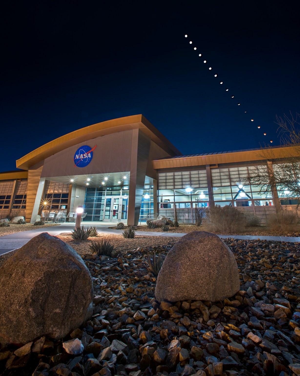
The image features a mixture of browns, greens, oranges, and yellows in both rectilinear and organic, curved shapes. A curving gray line runs diagonally through it.

Every month, NASA Earth Observatory features a puzzling satellite image. The September 2026 puzzler appears above. 

Your Challenge
I
dentify the location shown in this satellite image. Share what clues you see, where you think it is, and what makes this place interesting or unique to you.

How to Answer
Submit your response using this form and select “Puzzler Answer” as the topic. Please include your preferred name or alias.

You can keep it simple and just guess the location. Want to impress us? Tell us which satellite and instrument captured the image, which spectral bands were used, or point out a subtle detail about the geology or history of the area. If something catches your eye, or if this is your home or means something to you, we’d love to hear about it.

The Prize
We can’t offer prize money or a trip to space to see Earth like satellites and astronauts do. But we can offer something almost as rewarding: puzzler bragging rights.

About a week after the challenge, we’ll post the answer at the top of this page, along with a link to an Earth Observatory Image of the Day story that explains the image in more detail. We’ll recognize the first person who correctly guesses the location, and we may also highlight readers who share especially thoughtful or interesting answers. By submitting a response, you acknowledge that your comments may be edited, excerpted, and published on this page.

Until then, zoom in, look closely, and enjoy the challenge. See you at the reveal!

Source: science.nasa.gov

NASA Welcomes Türkiye as Newest Artemis Accords Signatory  

Turkish Minister of Industry and Technology, Mehmet Fatih Kacır, 3rd from left, signs the Artemis Accords for the Republic of Türkiye as NASA Administrator Jared Isaacman, left, U.S. Deputy Assistant Secretary of State for Space and Environment Connor Tomlinson, and Turkish Space Agency President, Yusuf Kıraç, right, look on, Monday, August 31, 2026, at the Mary W. Jackson NASA Headquarters building in Washington. Türkiye is the 71st country to sign the Artemis Accords, which establish a practical set of principles to guide space exploration cooperation among nations participating in NASA’s Artemis program.
Turkish Minister of Industry and Technology, Mehmet Fatih Kacır, 3rd from left, signs the Artemis Accords for the Republic of Türkiye as NASA Administrator Jared Isaacman, left, U.S. Deputy Assistant Secretary of State for Space and Environment Connor Tomlinson, and Turkish Space Agency President, Yusuf Kıraç, right, look on, Monday, August 31, 2026, at the Mary W. Jackson NASA Headquarters building in Washington.
NASA/Bill Ingalls

During a ceremony hosted by NASA Administrator Jared Isaacman at the agency’s headquarters in Washington on Monday, the Republic of Türkiye signed the Artemis Accords, joining the growing international coalition of like-minded nations dedicated to peaceful, transparent space exploration.

“It is my privilege to welcome the Republic of Türkiye as the 71st signatory of the Artemis Accords,” said Isaacman. “Last year, President Trump directed NASA to accelerate its return to the lunar surface and establish humanity’s first enduring presence on another world, a Moon Base, as well as lay the foundation for the manned exploration of Mars. NASA never undertakes these grand endeavors alone. On the Moon Base, we’re taking the Artemis Accords principles and putting them into practice on the lunar surface. NASA has invited every signatory to take part in this endeavor, creating opportunities for nations to contribute major pieces of hardware, scientific payloads, technology demonstrations, CubeSats, and other capabilities to future Artemis missions.”

Turkish Minister of Industry and Technology Mehmet Fatih Kacır signed on behalf of Türkiye. The President of the Turkish Space Agency Yusuf Kıraç, and the U.S. Deputy Assistant Secretary of State for Space and Environment Connor Tomlinson, also participated in the event.

Türkiye’s recent achievements in human spaceflight underscore its commitment to space exploration. In 2024, the country’s first astronaut, Alper Gezervaci, traveled to the International Space Station on Axiom Mission 3 and conducted scientific research alongside NASA astronauts. That same year, a second Turkish astronaut, Tuva Atasever, flew on Virgin Galactic 07 suborbital mission, conducting experiments and physiology research.

Türkiye will soon launch its first lunar mission, AYAP-1, joining the small but growing group of countries building and launching their own satellites to the Moon.

The country’s signing also comes as the country prepares to host the International Astronautical Congress in Antalya this October. Dozens of Artemis Accords signatories are expected to attend to discuss the future of peaceful and transparent space exploration.

In 2020, NASA and the State Department joined with seven other founding nations to establish the Artemis Accords, responding to the growing interest in lunar activities by both governments and private companies. They introduced the first set of practical principles aimed at enhancing the safety and coordination between nations as they explore the Moon, Mars, and beyond, committing nations to:

  • explore peaceably and transparently
  • render aid to those in need
  • enable access to scientific data
  • ensure activities do not interfere with those of others
  • preserve historically significant sites and artifacts by developing best practices

By signing the Artemis Accords, nations open the door to opportunities for future lunar exploration with NASA, advancing humanity’s return to the Moon, and shaping the Golden Age of space exploration and innovation.

Learn more about the Artemis Accords at: 

https://www.nasa.gov/artemis-accords

-end-

Source: www.nasa.gov
Ice Island Survives Run-In With Joe Island


AUGUST 24
AUGUST 23

A satellite view shows the iceberg after it pivoted out of the fjord into Nares Strait, wedged against a small, brown island.
NASA Earth Observatory / Lauren Dauphin

A satellite view shows a large tabular iceberg at the junction of its home fjord and Nares Strait.
NASA Earth Observatory / Lauren Dauphin

A satellite view shows the iceberg after it pivoted out of the fjord into Nares Strait, wedged against a small, brown island.
NASA Earth Observatory / Lauren Dauphin

A satellite view shows a large tabular iceberg at the junction of its home fjord and Nares Strait.
NASA Earth Observatory / Lauren Dauphin


AUGUST 24

AUGUST 23


An iceberg from Petermann Glacier encounters Joe Island in northwestern Greenland, visible in images captured by the OLI (Operational Land Imager) on Landsat 9 on August 23, 2026 (right), and August 24, 2026 (left). NASA Earth Observatory images by Lauren Dauphin.

Summer is prime iceberg season in Greenland’s glacier-fed fjords, and 2026 was no exception. Especially notable was the berg that broke from the Petermann Glacier along Greenland’s northwest coast in August. Roughly the size of St. Thomas in the U.S. Virgin Islands, it was the largest calving event by any Arctic glacier since 2020.

Iceberg calving is a routine part of an outlet glacier’s life cycle. Scientists watch the process closely, however, along with numerous other observations of the ice and its environment, for longer-term signs of instability. Petermann is one of Greenland’s largest marine-terminating glaciers and acts as a gatekeeper for ice flowing from the ice sheet into the ocean. Its future stability has implications for sea level rise.

The calving event of summer 2026 was spotted on August 4 by Adam Garbo, a doctoral student in glaciology at the University of Ottawa, in imagery from the European Space Agency’s Sentinel-1 mission. Garbo and an international team of colleagues have been using remote sensing to study and track the glacier’s ice tongue.

The team reported that the large tabular iceberg, or “ice island,” measured just over 76 square kilometers (29 square miles) at the time it calved—the largest to break from the glacier since the ice island of 2012 (130 square kilometers). The 2012 calving followed earlier major events in 2008 (31 square kilometers) and 2010 (just over 250 square kilometers).

The August 2026 event could have been even bigger. Garbo and colleagues had been expecting a major calving once one of the large rifts they were monitoring finally cut all the way across Petermann’s ice tongue. “What surprised us was that the calving instead followed a different fracture, producing a smaller ice island than we had originally anticipated,” Garbo said. As of late August, two large rifts remained and were expected to eventually produce new ice islands of roughly 94 square kilometers and 84 square kilometers, though the timing remained uncertain.

A detailed satellite view shows the iceberg wedged against the small, brown island, with sea ice packed densely to its left and more sparsely to its right.
August 24, 2026
NASA Earth Observatory/Lauren Dauphin

Glaciologist Mauri Pelto of Nichols College has also been tracking the iceberg, using images from NASA-USGS Landsat satellites, as it drifted down Petermann Fjord toward Nares Strait. In the week since it calved, the berg drifted an average of 3 kilometers per day. It continued toward the fjord’s junction with Nares Strait, where it rammed into a small rocky outcrop known as Joe Island (Joe Ø). The brief encounter is visible in images captured by the OLI (Operational Land Imager) on Landsat 9 on August 23 (top right) and August 24 (top left). A detailed view of the August 24 image is shown above.

Joe Island sits at the mouth of Petermann Fjord, making it one of the first obstacles a departing ice island meets. Collisions with it—like the one that split the 2010 ice island in two—often mark the start of a berg’s breakup. Petermann bergs tend to be thinner and more fragile than those calved by glaciers such as Greenland’s Jakobshavn and Helheim, and thinner still than Antarctica’s behemoths, Pelto noted.

“We were certainly watching closely as it interacted with Joe Island and were impressed that it survived the interaction without further fragmentation,” Garbo said.

The ice island was estimated to be less than 150 meters thick at the time of calving. Wind and surface currents have swept it out of the fjord, and satellite images show it pivoting away from Joe Island and continuing southwest through Nares Strait. As it drifts, it will fracture into smaller pieces as tides, winds, currents, and melting continue to weaken the ice.

Thicker bergs that calve from tidewater glaciers without floating ice-shelf extensions can drag and even become grounded on the seafloor within the fjord, while ice islands, like those from Petermann, might run aground later in their drift. Many ice islands have become “grounded” off the coasts of Coburg and Baffin islands.

Garbo and colleagues noted that ice islands and their fragments have been known to travel considerable distances, posing potential hazards to marine activities and infrastructure while also distributing freshwater through the ocean as they melt.

NASA Earth Observatory images by Lauren Dauphin, using Landsat data from the U.S. Geological Survey. Story by Kathryn Hansen.

References & Resources

You may also be interested in:

Stay up-to-date with the latest content from NASA as we explore the universe and discover more about our home planet.

Record-Setting Retreat of Hektoria Glacier

5 min read

Scientists relied on satellite data to understand how the Antarctic glacier lost so much ice so rapidly.

Article

Pasterze Hangs on as Austria’s Largest Glacier

4 min read

One narrowing icefall remains the linchpin for the Alpine glacier—and it may not be long for this world.

Article

An Uncommon Drifter in the Denmark Strait

4 min read

A large iceberg, observed in summer 2026, had drifted more than 1,000 kilometers south from the northeastern Greenland bay where…

Article

Source: science.nasa.gov